
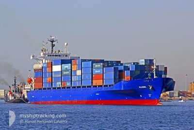
ALLEGRI
Container Ship
Current Trip
| Time Travelled | 3 days |
|---|---|
| Remaining Time | 4 h, 44 mins |
| Distance Travelled | 920.36 nm |
| Remaining Distance | 80.34 nm |
| AVG Speed | 11.5 Knots |
| MAX Speed | 15.7 Knots |
| AVG Wind | 13.6 knots |
| MAX Wind | 25 knots |
| MIN Temp | 14.1°C / 57.38°F |
| MAX Temp | 24.5°C / 76.1°F |
| Draught | 6.8 m |
| Position Received | 1 h, 57 m ago |
Current Position
| Longitude | 15.25607° |
|---|---|
| Latitude | 39.18736° |
| Status | Under way using engine |
| Speed | 13.9 Knots |
| Course | 337.7° |
| Area | Tyrrhenian Sea |
| Station | T-AIS |
| Position Received | 1 h, 57 m ago |
Info
Information
The current position of ALLEGRI is in Tyrrhenian Sea with coordinates 39.18736° / 15.25607° as reported on 2024-04-26 19:25 by AIS to our vessel tracker app. The vessel's current speed is 13.9 Knots and is heading at the port of SALERNO. The estimated time of arrival as calculated by MyShipTracking vessel tracking app is 2024-04-27 02:07 LT
The vessel ALLEGRI (IMO: 9127459, MMSI: 256649000) is a Container Ship that was built in 1997 ( 27 years old ). It's sailing under the flag of [MT] Malta.
In this page you can find informations about the vessels current position, last detected port calls, and current voyage information. If the vessels is not in coverage by AIS you will find the latest position.
The current position of ALLEGRI is detected by our AIS receivers and we are not responsible for the reliability of the data. The last position was recorded while the vessel was in Coverage by the Ais receivers of our vessel tracking app.
The current draught of ALLEGRI as reported by AIS is 6.8 meters
Weather
| Temperature | 16.3°C / 61.34°F |
|---|---|
| Wind Speed | 8 knots |
| Direction | 116° ESE |
| Pressure | 1014.9 hPa |
| Humidity | 70.1 % |
| Cloud Coverage | 100 % |
Featured Company
Last Port Calls
| Port | Arrival | Departure | Time In Port |
|---|---|---|---|
| 2024-04-22 03:04 | 2024-04-23 07:25 | 1 d | |
| 2024-04-19 11:54 | 2024-04-19 23:29 | 11 h | |
| 2024-04-18 12:03 | 2024-04-19 02:35 | 14 h | |
| 2024-04-17 16:11 | 2024-04-18 04:10 | 11 h | |
| 2024-04-15 04:40 | 2024-04-15 12:14 | 7 h | |
| 2024-04-12 11:53 | 2024-04-12 20:44 | 8 h | |
| 2024-04-09 15:17 | 2024-04-10 13:03 | 21 h | |
| 2024-04-07 22:07 | 2024-04-09 08:57 | 1 d | |
| 2024-04-05 06:00 | 2024-04-06 18:56 | 1 d | |
| 2024-03-31 05:59 | 2024-03-31 22:25 | 16 h |
Last Trips
| Origin | Departure | Destination | Arrival | Distance | |
|---|---|---|---|---|---|
| 2024-04-20 02:29 | 2024-04-22 05:04 | 358.79 nm | |||
| 2024-04-19 05:35 | 2024-04-19 14:54 | 67.98 nm | |||
| 2024-04-18 07:10 | 2024-04-18 15:03 | 98.99 nm | |||
| 2024-04-15 15:14 | 2024-04-17 19:11 | 693.16 nm | |||
| 2024-04-12 22:44 | 2024-04-15 07:40 | 665.95 nm | |||
| 2024-04-10 15:03 | 2024-04-12 13:53 | 366.84 nm | |||
| 2024-04-09 10:57 | 2024-04-09 17:17 | 60.74 nm | |||
| 2024-04-06 20:56 | 2024-04-08 00:07 | 234.21 nm | |||
| 2024-03-31 23:25 | 2024-04-05 08:00 | 1031.37 nm | |||
| 2024-03-30 09:06 | 2024-03-31 06:59 | 210.45 nm |
Events
| Time | Event | Details | Position / Dest | Info |
|---|---|---|---|---|
| 2024-04-26 19:45 | Status Changed | Default Under way using engine |
39.26123 / 15.21835
ITSAL
|
Speed: 13.9 kn Course: 337.7° |
| 2024-04-26 19:25 | OUT of Coverage |
39.18736 / 15.25607
Tyrrhenian Sea
ITSAL
|
Speed: 13.9 kn Course: 337.7° |
|
| 2024-04-26 18:57 | Status Changed | Under way using engine Default |
39.08834 / 15.30709
ITSAL
|
Speed: 14 kn Course: 337° |
| 2024-04-26 18:52 | Status Changed | Default Under way using engine |
39.06996 / 15.31717
ITSAL
|
Speed: 14.2 kn Course: 337° |
| 2024-04-26 15:02 | Change Sea Area | Italian part of the Tyrrhenian Sea Italian part of the Ionian Sea |
38.25487 / 15.67194
Tyrrhenian Sea
ITSAL
|
Speed: 13.9 kn Course: 64° |
| 2024-04-26 11:37 | Change Sea Area | Italian part of the Ionian Sea Greek part of the Ionian Sea |
37.80021 / 16.04346
Ionian Sea
ITSAL
|
Speed: 13.5 kn Course: 287.3° |
| 2024-04-26 11:36 | Status Changed | Under way using engine Default |
37.79830 / 16.05038
ITSAL
|
Speed: 13.6 kn Course: 279° |
| 2024-04-26 11:36 | IN Coverage |
37.80021 / 16.04346
Ionian Sea
ITSAL
|
Speed: 13.5 kn Course: 287.3° |
|
| 2024-04-25 22:03 | OUT of Coverage |
37.36270 / 19.36667
Ionian Sea
ITSAL
|
Speed: 10.6 kn Course: 280° |
|
| 2024-04-25 21:38 | IN Coverage |
37.35116 / 19.44942
Ionian Sea
ITSAL
|
Speed: 10.4 kn Course: 280.9° |