
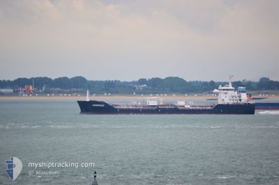
ALGOTITAN
Oil/Chemical Tanker
Current Trip
| Time Travelled | 4 days |
|---|---|
| Remaining Time | --- |
| Distance Travelled | 289.22 nm |
| Remaining Distance | --- |
| AVG Speed | 10 Knots |
| MAX Speed | 13.7 Knots |
| AVG Wind | 17.5 knots |
| MAX Wind | 31 knots |
| MIN Temp | -10°C / 14°F |
| MAX Temp | 3.5°C / 38.3°F |
| Draught | 7.2 m |
| Position Received | 15 m ago |
Current Position
| Longitude | --- |
|---|---|
| Latitude | --- |
| Status | At anchor |
| Speed | |
| Course | 37° |
| Area | Gulf of St-Lawrence |
| Station | T-AIS |
| Position Received | 15 m ago |
Info
Information
The current position of ALGOTITAN is in Gulf of St-Lawrence with coordinates 45.33582° / -73.90697° as reported on 2025-12-23 21:49 by AIS to our vessel tracker app. The vessel's current speed is 0 Knots
The vessel ALGOTITAN (IMO: 9333802, MMSI: 316050854) is a Oil/Chemical Tanker that was built in 2007 ( 18 years old ). It's sailing under the flag of [CA] Canada.
In this page you can find informations about the vessels current position, last detected port calls, and current voyage information. If the vessels is not in coverage by AIS you will find the latest position.
The current position of ALGOTITAN is detected by our AIS receivers and we are not responsible for the reliability of the data. The last position was recorded while the vessel was in Coverage by the Ais receivers of our vessel tracking app.
The current draught of ALGOTITAN as reported by AIS is 7.2 meters
Weather
| Temperature | -2.6°C / 27.32°F |
|---|---|
| Wind Speed | 12 knots |
| Direction | 71° ENE |
| Pressure | 1013.3 hPa |
| Humidity | 96.5 % |
| Cloud Coverage | 100 % |
Featured Company
Last Port Calls
| Port | Arrival | Departure | Time In Port |
|---|---|---|---|
| 2025-12-19 14:40 | 2025-12-19 15:29 | 49 m | |
| 2025-12-16 06:47 | 2025-12-18 07:51 | 2 d | |
| 2025-12-14 22:20 | 2025-12-14 23:48 | 1 h | |
| 2025-12-12 17:15 | 2025-12-13 03:55 | 10 h | |
| 2025-12-10 08:07 | 2025-12-11 04:51 | 20 h | |
| 2025-12-07 20:48 | 2025-12-07 22:22 | 1 h | |
| 2025-12-06 02:33 | 2025-12-06 03:37 | 1 h | |
| 2025-12-03 00:55 | 2025-12-04 14:58 | 1 d | |
| 2025-11-29 16:19 | 2025-12-01 13:41 | 1 d | |
| 2025-11-26 15:43 | 2025-11-28 04:51 | 1 d |
Last Trips
| Origin | Departure | Destination | Arrival | Distance | |
|---|---|---|---|---|---|
| 2025-12-18 02:51 | 2025-12-19 09:40 | 286.27 nm | |||
| 2025-12-14 18:48 | 2025-12-16 01:47 | 285.15 nm | |||
| 2025-12-12 22:55 | 2025-12-14 17:20 | 296.46 nm | |||
| 2025-12-10 23:51 | 2025-12-12 12:15 | 425.74 nm | |||
| 2025-12-07 17:22 | 2025-12-10 03:07 | 433.71 nm | |||
| 2025-12-05 22:37 | 2025-12-07 15:48 | 300.10 nm | |||
| 2025-12-04 09:58 | 2025-12-05 21:33 | 287.47 nm | |||
| 2025-12-01 07:41 | 2025-12-02 19:55 | 414.43 nm | |||
| 2025-11-27 23:51 | 2025-11-29 10:19 | 389.54 nm | |||
| 2025-11-25 12:15 | 2025-11-26 10:43 | 242.81 nm |
Events
| Time | Event | Details | Position / Dest | Info |
|---|---|---|---|---|
| 2025-12-23 22:04 | Status Changed | At anchor Default |
45.33593 / -73.90707
CAHAL
|
Speed: Course: -1° |
| 2025-12-23 21:57 | Status Changed | Default At anchor |
45.33500 / -73.90667
CAHAL
|
Speed: Course: 37° |
| 2025-12-23 21:49 | Status Changed | At anchor Default |
45.33582 / -73.90697
CAHAL
|
Speed: Course: -1° |
| 2025-12-23 21:21 | Status Changed | Default At anchor |
45.33500 / -73.90667
CAHAL
|
Speed: Course: 37° |
| 2025-12-23 20:58 | Status Changed | At anchor Default |
45.33592 / -73.90706
CAHAL
|
Speed: Course: -1° |
| 2025-12-23 20:42 | Status Changed | Default At anchor |
45.33500 / -73.90667
CAHAL
|
Speed: Course: 51° |
| 2025-12-23 20:34 | Status Changed | At anchor Default |
45.33594 / -73.90712
CAHAL
|
Speed: Course: 38° |
| 2025-12-23 20:28 | Status Changed | Default At anchor |
45.33586 / -73.90701
CAHAL
|
Speed: Course: 35° |
| 2025-12-23 20:22 | Status Changed | At anchor Default |
45.33579 / -73.90692
CAHAL
|
Speed: Course: 37° |
| 2025-12-23 20:13 | Status Changed | Default At anchor |
45.33584 / -73.90698
CAHAL
|
Speed: Course: 46° |