
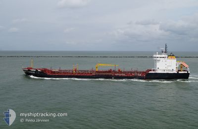
AL AMAL AL SAUDI
Oil/Chemical Tanker
Current Trip
| Trip Time | 18 days |
|---|---|
| Trip Distance | 1852.50 nm |
| AVG Speed | 5.1 Knots |
| MAX Speed | 7.5 Knots |
| Draught | 16 m |
| AVG Wind | 14.6 knots |
| MAX Wind | 27 knots |
| MIN Temp | 23.5°C / 74.3°F |
| MAX Temp | 29.6°C / 85.28°F |
| Position Received | 20 d ago |
Current Position
| Longitude | --- |
|---|---|
| Latitude | --- |
| Status | Under way sailing |
| Speed | 4.9 Knots |
| Course | 173° |
| Area | Red Sea |
| Station | T-AIS |
| Position Received | 20 d ago |
Info
Information
The current position of AL AMAL AL SAUDI is in Red Sea with coordinates 19.22275° / 38.96264° as reported on 2025-11-22 16:47 by AIS to our vessel tracker app. The vessel's current speed is 4.9 Knots and is currently inside the port of AL DUQM.
The vessel AL AMAL AL SAUDI (IMO: 9186728, MMSI: 403138000) is a Oil/Chemical Tanker that was built in 1998 ( 27 years old ). It's sailing under the flag of [SA] Saudi Arabia.
In this page you can find informations about the vessels current position, last detected port calls, and current voyage information. If the vessels is not in coverage by AIS you will find the latest position.
The current position of AL AMAL AL SAUDI is detected by our AIS receivers and we are not responsible for the reliability of the data. The last position was recorded while the vessel was in Coverage by the Ais receivers of our vessel tracking app.
The current draught of AL AMAL AL SAUDI as reported by AIS is 16 meters
Weather
| Temperature | 23.6°C / 74.48°F |
|---|---|
| Wind Speed | 9 knots |
| Direction | 96° E |
| Pressure | 1015.7 hPa |
| Humidity | 72 % |
| Cloud Coverage | --- |
Featured Company
Last Port Calls
| Port | Arrival | Departure | Time In Port |
|---|---|---|---|
| 2025-12-10 14:34 | |||
| 2025-10-28 10:27 | 2025-11-21 18:01 | 24 d | |
| 2025-10-25 11:04 | |||
| 2025-10-22 10:02 | |||
| 2025-10-21 10:43 | |||
| 2025-10-20 07:16 | |||
| 2025-10-19 04:03 | |||
| 2025-10-18 15:01 | |||
| 2025-10-11 10:54 | |||
| 2025-10-09 07:25 |
Most Visited Ports (Last year)
| Port | Arrivals | |
|---|---|---|
| 63 | ||
| 1 | ||
| 1 |
Events
| Time | Event | Details | Position / Dest | Info |
|---|---|---|---|---|
| 2025-12-10 11:10 | STOP Moving |
19.66446 / 57.71564
[OM] AL DUQM
|
Speed: Course: -1° |
|
| 2025-12-10 10:34 | PORT ARRIVAL |
|
19.67103 / 57.72016
[OM] AL DUQM
|
Speed: 6.4 kn Course: 202° |
| 2025-12-10 08:06 | START Moving | 5.98 nm, North East of AL DUQM |
19.74052 / 57.78545
JEDDAH
|
Speed: 4 kn Course: -1° |
| 2025-12-06 07:17 | STOP Moving | 5.87 nm, North East of AL DUQM |
19.74102 / 57.78265
JEDDAH
|
Speed: 0.1 kn Course: 221° |