
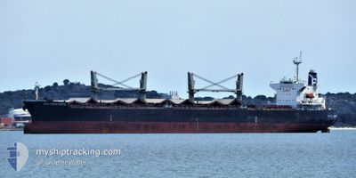
AGIA EIRINI FORCE
Bulk Carrier
Current Trip
| Time Travelled | 5 days |
|---|---|
| Remaining Time | --- |
| Distance Travelled | 1204.23 nm |
| Remaining Distance | --- |
| AVG Speed | 12.1 Knots |
| MAX Speed | 13.6 Knots |
| AVG Wind | 9.8 knots |
| MAX Wind | 21.7 knots |
| MIN Temp | 27.2°C / 80.96°F |
| MAX Temp | 31.4°C / 88.52°F |
| Draught | 10 m |
| Position Received | 4 d ago |
Current Position
| Longitude | 76.50180° |
|---|---|
| Latitude | 8.50144° |
| Status | Under way using engine |
| Speed | 12.5 Knots |
| Course | 312.4° |
| Area | Laccadive Sea |
| Station | T-AIS |
| Position Received | 4 d ago |
Info
Information
The current position of AGIA EIRINI FORCE is in Laccadive Sea with coordinates 8.50144° / 76.50180° as reported on 2024-04-29 22:43 by AIS to our vessel tracker app. The vessel's current speed is 12.5 Knots
The vessel AGIA EIRINI FORCE (IMO: 9340063, MMSI: 538008251) is a Bulk Carrier that was built in 2008 ( 16 years old ). It's sailing under the flag of [MH] Marshall Is.
In this page you can find informations about the vessels current position, last detected port calls, and current voyage information. If the vessels is not in coverage by AIS you will find the latest position.
The current position of AGIA EIRINI FORCE is detected by our AIS receivers and we are not responsible for the reliability of the data. The last position was recorded while the vessel was in Coverage by the Ais receivers of our vessel tracking app.
The current draught of AGIA EIRINI FORCE as reported by AIS is 10 meters
Weather
| Temperature | 30°C / 86°F |
|---|---|
| Wind Speed | 17 knots |
| Direction | 260° W |
| Pressure | 1006.6 hPa |
| Humidity | 64.3 % |
| Cloud Coverage | 90 % |
Featured Company
Events
| Time | Event | Details | Position / Dest | Info |
|---|---|---|---|---|
| 2024-05-03 12:59 | STOP Moving | 14.09 nm, East of MUNDRA |
22.74257 / 69.94280
IN IXY
|
Speed: 0.3 kn Course: 231° |
| 2024-04-30 15:39 | START Moving |
10.87167 / 74.58833
IN IXY
|
Speed: 11 kn Course: 320° |
|
| 2024-04-30 13:00 | START Moving |
10.63667 / 74.78333
IN IXY
|
Speed: 8 kn Course: 324° |
|
| 2024-04-30 12:08 | STOP Moving |
10.62500 / 74.78833
IN IXY
|
Speed: Course: -1° |
|
| 2024-04-29 22:53 | Status Changed | Default Under way using engine |
8.52333 / 76.47334
IN IXY
|
Speed: 12.5 kn Course: 312.4° |
| 2024-04-29 22:43 | Status Changed | Under way using engine Default |
8.50144 / 76.50180
IN IXY
|
Speed: 12 kn Course: 315° |
| 2024-04-29 22:43 | OUT of Coverage |
8.50144 / 76.50180
Laccadive Sea
IN IXY
|
Speed: 12.5 kn Course: 312.4° |
|
| 2024-04-29 22:02 | Status Changed | Default Under way using engine |
8.38500 / 76.59333
IN IXY
|
Speed: 13.1 kn Course: 324.5° |
| 2024-04-29 21:47 | Status Changed | Under way using engine Default |
8.34084 / 76.62701
IN IXY
|
Speed: 13 kn Course: 324° |
| 2024-04-29 21:41 | Status Changed | Default Under way using engine |
8.32333 / 76.63834
IN IXY
|
Speed: 13.1 kn Course: 326.4° |