
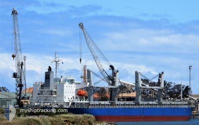
AC AMITY
Cargo
Current Trip
JP KANDA
| Time Travelled | 1 day |
|---|---|
| Remaining Time | --- |
| Distance Travelled | 489.06 nm |
| Remaining Distance | --- |
| AVG Speed | 10.7 Knots |
| MAX Speed | 13.5 Knots |
| AVG Wind | 18.8 knots |
| MAX Wind | 23.3 knots |
| MIN Temp | 6.8°C / 44.24°F |
| MAX Temp | 13.1°C / 55.58°F |
| Draught | 6.5 m |
| Position Received | 7 d ago |
Current Position
| Longitude | --- |
|---|---|
| Latitude | --- |
| Status | Under way using engine |
| Speed | 11.8 Knots |
| Course | 183.7° |
| Area | Philippine Sea |
| Station | T-AIS |
| Position Received | 7 d ago |
Info
Information
The current position of AC AMITY is in Philippine Sea with coordinates 34.05830° / 134.95272° as reported on 2025-12-29 07:25 by AIS to our vessel tracker app. The vessel's current speed is 11.8 Knots
The vessel AC AMITY (IMO: 9623116, MMSI: 351187000) is a Cargo It's sailing under the flag of [PA] Panama.
In this page you can find informations about the vessels current position, last detected port calls, and current voyage information. If the vessels is not in coverage by AIS you will find the latest position.
The current position of AC AMITY is detected by our AIS receivers and we are not responsible for the reliability of the data. The last position was recorded while the vessel was in Coverage by the Ais receivers of our vessel tracking app.
The current draught of AC AMITY as reported by AIS is 6.5 meters
Weather
| Temperature | 12.4°C / 54.32°F |
|---|---|
| Wind Speed | 19 knots |
| Direction | 3° N |
| Pressure | 1023.9 hPa |
| Humidity | 59.8 % |
| Cloud Coverage | 100 % |
Featured Company
Last Port Calls
| Port | Arrival | Departure | Time In Port |
|---|---|---|---|
| 2025-12-31 15:44 | 2026-01-04 09:24 | 3 d | |
| 2025-12-27 06:42 | 2025-12-29 12:52 | 2 d | |
| 2025-12-24 05:54 | 2025-12-25 23:10 | 1 d | |
| 2025-12-20 07:26 | 2025-12-22 12:02 | 2 d | |
| 2025-12-17 08:42 | 2025-12-18 15:36 | 1 d | |
| 2025-12-16 07:34 | 2025-12-17 06:22 | 22 h | |
| 2025-11-03 18:41 | 2025-11-03 19:01 | 19 m |
Most Visited Ports (Last year)
| Port | Arrivals | |
|---|---|---|
| 2 | ||
| 2 | ||
| 1 | ||
| 1 | ||
| 1 | ||
| 1 |
Last Trips
| Origin | Departure | Destination | Arrival | Distance | |
|---|---|---|---|---|---|
| 2025-12-29 12:52 | 2025-12-31 15:44 | 409.71 nm | |||
| 2025-12-25 23:10 | 2025-12-27 06:42 | 251.12 nm | |||
| 2025-12-22 12:02 | 2025-12-24 05:54 | 300.14 nm | |||
| 2025-12-18 15:36 | 2025-12-20 07:26 | 188.01 nm | |||
| 2025-12-17 06:22 | 2025-12-17 08:42 | 23.22 nm | |||
| 2025-11-03 19:01 | 2025-12-16 07:34 | 6057.48 nm | |||
| 2025-10-23 14:03 | 2025-11-03 18:41 | 3563.27 nm |
Events
| Time | Event | Details | Position / Dest | Info |
|---|---|---|---|---|
| 2026-01-04 00:24 | PORT DEPARTURE |
|
33.80640 / 131.03711
JP KANDA
|
Speed: 9.5 kn Course: 68° |
| 2026-01-04 00:13 | START Moving |
33.79832 / 131.00352
[JP] KANDA
|
Speed: 6.4 kn Course: 89° |
|
| 2025-12-31 06:44 | STOP Moving |
33.79833 / 130.99333
[JP] KANDA
|
Speed: Course: -1° |
|
| 2025-12-31 06:44 | PORT ARRIVAL |
|
33.79833 / 130.99333
[JP] KANDA
|
Speed: 3.5 kn Course: 256° |
| 2025-12-30 11:26 | START Moving |
32.16833 / 132.63167
JP KANDA
|
Speed: 5 kn Course: 358° |
|
| 2025-12-30 00:53 | STOP Moving |
32.25167 / 132.42833
JP KANDA
|
Speed: Course: -1° |
|
| 2025-12-29 07:32 | Status Changed | Default Under way using engine |
34.03207 / 134.95113
JP KANDA
|
Speed: 11.8 kn Course: 183.7° |
| 2025-12-29 07:25 | OUT of Coverage |
34.05830 / 134.95272
Philippine Sea
JP KANDA
|
Speed: 11.8 kn Course: 183.7° |
|
| 2025-12-29 07:21 | Status Changed | Under way using engine Default |
34.06869 / 134.95355
JP KANDA
|
Speed: 11.6 kn Course: 184° |
| 2025-12-29 07:20 | Status Changed | Default Under way using engine |
34.07202 / 134.95386
JP KANDA
|
Speed: 11.5 kn Course: 183.7° |