
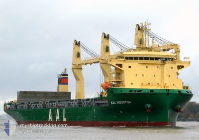
AAL HOUSTON
Cargo
Current Trip
| Time Travelled | 12 days |
|---|---|
| Remaining Time | --- |
| Distance Travelled | 4021.88 nm |
| Remaining Distance | --- |
| AVG Speed | 12.9 Knots |
| MAX Speed | 16.6 Knots |
| AVG Wind | 13.4 knots |
| MAX Wind | 25 knots |
| MIN Temp | 23.7°C / 74.66°F |
| MAX Temp | 27.7°C / 81.86°F |
| Draught | 8.1 m |
| Position Received | 5 m ago |
Current Position
| Longitude | --- |
|---|---|
| Latitude | --- |
| Status | At anchor |
| Speed | 0.1 Knots |
| Course | 295° |
| Area | South Atlantic Ocean |
| Station | T-AIS |
| Position Received | 5 m ago |
Info
Information
The current position of AAL HOUSTON is in South Atlantic Ocean with coordinates -23.05901° / -43.11921° as reported on 2025-12-13 07:17 by AIS to our vessel tracker app. The vessel's current speed is 0.1 Knots
The vessel AAL HOUSTON (IMO: 9958779, MMSI: 255915733) is a Cargo It's sailing under the flag of [PT] Portugal.
In this page you can find informations about the vessels current position, last detected port calls, and current voyage information. If the vessels is not in coverage by AIS you will find the latest position.
The current position of AAL HOUSTON is detected by our AIS receivers and we are not responsible for the reliability of the data. The last position was recorded while the vessel was in Coverage by the Ais receivers of our vessel tracking app.
The current draught of AAL HOUSTON as reported by AIS is 8.1 meters
Weather
| Temperature | 24.4°C / 75.92°F |
|---|---|
| Wind Speed | 4 knots |
| Direction | 329° NNW |
| Pressure | 1006 hPa |
| Humidity | 83.7 % |
| Cloud Coverage | 100 % |
Featured Company
Last Port Calls
| Port | Arrival | Departure | Time In Port |
|---|---|---|---|
| 2025-11-23 15:26 | 2025-11-30 05:49 | 6 d | |
| 2025-11-02 07:14 | 2025-11-10 22:14 | 8 d | |
| 2025-10-21 15:04 | 2025-10-25 07:15 | 3 d | |
| 2025-10-19 19:40 | 2025-10-20 23:38 | 1 d | |
| 2025-10-17 04:47 | 2025-10-18 16:03 | 1 d | |
| 2025-10-09 16:26 | 2025-10-17 04:28 | 7 d |
Most Visited Ports (Last year)
| Port | Arrivals | |
|---|---|---|
| 2 | ||
| 2 | ||
| 2 | ||
| 1 | ||
| 1 | ||
| 1 |
Last Trips
| Origin | Departure | Destination | Arrival | Distance | |
|---|---|---|---|---|---|
| 2025-11-10 22:14 | 2025-11-23 15:26 | 4241.58 nm | |||
| 2025-10-25 07:15 | 2025-11-02 07:14 | 1379.37 nm | |||
| 2025-10-20 23:38 | 2025-10-21 15:04 | 194.10 nm | |||
| 2025-10-18 16:03 | 2025-10-19 19:40 | 313.66 nm | |||
| 2025-10-17 04:28 | 2025-10-17 04:47 | 1.61 nm | |||
| 2025-08-23 10:14 | 2025-10-09 16:26 | 11849.76 nm |
Events
| Time | Event | Details | Position / Dest | Info |
|---|---|---|---|---|
| 2025-12-13 07:17 | Status Changed | At anchor Default |
-23.05901 / -43.11921
BRRIO
|
Speed: Course: -1° |
| 2025-12-13 07:01 | IN Coverage |
-23.05901 / -43.11921
South Atlantic Ocean
|
Speed: 0.1 kn Course: 359° |
|
| 2025-12-13 06:33 | Destination Changed | BRRIO UYNVP |
-23.05901 / -43.11885
BRRIO
|
Speed: 0.1 kn Course: 260° |
| 2025-12-13 06:33 | ETA Changed | 2025/12/13 02:15 2025/12/14 15:00 |
-23.05901 / -43.11885
BRRIO
|
Speed: 0.1 kn Course: 260° |
| 2025-12-13 05:32 | Status Changed | Default At anchor |
-23.05836 / -43.11919
UYNVP
|
Speed: Course: 216° |
| 2025-12-13 05:26 | OUT of Coverage |
-23.05844 / -43.11924
South Atlantic Ocean
UYNVP
|
Speed: Course: 147.4° |
|
| 2025-12-13 05:23 | Status Changed | At anchor Default |
-23.05839 / -43.11921
UYNVP
|
Speed: Course: -1° |
| 2025-12-13 04:59 | Status Changed | Default At anchor |
-23.05840 / -43.11925
UYNVP
|
Speed: Course: 221° |
| 2025-12-13 04:53 | Status Changed | At anchor Default |
-23.05843 / -43.11922
UYNVP
|
Speed: Course: -1° |
| 2025-12-13 04:41 | Status Changed | Default At anchor |
-23.05848 / -43.11918
UYNVP
|
Speed: Course: 214° |