
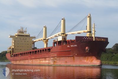
AAL GEELONG
General Cargo
Current Trip
| Time Travelled | 2 days |
|---|---|
| Remaining Time | 5 days |
| Distance Travelled | 446.18 nm |
| Remaining Distance | 1423.18 nm |
| AVG Speed | 6.5 Knots |
| MAX Speed | 12 Knots |
| AVG Wind | 20.9 knots |
| MAX Wind | 35 knots |
| MIN Temp | 10.7°C / 51.26°F |
| MAX Temp | 16.5°C / 61.7°F |
| Draught | 6.2 m |
| Position Received | 22 h, 2 m ago |
Current Position
| Longitude | --- |
|---|---|
| Latitude | --- |
| Status | Under way using engine |
| Speed | 5.9 Knots |
| Course | 252.2° |
| Area | North Atlantic Ocean |
| Station | T-AIS |
| Position Received | 22 h, 2 m ago |
Info
Information
The current position of AAL GEELONG is in North Atlantic Ocean with coordinates 43.71772° / -9.14812° as reported on 2025-12-05 12:37 by AIS to our vessel tracker app. The vessel's current speed is 5.9 Knots and is heading at the port of LIVORNO. The estimated time of arrival as calculated by MyShipTracking vessel tracking app is 2025-12-12 05:16 LT
The vessel AAL GEELONG (IMO: 9393539, MMSI: 210998000) is a General Cargo that was built in 2009 ( 16 years old ). It's sailing under the flag of [CY] Cyprus.
In this page you can find informations about the vessels current position, last detected port calls, and current voyage information. If the vessels is not in coverage by AIS you will find the latest position.
The current position of AAL GEELONG is detected by our AIS receivers and we are not responsible for the reliability of the data. The last position was recorded while the vessel was in Coverage by the Ais receivers of our vessel tracking app.
The current draught of AAL GEELONG as reported by AIS is 6.2 meters
Weather
| Temperature | 16.5°C / 61.7°F |
|---|---|
| Wind Speed | 18 knots |
| Direction | 229° SW |
| Pressure | 1020.3 hPa |
| Humidity | 93.3 % |
| Cloud Coverage | 96 % |
Featured Company
Last Port Calls
| Port | Arrival | Departure | Time In Port |
|---|---|---|---|
| 2025-11-30 22:50 | 2025-12-03 15:15 | 2 d | |
| 2025-11-25 01:43 | 2025-11-27 22:27 | 2 d | |
| 2025-11-18 20:47 | 2025-11-19 23:38 | 1 d | |
| 2025-11-14 17:42 | 2025-11-15 17:18 | 23 h | |
| 2025-11-11 18:13 | 2025-11-13 14:42 | 1 d | |
| 2025-11-09 15:43 | 2025-11-10 17:46 | 1 d | |
| 2025-10-30 08:40 | 2025-10-30 22:01 | 13 h | |
| 2025-10-07 07:02 | 2025-10-07 15:39 | 8 h |
Most Visited Ports (Last year)
| Port | Arrivals | |
|---|---|---|
| 2 | ||
| 2 | ||
| 1 | ||
| 1 | ||
| 1 | ||
| 1 |
Last Trips
| Origin | Departure | Destination | Arrival | Distance | |
|---|---|---|---|---|---|
| 2025-11-27 22:27 | 2025-11-30 22:50 | 794.99 nm | |||
| 2025-11-19 23:38 | 2025-11-25 01:43 | 1102.37 nm | |||
| 2025-11-15 17:18 | 2025-11-18 20:47 | 958.39 nm | |||
| 2025-11-13 14:42 | 2025-11-14 17:42 | 315.05 nm | |||
| 2025-11-10 17:46 | 2025-11-11 18:13 | 276.74 nm | |||
| 2025-10-30 22:01 | 2025-11-09 15:43 | 491.73 nm | |||
| 2025-10-07 15:39 | 2025-10-30 08:40 | 6804.56 nm | |||
| 2025-09-11 10:00 | 2025-10-07 07:02 | 7276.24 nm |
Events
| Time | Event | Details | Position / Dest | Info |
|---|---|---|---|---|
| 2025-12-05 12:50 | Status Changed | Default Under way using engine |
43.71295 / -9.17576
ITLIV
|
Speed: 5.9 kn Course: 252.2° |
| 2025-12-05 12:37 | OUT of Coverage |
43.71772 / -9.14812
North Atlantic Ocean
ITLIV
|
Speed: 5.9 kn Course: 252.2° |
|
| 2025-12-05 12:32 | Status Changed | Under way using engine Default |
43.72016 / -9.13579
ITLIV
|
Speed: 5.5 kn Course: 253° |
| 2025-12-05 12:26 | Status Changed | Default Under way using engine |
43.72237 / -9.12406
ITLIV
|
Speed: 5.5 kn Course: 270.3° |
| 2025-12-05 12:26 | Status Changed | Under way using engine Default |
43.72270 / -9.12283
ITLIV
|
Speed: 5.9 kn Course: 257° |
| 2025-12-05 11:59 | Status Changed | Default Under way using engine |
43.73429 / -9.06509
ITLIV
|
Speed: 6.1 kn Course: 248.4° |
| 2025-12-05 09:06 | Status Changed | Under way using engine Default |
43.84262 / -8.69135
ITLIV
|
Speed: 6.8 kn Course: 236° |
| 2025-12-05 08:59 | IN Coverage |
43.84262 / -8.69135
North Atlantic Ocean
ITLIV
|
Speed: 6.3 kn Course: 243.5° |
|
| 2025-12-05 03:35 | Status Changed | Default Under way using engine |
43.87349 / -7.93623
ITLIV
|
Speed: 6.2 kn Course: 269.2° |
| 2025-12-05 03:30 | OUT of Coverage |
43.87286 / -7.92411
North Atlantic Ocean
ITLIV
|
Speed: 6.2 kn Course: 269.2° |