
AA-D
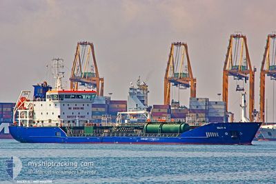
Oil/Chemical Tanker
Current Trip
| Time Travelled | 9 h, 20 mins |
|---|---|
| Remaining Time | 59 mins |
| Distance Travelled | 119.12 nm |
| Remaining Distance | 15.98 nm |
| AVG Speed | 12.8 Knots |
| MAX Speed | 14.4 Knots |
| AVG Wind | 7.9 knots |
| MAX Wind | 9 knots |
| MIN Temp | 15.6°C / 60.08°F |
| MAX Temp | 17.1°C / 62.78°F |
| Draught | 5.2 m |
| Position Received | 1 m ago |
Current Position
| Longitude | --- |
|---|---|
| Latitude | --- |
| Status | Under way using engine |
| Speed | 15.3 Knots |
| Course | 72.4° |
| Area | Strait of Gibraltar |
| Station | T-AIS |
| Position Received | 1 m ago |
Info
Information
The current position of AA-D is in Strait of Gibraltar with coordinates 35.96207° / -5.44411° as reported on 2025-12-06 09:59 by AIS to our vessel tracker app. The vessel's current speed is 15.3 Knots and is heading at the port of ALGECIRAS. The estimated time of arrival as calculated by MyShipTracking vessel tracking app is 2025-12-06 11:59 LT
The vessel AA-D (IMO: 9566708, MMSI: 256992000) is a Oil/Chemical Tanker that was built in 2012 ( 13 years old ). It's sailing under the flag of [MT] Malta.
In this page you can find informations about the vessels current position, last detected port calls, and current voyage information. If the vessels is not in coverage by AIS you will find the latest position.
The current position of AA-D is detected by our AIS receivers and we are not responsible for the reliability of the data. The last position was recorded while the vessel was in Coverage by the Ais receivers of our vessel tracking app.
The current draught of AA-D as reported by AIS is 5.2 meters
Weather
| Temperature | 15.4°C / 59.72°F |
|---|---|
| Wind Speed | 8 knots |
| Direction | 263° W |
| Pressure | 1024.5 hPa |
| Humidity | 86.5 % |
| Cloud Coverage | 16 % |
Featured Company
Last Port Calls
| Port | Arrival | Departure | Time In Port |
|---|---|---|---|
| 2025-12-04 19:10 | 2025-12-06 01:40 | 1 d | |
| 2025-12-02 10:17 | 2025-12-03 14:54 | 1 d | |
| 2025-11-30 05:19 | 2025-12-01 15:09 | 1 d | |
| 2025-11-28 03:33 | 2025-11-29 13:54 | 1 d | |
| 2025-11-25 10:49 | 2025-11-28 03:08 | 2 d | |
| 2025-11-21 01:38 | 2025-11-22 13:42 | 1 d | |
| 2025-11-11 07:30 | 2025-11-16 08:09 | 5 d | |
| 2025-11-06 10:44 | 2025-11-07 15:51 | 1 d | |
| 2025-11-05 16:55 | 2025-11-05 21:15 | 4 h | |
| 2025-11-03 18:45 | 2025-11-04 21:59 | 1 d |
Last Trips
| Origin | Departure | Destination | Arrival | Distance | |
|---|---|---|---|---|---|
| 2025-12-03 14:54 | 2025-12-04 19:10 | 135.92 nm | |||
| 2025-12-01 15:09 | 2025-12-02 10:17 | 176.47 nm | |||
| 2025-11-29 13:54 | 2025-11-30 05:19 | 130.91 nm | |||
| 2025-11-28 03:08 | 2025-11-28 03:33 | 2.34 nm | |||
| 2025-11-22 13:42 | 2025-11-25 10:49 | 252.35 nm | |||
| 2025-11-16 08:09 | 2025-11-21 01:38 | 24.29 nm | |||
| 2025-11-07 15:51 | 2025-11-11 07:30 | 139.48 nm | |||
| 2025-11-05 21:15 | 2025-11-06 10:44 | 21.06 nm | |||
| 2025-11-04 21:59 | 2025-11-05 16:55 | 139.24 nm | |||
| 2025-11-03 06:41 | 2025-11-03 18:45 | 130.70 nm |
Events
| Time | Event | Details | Position / Dest | Info |
|---|---|---|---|---|
| 2025-12-06 09:10 | ETA Changed | 2025/12/06 12:00 2025/12/06 13:00 |
35.91042 / -5.67522
ESALG
|
Speed: 13.2 kn Course: 83.2° |
| 2025-12-06 08:49 | Change Sea Area | Moroccan part of the Strait of Gibraltar Moroccan part of the North Atlantic Ocean |
35.89928 / -5.76533
Strait of Gibraltar
ESALG
|
Speed: 12.3 kn Course: 82.2° |
| 2025-12-06 08:48 | Status Changed | Under way using engine Default |
35.89907 / -5.76745
ESALG
|
Speed: 12.4 kn Course: 88° |
| 2025-12-06 08:35 | IN Coverage |
35.89928 / -5.76533
Strait of Gibraltar
ESALG
|
Speed: 12.3 kn Course: 82.2° |
|
| 2025-12-06 07:55 | Status Changed | Default Under way using engine |
35.89561 / -6.01059
ESALG
|
Speed: 13.4 kn Course: 90.9° |
| 2025-12-06 07:47 | Detected in Sea | Moroccan part of the North Atlantic Ocean |
35.89614 / -6.04406
North Atlantic Ocean
ESALG
|
Speed: 13.4 kn Course: 90.9° |
| 2025-12-06 07:47 | Status Changed | Under way using engine Default |
35.89614 / -6.04406
ESALG
|
Speed: 13.2 kn Course: 90° |
| 2025-12-06 07:47 | OUT of Coverage |
35.89614 / -6.04406
North Atlantic Ocean
ESALG
|
Speed: 13.4 kn Course: 90.9° |
|
| 2025-12-06 07:34 | IN Coverage |
35.89614 / -6.04406
North Atlantic Ocean
ESALG
|
Speed: 13.4 kn Course: 90.9° |
|
| 2025-12-06 03:43 | OUT of Coverage |
36.49793 / -6.71005
North Atlantic Ocean
ESALG
|
Speed: 12.6 kn Course: 160.4° |