
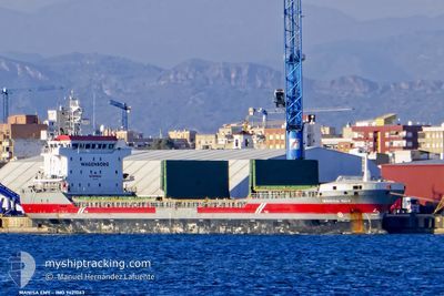
MANISA EMY
General Cargo
Current Trip
| Time Travelled | 1 day |
|---|---|
| Remaining Time | --- |
| Distance Travelled | 408.37 nm |
| Remaining Distance | --- |
| AVG Speed | 9.2 Knots |
| MAX Speed | 12.4 Knots |
| AVG Wind | 18.2 knots |
| MAX Wind | 34.9 knots |
| MIN Temp | 14.7°C / 58.46°F |
| MAX Temp | 18.6°C / 65.48°F |
| Draught | 5.8 m |
| Position Received | 1 h, 8 m ago |
Current Position
| Longitude | 12.35606° |
|---|---|
| Latitude | 40.00629° |
| Status | Under way using engine |
| Speed | 10.9 Knots |
| Course | 119.7° |
| Area | Tyrrhenian Sea |
| Station | T-AIS |
| Position Received | 1 h, 8 m ago |
Info
Information
The current position of MANISA EMY is in Tyrrhenian Sea with coordinates 40.00629° / 12.35606° as reported on 2024-04-29 07:38 by AIS to our vessel tracker app. The vessel's current speed is 10.9 Knots and is heading at the port of ISKENDERUN. The estimated time of arrival as calculated by MyShipTracking vessel tracking app is 2024-05-04 07:00 LT
The vessel MANISA EMY (IMO: 9421063, MMSI: 244790314) is a General Cargo that was built in 2008 ( 16 years old ). It's sailing under the flag of [NL] Netherlands.
In this page you can find informations about the vessels current position, last detected port calls, and current voyage information. If the vessels is not in coverage by AIS you will find the latest position.
The current position of MANISA EMY is detected by our AIS receivers and we are not responsible for the reliability of the data. The last position was recorded while the vessel was in Coverage by the Ais receivers of our vessel tracking app.
The current draught of MANISA EMY as reported by AIS is 5.8 meters
Weather
| Temperature | 17.4°C / 63.32°F |
|---|---|
| Wind Speed | 14 knots |
| Direction | 97° E |
| Pressure | 1016.3 hPa |
| Humidity | 78.9 % |
| Cloud Coverage | --- |
Featured Company
Last Port Calls
| Port | Arrival | Departure | Time In Port |
|---|---|---|---|
| 2024-04-24 10:34 | 2024-04-27 14:40 | 3 d | |
| 2024-04-20 13:32 | 2024-04-24 09:48 | 3 d | |
| 2024-04-16 11:00 | 2024-04-19 18:18 | 3 d | |
| 2024-04-10 10:34 | 2024-04-11 14:56 | 1 d | |
| 2024-04-09 13:05 | 2024-04-09 22:24 | 9 h | |
| 2024-04-06 21:30 | 2024-04-08 12:27 | 1 d | |
| 2024-04-03 15:06 | 2024-04-05 10:08 | 1 d | |
| 2024-03-25 09:27 | 2024-03-26 12:57 | 1 d | |
| 2024-03-06 21:19 | 2024-03-10 22:34 | 4 d | |
| 2024-02-25 07:24 | 2024-02-25 12:04 | 4 h |
Last Trips
| Origin | Departure | Destination | Arrival | Distance | |
|---|---|---|---|---|---|
| 2024-04-24 11:48 | 2024-04-24 12:34 | 3.20 nm | |||
| 2024-04-19 20:18 | 2024-04-20 15:32 | 204.87 nm | |||
| 2024-04-11 17:56 | 2024-04-16 13:00 | 1063.79 nm | |||
| 2024-04-10 01:24 | 2024-04-10 13:34 | 1.61 nm | |||
| 2024-04-08 15:27 | 2024-04-09 16:05 | 287.57 nm | |||
| 2024-04-05 13:08 | 2024-04-07 00:30 | 347.91 nm | |||
| 2024-03-26 13:57 | 2024-04-03 18:06 | 1598.64 nm | |||
| 2024-03-10 23:34 | 2024-03-25 10:27 | 2435.63 nm | |||
| 2024-02-25 13:04 | 2024-03-06 22:19 | 2001.95 nm | |||
| 2024-02-16 09:26 | 2024-02-25 08:24 | 1996.83 nm |
Events
| Time | Event | Details | Position / Dest | Info |
|---|---|---|---|---|
| 2024-04-29 07:54 | Status Changed | Default Under way using engine |
39.98167 / 12.41167
ISDEMIR
|
Speed: 10.9 kn Course: 119.7° |
| 2024-04-29 07:38 | OUT of Coverage |
40.00629 / 12.35606
Tyrrhenian Sea
ISDEMIR
|
Speed: 10.9 kn Course: 119.7° |
|
| 2024-04-29 07:23 | Status Changed | Under way using engine Default |
40.02910 / 12.30797
ISDEMIR
|
Speed: 8 kn Course: 127° |
| 2024-04-29 07:06 | IN Coverage |
40.02476 / 12.31659
Tyrrhenian Sea
ISDEMIR
|
Speed: 10.7 kn Course: 122.6° |
|
| 2024-04-28 23:12 | Status Changed | Default Under way using engine |
40.78167 / 10.68833
ISDEMIR
|
Speed: 11.3 kn Course: 118.5° |
| 2024-04-28 22:33 | OUT of Coverage |
40.84217 / 10.54904
Tyrrhenian Sea
ISDEMIR
|
Speed: 11.3 kn Course: 118.5° |
|
| 2024-04-28 22:20 | Status Changed | Under way using engine Default |
40.86206 / 10.50060
ISDEMIR
|
Speed: 11 kn Course: 120° |
| 2024-04-28 22:03 | Status Changed | Default Under way using engine |
40.88833 / 10.43833
ISDEMIR
|
Speed: 11.2 kn Course: 122.5° |
| 2024-04-28 19:41 | Status Changed | Under way using engine Default |
41.11721 / 9.93858
ISDEMIR
|
Speed: 11.2 kn Course: 122° |
| 2024-04-28 19:10 | Status Changed | Default Under way using engine |
41.16739 / 9.83102
ISDEMIR
|
Speed: 11.2 kn Course: 122.5° |