
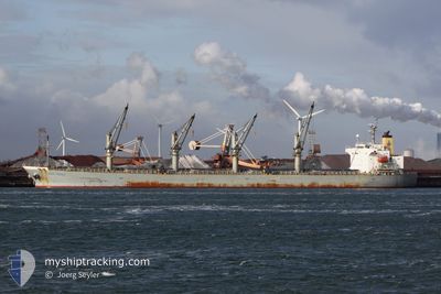
ZHONG WANG TENG DA
Bulk Carrier
Current Trip
IN BOM
| Time Travelled | 12 h, 42 mins |
|---|---|
| Remaining Time | --- |
| Distance Travelled | 146.31 nm |
| Remaining Distance | --- |
| AVG Speed | 12.3 Knop |
| MAX Speed | 14.1 Knop |
| AVG Wind | 7.8 knots |
| MAX Wind | 11 knots |
| MIN Temp | 24.5°C / 76.1°F |
| MAX Temp | 28°C / 82.4°F |
| Djupgående | 9.2 m |
| Position mottagen | 21 d sen |
Current Position
| Longitud | --- |
|---|---|
| Latitude | --- |
| Status | Under way using engine |
| Fart | 11.8 Knop |
| Kurs | 306.4° |
| Område | Laccadive Sea |
| Station | T-AIS |
| Position mottagen | 21 d sen |
Info
Information
The current position of ZHONG WANG TENG DA is in Laccadive Sea with coordinates 8.04778° / 76.93698° as reported on 2025-11-17 16:03 by AIS to our vessel tracker app. The vessel's current speed is 11.8 Knop
The vessel ZHONG WANG TENG DA (IMO: 9249283, MMSI: 413332320) is a Bulk Carrier that was built in 2003 ( 22 År gammal ). It's sailing under the flag of [CN] China.
In this page you can find informations about the vessels current position, last detected port calls, and current voyage information. If the vessels is not in coverage by AIS you will find the latest position.
The current position of ZHONG WANG TENG DA is detected by our AIS receivers and we are not responsible for the reliability of the data. The last position was recorded while the vessel was in Coverage by the Ais receivers of our vessel tracking app.
The current draught of ZHONG WANG TENG DA as reported by AIS is 9.2 meters
Weather
| Temperature | 25°C / 77°F |
|---|---|
| Wind Speed | 9 knots |
| Direction | 36° NE |
| Pressure | 1016.4 hPa |
| Humidity | 56.3 % |
| Cloud Coverage | --- |
Featured Company
Last Port Calls
| Port | Arrival | Departure | Time In Port |
|---|---|---|---|
| 2025-12-03 19:47 | 2025-12-08 14:27 | 4 d | |
| 2025-11-25 18:30 | 2025-11-28 06:59 | 2 d | |
| 2025-11-23 01:31 | 2025-11-25 14:26 | 2 d | |
| 2025-10-26 16:32 | 2025-10-31 23:56 | 5 d | |
| 2025-10-18 20:08 | 2025-10-24 00:56 | 5 d | |
| 2025-10-08 04:44 | 2025-10-10 20:56 | 2 d |
Last Trips
| Origin | Departure | Destination | Arrival | Distance | |
|---|---|---|---|---|---|
| 2025-11-28 06:59 | 2025-12-03 19:47 | 446.19 nm | |||
| 2025-11-25 14:26 | 2025-11-25 18:30 | 7.34 nm | |||
| 2025-10-31 23:56 | 2025-11-23 01:31 | 5068.23 nm | |||
| 2025-10-24 00:56 | 2025-10-26 16:32 | 452.91 nm | |||
| 2025-10-10 20:56 | 2025-10-18 20:08 | 514.04 nm | |||
| 2025-09-05 02:48 | 2025-10-08 04:44 | 6568.78 nm |
Events
| Tid | Event | Detaljer | Position / Dest | Information |
|---|---|---|---|---|
| 2025-12-08 08:57 | STARTAR förflyttning | 1.64 nm, South East of MUNDRA |
22.72287 / 69.71487
IN BOM
|
Fart: 4.3 kn Kurs: 185° |
| 2025-12-08 08:57 | AVGÅTT HAMN |
|
22.72287 / 69.71487
IN BOM
|
Fart: 1.1 kn Kurs: 256° |
| 2025-12-03 14:17 | ANLÄNDER HAMN |
|
22.73333 / 69.71333
[IN] MUNDRA
|
Fart: 1.8 kn Kurs: 283° |
| 2025-12-03 12:49 | STOPPAR förflyttning | 2.88 nm, South East of MUNDRA |
22.70215 / 69.72595
IN BOM
|
Fart: 0.1 kn Kurs: 20° |
| 2025-12-03 12:23 | STARTAR förflyttning | 3.77 nm, South East of MUNDRA |
22.68143 / 69.72308
IN BOM
|
Fart: 3.9 kn Kurs: 24° |
| 2025-11-29 14:24 | STOPPAR förflyttning | 4.22 nm, South East of MUNDRA |
22.67588 / 69.72910
IN BOM
|
Fart: 0.1 kn Kurs: 282° |