
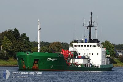
ZAPADNYY
Edible Oil Tanker
Current Trip
| Time Travelled | 1 day |
|---|---|
| Remaining Time | 3 days |
| Distance Travelled | 281.05 nm |
| Remaining Distance | 673.57 nm |
| AVG Speed | 8.4 Knop |
| MAX Speed | 10.3 Knop |
| AVG Wind | 8.2 knots |
| MAX Wind | 16 knots |
| MIN Temp | 9°C / 48.2°F |
| MAX Temp | 11.4°C / 52.52°F |
| Djupgående | 3.7 m |
| Position mottagen | 1 m sen |
Current Position
| Longitud | 4.18466° |
|---|---|
| Latitude | 56.00808° |
| Status | Under way using engine |
| Fart | 8.8 Knop |
| Kurs | 62.9° |
| Område | North Sea |
| Station | T-AIS |
| Position mottagen | 1 m sen |
Info
Information
The current position of ZAPADNYY is in North Sea with coordinates 56.00808° / 4.18466° as reported on 2024-05-07 20:08 by AIS to our vessel tracker app. The vessel's current speed is 8.8 Knop and is heading at the port of GDANSK. The estimated time of arrival as calculated by MyShipTracking vessel tracking app is 2024-05-11 04:06 LT
The vessel ZAPADNYY (IMO: 8711837, MMSI: 312786000) is a Edible Oil Tanker that was built in 1988 ( 36 År gammal ). It's sailing under the flag of [BZ] Belize.
In this page you can find informations about the vessels current position, last detected port calls, and current voyage information. If the vessels is not in coverage by AIS you will find the latest position.
The current position of ZAPADNYY is detected by our AIS receivers and we are not responsible for the reliability of the data. The last position was recorded while the vessel was in Coverage by the Ais receivers of our vessel tracking app.
The current draught of ZAPADNYY as reported by AIS is 3.7 meters
Weather
| Temperature | 9.8°C / 49.64°F |
|---|---|
| Wind Speed | 9 knots |
| Direction | 7° N |
| Pressure | 1024.8 hPa |
| Humidity | 93.7 % |
| Cloud Coverage | 78 % |
Featured Company
Last Port Calls
| Port | Arrival | Departure | Time In Port |
|---|---|---|---|
| 2024-05-05 10:14 | 2024-05-06 11:14 | 1 d | |
| 2024-04-29 14:09 | 2024-04-30 11:11 | 21 h | |
| 2024-04-28 17:40 |
Most Visited Ports (Last year)
| Port | Arrivals | |
|---|---|---|
| 15 | ||
| 5 | ||
| 4 | ||
| 4 | ||
| 4 | ||
| 2 |
Last Trips
| Origin | Departure | Destination | Arrival | Distance | |
|---|---|---|---|---|---|
| 2024-04-30 13:11 | 2024-05-05 11:14 | 934.75 nm | |||
| 2024-04-28 20:40 | 2024-04-29 16:09 | 160.53 nm |
Events
| Tid | Event | Detaljer | Position / Dest | Information |
|---|---|---|---|---|
| 2024-05-07 19:33 | Status ändrad | Under way using engine Default |
55.97029 / 4.04832
PLGDN
|
Fart: 8 kn Kurs: 65° |
| 2024-05-07 19:19 | Status ändrad | Default Under way using engine |
55.95500 / 3.99167
PLGDN
|
Fart: 9 kn Kurs: 64.1° |
| 2024-05-07 18:44 | Status ändrad | Under way using engine Default |
55.91686 / 3.85449
PLGDN
|
Fart: 9 kn Kurs: 64° |
| 2024-05-07 18:34 | Status ändrad | Default Under way using engine |
55.90500 / 3.81167
PLGDN
|
Fart: 9.1 kn Kurs: 62.2° |
| 2024-05-07 18:08 | Upptäckt i hav | Danish part of the North Sea |
55.87543 / 3.70838
North Sea
PLGDN
|
Fart: 9.1 kn Kurs: 62.7° |
| 2024-05-07 18:07 | Status ändrad | Under way using engine Default |
55.87447 / 3.70506
PLGDN
|
Fart: 9 kn Kurs: 64° |
| 2024-05-07 18:00 | Status ändrad | Default Under way using engine |
55.86673 / 3.67786
PLGDN
|
Fart: 9 kn Kurs: 63.5° |
| 2024-05-07 17:49 | Destination ändrad | PLGDN DEBRE |
55.85424 / 3.63429
PLGDN
|
Fart: 8.9 kn Kurs: 63.6° |
| 2024-05-07 17:49 | ETA ändrat | 2024/05/11 04:00 2024/05/08 12:00 |
55.85424 / 3.63429
PLGDN
|
Fart: 8.9 kn Kurs: 63.6° |
| 2024-05-07 17:23 | Status ändrad | Under way using engine Default |
55.82434 / 3.53159
DEBRE
|
Fart: 8 kn Kurs: 60° |