
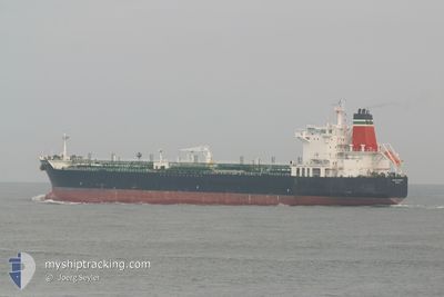
YONGAN OCEAN
Crude Oil Tanker
Current Trip
KHOR AL ZUBAIR
| Time Travelled | 5 days |
|---|---|
| Remaining Time | --- |
| Distance Travelled | 94.36 nm |
| Remaining Distance | --- |
| AVG Speed | 7.5 Knop |
| MAX Speed | 10.6 Knop |
| AVG Wind | 11.1 knots |
| MAX Wind | 22.4 knots |
| MIN Temp | 24.5°C / 76.1°F |
| MAX Temp | 30.2°C / 86.36°F |
| Djupgående | 7.7 m |
| Position mottagen | 3 h, 13 m sen |
Current Position
| Longitud | 48.70464° |
|---|---|
| Latitude | 29.69134° |
| Status | At anchor |
| Fart | 0.2 Knop |
| Kurs | 237° |
| Område | Persian Gulf |
| Station | T-AIS |
| Position mottagen | 3 h, 13 m sen |
Info
Information
The current position of YONGAN OCEAN is in Persian Gulf with coordinates 29.69134° / 48.70464° as reported on 2024-05-13 17:15 by AIS to our vessel tracker app. The vessel's current speed is 0.2 Knop
The vessel YONGAN OCEAN (IMO: 9288758, MMSI: 373336000) is a Crude Oil Tanker that was built in 2004 ( 20 År gammal ). It's sailing under the flag of [PA] Panama.
In this page you can find informations about the vessels current position, last detected port calls, and current voyage information. If the vessels is not in coverage by AIS you will find the latest position.
The current position of YONGAN OCEAN is detected by our AIS receivers and we are not responsible for the reliability of the data. The last position was recorded while the vessel was in Coverage by the Ais receivers of our vessel tracking app.
The current draught of YONGAN OCEAN as reported by AIS is 7.7 meters
Weather
| Temperature | 26.8°C / 80.24°F |
|---|---|
| Wind Speed | 4 knots |
| Direction | 169° S |
| Pressure | 1004.9 hPa |
| Humidity | 74 % |
| Cloud Coverage | 48 % |
Featured Company
Last Port Calls
| Port | Arrival | Departure | Time In Port |
|---|---|---|---|
| 2024-05-03 01:16 | 2024-05-08 01:44 | 5 d | |
| 2024-04-21 07:19 | 2024-04-26 16:04 | 5 d | |
| 2024-04-01 10:00 | 2024-04-07 02:53 | 5 d | |
| 2024-03-14 17:00 | 2024-03-20 05:38 | 5 d |
Most Visited Ports (Last year)
| Port | Arrivals | |
|---|---|---|
| 3 | ||
| 3 | ||
| 3 | ||
| 3 | ||
| 2 | ||
| 2 |
Last Trips
| Origin | Departure | Destination | Arrival | Distance | |
|---|---|---|---|---|---|
| 2024-04-26 19:04 | 2024-05-03 04:16 | 140.62 nm | |||
| 2024-04-07 05:53 | 2024-04-21 10:19 | 1331.58 nm | |||
| 2024-03-20 09:38 | 2024-04-01 13:00 | 843.92 nm | |||
| 2024-01-31 08:59 | 2024-03-14 21:00 | 3443.82 nm |
Events
| Tid | Event | Detaljer | Position / Dest | Information |
|---|---|---|---|---|
| 2024-05-13 17:27 | Status ändrad | Default At anchor |
29.69236 / 48.70426
KHOR AL ZUBAIR
|
Fart: 0.2 kn Kurs: 237° |
| 2024-05-13 17:15 | UTANFÖR täckningsområde |
29.69134 / 48.70464
Persian Gulf
|
Fart: 0.2 kn Kurs: 324.5° |
|
| 2024-05-13 17:07 | Djupgående ändrat | 7.7 11.2 |
29.69108 / 48.70482
KHOR AL ZUBAIR
|
Fart: 0.2 kn Kurs: 237° |
| 2024-05-13 17:07 | Destination ändrad | KHOR AL ZUBAIR HAMRIYAH |
29.69108 / 48.70482
KHOR AL ZUBAIR
|
Fart: 0.2 kn Kurs: 237° |
| 2024-05-13 17:07 | ETA ändrat | 2024/05/10 10:00 2025/02/28 16:00 |
29.69108 / 48.70482
KHOR AL ZUBAIR
|
Fart: 0.2 kn Kurs: 237° |
| 2024-05-13 16:51 | Djupgående ändrat | 11.2 7.7 |
29.69090 / 48.70497
HAMRIYAH
|
Fart: 0.2 kn Kurs: 245° |
| 2024-05-13 16:51 | Destination ändrad | HAMRIYAH KHOR AL ZUBAIR |
29.69090 / 48.70497
HAMRIYAH
|
Fart: 0.2 kn Kurs: 245° |
| 2024-05-13 16:51 | ETA ändrat | 2025/02/28 16:00 2024/05/10 10:00 |
29.69090 / 48.70497
HAMRIYAH
|
Fart: 0.2 kn Kurs: 245° |
| 2024-05-13 16:45 | Status ändrad | At anchor Default |
29.69090 / 48.70500
KHOR AL ZUBAIR
|
Fart: 0.1 kn Kurs: 264° |
| 2024-05-13 16:18 | Status ändrad | Default At anchor |
29.69062 / 48.70513
KHOR AL ZUBAIR
|
Fart: Kurs: 258° |