
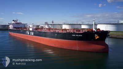
YASA POLARIS
Tanker
Current Trip
| Time Travelled | 58 days |
|---|---|
| Remaining Time | 10 h, 3 mins |
| Distance Travelled | 8827.47 nm |
| Remaining Distance | 138.76 nm |
| AVG Speed | 11.4 Knop |
| MAX Speed | 13.9 Knop |
| AVG Wind | 13.3 knots |
| MAX Wind | 27 knots |
| MIN Temp | 17.1°C / 62.78°F |
| MAX Temp | 31.2°C / 88.16°F |
| Djupgående | 15 m |
| Position mottagen | 5 h, 13 m sen |
Current Position
| Longitud | 100.83457° |
|---|---|
| Latitude | 9.94780° |
| Status | Under way using engine |
| Fart | 13.2 Knop |
| Kurs | 357.8° |
| Område | Gulf of Thailand |
| Station | T-AIS |
| Position mottagen | 5 h, 13 m sen |
Info
Information
The current position of YASA POLARIS is in Gulf of Thailand with coordinates 9.94780° / 100.83457° as reported on 2024-05-02 14:11 by AIS to our vessel tracker app. The vessel's current speed is 13.2 Knop and is heading at the port of SIRACHA. The estimated time of arrival as calculated by MyShipTracking vessel tracking app is 2024-05-03 05:28 LT
The vessel YASA POLARIS (IMO: 9907457, MMSI: 538009487) is a Tanker It's sailing under the flag of [MH] Marshall Is.
In this page you can find informations about the vessels current position, last detected port calls, and current voyage information. If the vessels is not in coverage by AIS you will find the latest position.
The current position of YASA POLARIS is detected by our AIS receivers and we are not responsible for the reliability of the data. The last position was recorded while the vessel was in Coverage by the Ais receivers of our vessel tracking app.
The current draught of YASA POLARIS as reported by AIS is 15 meters
Weather
| Temperature | 30.2°C / 86.36°F |
|---|---|
| Wind Speed | 8 knots |
| Direction | 187° S |
| Pressure | 1006.8 hPa |
| Humidity | 73.2 % |
| Cloud Coverage | 11 % |
Featured Company
Events
| Tid | Event | Detaljer | Position / Dest | Information |
|---|---|---|---|---|
| 2024-05-02 14:14 | Status ändrad | Default Under way using engine |
9.95891 / 100.83412
TH SRI
|
Fart: 13.2 kn Kurs: 357.8° |
| 2024-05-02 14:11 | UTANFÖR täckningsområde |
9.94780 / 100.83457
Gulf of Thailand
|
Fart: 13.2 kn Kurs: 357.8° |
|
| 2024-05-02 13:50 | Byter havsområde | Thailand part of the Gulf of Thailand Malaysian part of the Singapore Strait |
9.86835 / 100.83749
Gulf of Thailand
|
Fart: 13.3 kn Kurs: 357.9° |
| 2024-05-02 13:48 | I täckningsområde |
9.86835 / 100.83749
Gulf of Thailand
|
Fart: 13.3 kn Kurs: 357.9° |
|
| 2024-05-02 13:46 | Status ändrad | Under way using engine Default |
9.85475 / 100.83796
TH SRI
|
Fart: 13.3 kn Kurs: 358° |
| 2024-04-30 11:51 | Status ändrad | Default Constrained by her draught |
1.27415 / 104.27054
TH SRI
|
Fart: 11 kn Kurs: 82.9° |
| 2024-04-30 11:46 | UTANFÖR täckningsområde |
1.27211 / 104.25418
Singapore Strait
TH SRI
|
Fart: 11 kn Kurs: 82.9° |
|
| 2024-04-30 11:13 | Byter havsområde | Malaysian part of the Singapore Strait Indonesian part of the Singapore Strait |
1.26195 / 104.15125
Singapore Strait
TH SRI
|
Fart: 11.5 kn Kurs: 83.7° |
| 2024-04-30 09:13 | Byter havsområde | Indonesian part of the Singapore Strait Singaporean part of the Singapore Strait |
1.17751 / 103.81858
Singapore Strait
TH SRI
|
Fart: 10.3 kn Kurs: 73.3° |
| 2024-04-30 08:50 | Byter havsområde | Singaporean part of the Singapore Strait Indonesian part of the Singapore Strait |
1.14512 / 103.76197
Singapore Strait
TH SRI
|
Fart: 10.6 kn Kurs: 49.8° |