
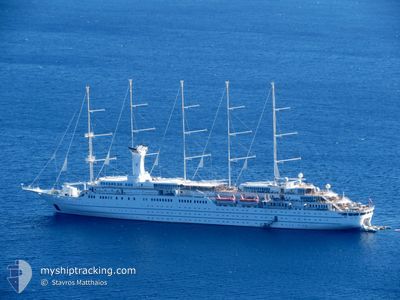
WIND SURF
Passengers Ship
Current Trip
| Time Travelled | 2 days |
|---|---|
| Remaining Time | --- |
| Distance Travelled | 539.74 nm |
| Remaining Distance | --- |
| AVG Speed | 10.3 Knop |
| MAX Speed | 13 Knop |
| AVG Wind | 6.1 knots |
| MAX Wind | 15 knots |
| MIN Temp | 15.9°C / 60.62°F |
| MAX Temp | 25.9°C / 78.62°F |
| Djupgående | 5.4 m |
| Position mottagen | 3 h, 28 m sen |
Current Position
| Longitud | 17.98940° |
|---|---|
| Latitude | 39.25072° |
| Status | Under way using engine |
| Fart | 10.2 Knop |
| Kurs | 44.1° |
| Område | Ionian Sea |
| Station | T-AIS |
| Position mottagen | 3 h, 28 m sen |
Info
Information
The current position of WIND SURF is in Ionian Sea with coordinates 39.25072° / 17.98940° as reported on 2024-05-01 08:06 by AIS to our vessel tracker app. The vessel's current speed is 10.2 Knop
The vessel WIND SURF (IMO: 8700785, MMSI: 309242000) is a Passengers Ship that was built in 1989 ( 35 År gammal ). It's sailing under the flag of [BS] Bahamas.
In this page you can find informations about the vessels current position, last detected port calls, and current voyage information. If the vessels is not in coverage by AIS you will find the latest position.
The current position of WIND SURF is detected by our AIS receivers and we are not responsible for the reliability of the data. The last position was recorded while the vessel was in Coverage by the Ais receivers of our vessel tracking app.
The current draught of WIND SURF as reported by AIS is 5.4 meters
Weather
| Temperature | 18°C / 64.4°F |
|---|---|
| Wind Speed | 14 knots |
| Direction | 178° S |
| Pressure | 1014.3 hPa |
| Humidity | 83.1 % |
| Cloud Coverage | 36 % |
Featured Company
Last Port Calls
| Port | Arrival | Departure | Time In Port |
|---|---|---|---|
| 2024-04-28 04:21 | 2024-04-28 14:28 | 10 h | |
| 2024-04-27 05:12 | 2024-04-27 16:35 | 11 h | |
| 2024-04-23 06:31 | 2024-04-23 17:14 | 10 h | |
| 2024-04-21 04:13 | 2024-04-21 22:17 | 18 h | |
| 2024-04-20 06:16 | 2024-04-20 15:23 | 9 h | |
| 2024-04-19 04:11 | 2024-04-19 10:27 | 6 h | |
| 2024-04-18 04:08 | 2024-04-18 17:06 | 12 h | |
| 2024-04-17 05:16 | 2024-04-17 18:09 | 12 h | |
| 2024-04-16 06:30 | 2024-04-16 16:24 | 9 h | |
| 2024-04-15 05:47 | 2024-04-15 20:11 | 14 h |
Most Visited Ports (Last year)
| Port | Arrivals | |
|---|---|---|
| 17 | ||
| 10 | ||
| 10 | ||
| 7 | ||
| 6 | ||
| 5 |
Last Trips
| Origin | Departure | Destination | Arrival | Distance | |
|---|---|---|---|---|---|
| 2024-04-27 18:35 | 2024-04-28 06:21 | 118.24 nm | |||
| 2024-04-23 19:14 | 2024-04-27 07:12 | 359.39 nm | |||
| 2024-04-22 00:17 | 2024-04-23 08:31 | 232.02 nm | |||
| 2024-04-20 17:23 | 2024-04-21 06:13 | 136.26 nm | |||
| 2024-04-19 12:27 | 2024-04-20 08:16 | 223.23 nm | |||
| 2024-04-18 19:06 | 2024-04-19 06:11 | 126.00 nm | |||
| 2024-04-17 20:09 | 2024-04-18 06:08 | 105.02 nm | |||
| 2024-04-16 18:24 | 2024-04-17 07:16 | 69.91 nm | |||
| 2024-04-15 22:11 | 2024-04-16 08:30 | 102.73 nm | |||
| 2024-04-14 00:13 | 2024-04-15 07:47 | 290.11 nm |
Events
| Tid | Event | Detaljer | Position / Dest | Information |
|---|---|---|---|---|
| 2024-05-01 08:09 | Status ändrad | Default Under way using engine |
39.25648 / 17.99663
IT GIA > ME KOT
|
Fart: 10.2 kn Kurs: 44.1° |
| 2024-05-01 08:06 | UTANFÖR täckningsområde |
39.25072 / 17.98940
Ionian Sea
IT GIA > ME KOT
|
Fart: 10.2 kn Kurs: 44.1° |
|
| 2024-05-01 07:55 | I täckningsområde |
39.22840 / 17.96128
Ionian Sea
IT GIA > ME KOT
|
Fart: 10.3 kn Kurs: 44.3° |
|
| 2024-05-01 07:53 | Status ändrad | Under way using engine Default |
39.22362 / 17.95525
IT GIA > ME KOT
|
Fart: 10.2 kn Kurs: 44° |
| 2024-05-01 06:32 | Status ändrad | Default Under way using engine |
39.06094 / 17.75052
IT GIA > ME KOT
|
Fart: 10.1 kn Kurs: 44.5° |
| 2024-05-01 06:24 | UTANFÖR täckningsområde |
39.04364 / 17.72884
Ionian Sea
IT GIA > ME KOT
|
Fart: 10.1 kn Kurs: 44.5° |
|
| 2024-05-01 06:13 | Status ändrad | Under way using engine Default |
39.02173 / 17.70127
IT GIA > ME KOT
|
Fart: 10 kn Kurs: 44° |
| 2024-05-01 06:06 | Status ändrad | Default Under way using engine |
39.00774 / 17.68371
IT GIA > ME KOT
|
Fart: 9.9 kn Kurs: 43.9° |
| 2024-05-01 06:02 | Status ändrad | Under way using engine Default |
39.00014 / 17.67424
IT GIA > ME KOT
|
Fart: 9.9 kn Kurs: 44° |
| 2024-05-01 06:02 | I täckningsområde |
39.00014 / 17.67424
Ionian Sea
IT GIA > ME KOT
|
Fart: 9.9 kn Kurs: 43.9° |