
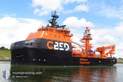
WIND CREATION
Cargo
Current Trip
STB-OWF
| Time Travelled | 4 h, 40 mins |
|---|---|
| Remaining Time | --- |
| Distance Travelled | 20.14 nm |
| Remaining Distance | --- |
| AVG Speed | 8.7 Knop |
| MAX Speed | 13 Knop |
| AVG Wind | 15.9 knots |
| MAX Wind | 17 knots |
| MIN Temp | 13°C / 55.4°F |
| MAX Temp | 13.6°C / 56.48°F |
| Djupgående | 5.7 m |
| Position mottagen | 1 m sen |
Current Position
| Longitud | -2.44614° |
|---|---|
| Latitude | 48.81628° |
| Status | Under way using engine |
| Fart | 0.3 Knop |
| Kurs | 280° |
| Område | English Channel |
| Station | T-AIS |
| Position mottagen | 1 m sen |
Info
Information
The current position of WIND CREATION is in English Channel with coordinates 48.81628° / -2.44614° as reported on 2024-06-16 05:19 by AIS to our vessel tracker app. The vessel's current speed is 0.3 Knop
The vessel WIND CREATION (IMO: 9730517, MMSI: 232054785) is a Cargo It's sailing under the flag of [GB] United Kingdom.
In this page you can find informations about the vessels current position, last detected port calls, and current voyage information. If the vessels is not in coverage by AIS you will find the latest position.
The current position of WIND CREATION is detected by our AIS receivers and we are not responsible for the reliability of the data. The last position was recorded while the vessel was in Coverage by the Ais receivers of our vessel tracking app.
The current draught of WIND CREATION as reported by AIS is 5.7 meters
Weather
| Temperature | 13.3°C / 55.94°F |
|---|---|
| Wind Speed | 15 knots |
| Direction | 242° WSW |
| Pressure | 1004.3 hPa |
| Humidity | 84 % |
| Cloud Coverage | 90 % |
Featured Company
Last Port Calls
| Port | Arrival | Departure | Time In Port |
|---|---|---|---|
| 2024-06-10 18:11 | 2024-06-16 00:41 | 5 d | |
| 2024-06-04 17:18 | 2024-06-06 18:22 | 2 d | |
| 2024-05-31 12:31 | 2024-06-02 22:19 | 2 d | |
| 2024-05-28 20:05 | 2024-05-28 22:04 | 1 h | |
| 2024-05-23 11:00 |
Most Visited Ports (Last year)
| Port | Arrivals | |
|---|---|---|
| 2 | ||
| 1 | ||
| 1 |
Last Trips
| Origin | Departure | Destination | Arrival | Distance | |
|---|---|---|---|---|---|
| 2024-06-06 20:22 | 2024-06-10 20:11 | 391.61 nm | |||
| 2024-06-03 00:19 | 2024-06-04 19:18 | 64.68 nm | |||
| 2024-05-29 00:04 | 2024-05-31 14:31 | 291.03 nm | |||
| 2024-05-23 13:00 | 2024-05-28 22:05 | 220.33 nm |
Events
| Tid | Event | Detaljer | Position / Dest | Information |
|---|---|---|---|---|
| 2024-06-16 02:51 | STOPPAR förflyttning | 13.19 nm, North West of SAINT CAST LE GUIDO |
48.81389 / -2.44764
STB-OWF
|
Fart: 0.3 kn Kurs: 224° |
| 2024-06-16 00:41 | AVGÅTT HAMN |
|
48.64247 / -2.03452
STB-OWF
|
Fart: 7.2 kn Kurs: 314° |
| 2024-06-16 00:39 | STARTAR förflyttning |
48.64175 / -2.02963
[FR] SAINT MALO
|
Fart: 3.4 kn Kurs: 256° |
|
| 2024-06-16 00:32 | Status ändrad | Under way using engine Moored |
48.64246 / -2.02725
[FR] SAINT MALO
|
Fart: 1.6 kn Kurs: 62° |
| 2024-06-15 22:22 | ETA ändrat | 2024/06/16 03:30 2024/06/10 19:30 |
48.64568 / -2.02292
[FR] SAINT MALO
|
Fart: Kurs: 353° |
| 2024-06-15 22:16 | Destination ändrad | STB-OWF FRSML |
48.64564 / -2.02292
[FR] SAINT MALO
|
Fart: Kurs: 353° |
| 2024-06-10 20:06 | Status ändrad | Moored Under way using engine |
48.64567 / -2.02299
[FR] SAINT MALO
|
Fart: Kurs: 353° |
| 2024-06-10 18:25 | STOPPAR förflyttning |
48.64268 / -2.02644
[FR] SAINT MALO
|
Fart: 0.3 kn Kurs: 250° |
|
| 2024-06-10 18:11 | ANLÄNDER HAMN |
|
48.64108 / -2.03205
[FR] SAINT MALO
|
Fart: 0.5 kn Kurs: 249° |
| 2024-06-10 17:23 | STARTAR förflyttning | 5.19 nm, North West of SAINT MALO |
48.71048 / -2.10879
FRSML
|
Fart: 8.4 kn Kurs: 221.7° |