
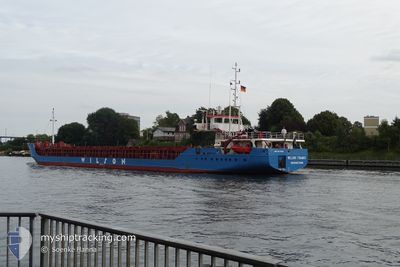
WILSON THAMES
General Cargo
Current Trip
| Time Travelled | 5 days |
|---|---|
| Remaining Time | --- |
| Distance Travelled | 1206.92 nm |
| Remaining Distance | --- |
| AVG Speed | 10.9 Knop |
| MAX Speed | 13 Knop |
| AVG Wind | 8.3 knots |
| MAX Wind | 25 knots |
| MIN Temp | -1.6°C / 29.12°F |
| MAX Temp | 13.5°C / 56.3°F |
| Djupgående | 4.5 m |
| Position mottagen | Nu |
Current Position
| Longitud | --- |
|---|---|
| Latitude | --- |
| Status | Under way using engine |
| Fart | 10.8 Knop |
| Kurs | 220° |
| Område | Kattegat |
| Station | T-AIS |
| Position mottagen | Nu |
Info
Information
The current position of WILSON THAMES is in Kattegat with coordinates 55.57703° / 12.82771° as reported on 2024-10-06 11:10 by AIS to our vessel tracker app. The vessel's current speed is 10.8 Knop and is heading at the port of OLKILUOTO. The estimated time of arrival as calculated by MyShipTracking vessel tracking app is 2024-10-09 19:00 LT
The vessel WILSON THAMES (IMO: 9177894, MMSI: 314438000) is a General Cargo that was built in 2000 ( 24 År gammal ). It's sailing under the flag of [BB] Barbados.
In this page you can find informations about the vessels current position, last detected port calls, and current voyage information. If the vessels is not in coverage by AIS you will find the latest position.
The current position of WILSON THAMES is detected by our AIS receivers and we are not responsible for the reliability of the data. The last position was recorded while the vessel was in Coverage by the Ais receivers of our vessel tracking app.
The current draught of WILSON THAMES as reported by AIS is 4.5 meters
Weather
| Temperature | 12.4°C / 54.32°F |
|---|---|
| Wind Speed | 8 knots |
| Direction | 134° SE |
| Pressure | 1014.7 hPa |
| Humidity | 73.5 % |
| Cloud Coverage | 4 % |
Featured Company
Last Port Calls
| Port | Arrival | Departure | Time In Port |
|---|---|---|---|
| 2024-09-30 17:23 | 2024-10-01 12:17 | 18 h | |
| 2024-09-26 22:03 | 2024-09-27 10:14 | 12 h | |
| 2024-09-21 05:23 | 2024-09-23 22:22 | 2 d | |
| 2024-09-17 21:57 | 2024-09-19 18:34 | 1 d | |
| 2024-09-10 21:37 | 2024-09-13 11:09 | 2 d | |
| 2024-09-08 08:53 | 2024-09-08 19:13 | 10 h | |
| 2024-09-01 12:19 | 2024-09-04 13:45 | 3 d | |
| 2024-08-31 21:55 | 2024-08-31 22:42 | 47 m | |
| 2024-08-30 11:44 |
Last Trips
| Origin | Departure | Destination | Arrival | Distance | |
|---|---|---|---|---|---|
| 2024-09-27 10:14 | 2024-09-30 17:23 | 479.98 nm | |||
| 2024-09-23 22:22 | 2024-09-26 22:03 | 686.26 nm | |||
| 2024-09-19 18:34 | 2024-09-21 05:23 | 358.91 nm | |||
| 2024-09-13 11:09 | 2024-09-17 21:57 | 1119.66 nm | |||
| 2024-09-08 19:13 | 2024-09-10 21:37 | 486.00 nm | |||
| 2024-09-04 13:45 | 2024-09-08 08:53 | 837.21 nm | |||
| 2024-08-31 22:42 | 2024-09-01 12:19 | 89.68 nm | |||
| 2024-08-30 11:44 | 2024-08-31 21:55 | 376.14 nm |
Events
| Tid | Event | Detaljer | Position / Dest | Information |
|---|---|---|---|---|
| 2024-10-06 09:13 | Byter havsområde | Swedish part of the Kattegat Danish part of the Kattegat |
55.85910 / 12.69819
Kattegat
FIOLK
|
Fart: 10.7 kn Kurs: 145.7° |
| 2024-10-06 06:45 | Byter havsområde | Danish part of the Kattegat Swedish part of the Kattegat |
56.20881 / 12.35964
Kattegat
FIOLK
|
Fart: 11.9 kn Kurs: 158.9° |
| 2024-10-05 22:49 | Byter havsområde | Swedish part of the Kattegat Danish part of the Kattegat |
57.48835 / 11.36806
Kattegat
FIOLK
|
Fart: 10.7 kn Kurs: 133° |
| 2024-10-05 20:34 | Byter havsområde | Danish part of the Kattegat Danish part of the Skaggerak |
57.77643 / 10.86104
Kattegat
FIOLK
|
Fart: 10.5 kn Kurs: 130.8° |
| 2024-10-05 15:37 | Byter havsområde | Danish part of the Skaggerak Norwegian part of the Skaggerak |
57.83646 / 9.13875
Skaggerak
FIOLK
|
Fart: 12.1 kn Kurs: 93.7° |
| 2024-10-05 10:01 | Byter havsområde | Norwegian part of the Skaggerak Norwegian part of the North Sea |
57.90653 / 7.17297
Skaggerak
FIOLK
|
Fart: 11.4 kn Kurs: 101.6° |
| 2024-10-04 13:31 | STARTAR förflyttning | 2.91 nm, North of ODDA |
60.12037 / 6.55281
FIOLK
|
Fart: 5.9 kn Kurs: 0.4° |
| 2024-10-04 11:39 | Status ändrad | Under way using engine Default |
60.11716 / 6.55300
FIOLK
|
Fart: Kurs: 7° |
| 2024-10-04 11:37 | Status ändrad | Default Under way using engine |
60.11716 / 6.55300
FIOLK
|
Fart: Kurs: 7° |
| 2024-10-04 09:30 | Djupgående ändrat | 4.5 3.6 |
60.11717 / 6.55302
FIOLK
|
Fart: Kurs: 7° |