
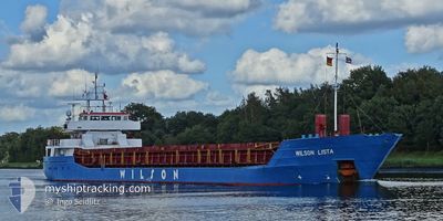
WILSON LISTA
General Cargo
Current Trip
NOAES > MOMQN
| Time Travelled | 4 days |
|---|---|
| Remaining Time | --- |
| Distance Travelled | 607.39 nm |
| Remaining Distance | --- |
| AVG Speed | 9.5 Knop |
| MAX Speed | 11.4 Knop |
| AVG Wind | 13.3 knots |
| MAX Wind | 31 knots |
| MIN Temp | 4.7°C / 40.46°F |
| MAX Temp | 9.6°C / 49.28°F |
| Djupgående | 5.3 m |
| Position mottagen | 1 m sen |
Current Position
| Longitud | 13.02992° |
|---|---|
| Latitude | 66.21591° |
| Status | At anchor |
| Fart | |
| Kurs | 87° |
| Område | Norwegian Sea |
| Station | T-AIS |
| Position mottagen | 1 m sen |
Info
Information
The current position of WILSON LISTA is in Norwegian Sea with coordinates 66.21591° / 13.02992° as reported on 2024-05-10 23:27 by AIS to our vessel tracker app. The vessel's current speed is 0 Knop
The vessel WILSON LISTA (IMO: 9117208, MMSI: 314188000) is a General Cargo that was built in 1994 ( 30 År gammal ). It's sailing under the flag of [BB] Barbados.
In this page you can find informations about the vessels current position, last detected port calls, and current voyage information. If the vessels is not in coverage by AIS you will find the latest position.
The current position of WILSON LISTA is detected by our AIS receivers and we are not responsible for the reliability of the data. The last position was recorded while the vessel was in Coverage by the Ais receivers of our vessel tracking app.
The current draught of WILSON LISTA as reported by AIS is 5.3 meters
Weather
| Temperature | 4.8°C / 40.64°F |
|---|---|
| Wind Speed | 5 knots |
| Direction | 132° SE |
| Pressure | 1023.5 hPa |
| Humidity | 69.5 % |
| Cloud Coverage | 50 % |
Featured Company
Last Port Calls
| Port | Arrival | Departure | Time In Port |
|---|---|---|---|
| 2024-05-05 11:32 | 2024-05-06 18:16 | 1 d | |
| 2024-04-21 09:33 | 2024-04-24 22:00 | 3 d | |
| 2024-04-14 00:57 | 2024-04-14 21:01 | 20 h | |
| 2024-04-13 17:15 | 2024-04-13 23:49 | 6 h | |
| 2024-04-09 19:22 | 2024-04-10 19:12 | 23 h | |
| 2024-04-08 06:14 | 2024-04-08 20:24 | 14 h | |
| 2024-03-20 16:09 | 2024-03-20 22:07 | 5 h | |
| 2024-03-18 15:10 | 2024-03-19 13:40 | 22 h | |
| 2024-03-15 07:34 | 2024-03-16 08:23 | 1 d | |
| 2024-03-10 20:53 | 2024-03-12 00:22 | 1 d |
Last Trips
| Origin | Departure | Destination | Arrival | Distance | |
|---|---|---|---|---|---|
| 2024-04-24 23:00 | 2024-05-05 13:32 | 1741.52 nm | |||
| 2024-04-10 21:12 | 2024-04-21 10:33 | 878.04 nm | |||
| 2024-04-10 21:12 | 2024-04-14 01:57 | 683.70 nm | |||
| 2024-04-10 21:12 | 2024-04-13 18:15 | 673.64 nm | |||
| 2024-04-08 21:24 | 2024-04-09 21:22 | 206.35 nm | |||
| 2024-03-20 23:07 | 2024-04-08 07:14 | 1548.86 nm | |||
| 2024-03-19 14:40 | 2024-03-20 17:09 | 224.77 nm | |||
| 2024-03-16 08:23 | 2024-03-18 16:10 | 540.83 nm | |||
| 2024-03-12 00:22 | 2024-03-15 07:34 | 162.98 nm | |||
| 2024-02-28 23:48 | 2024-03-10 20:53 | 1442.84 nm |
Events
| Tid | Event | Detaljer | Position / Dest | Information |
|---|---|---|---|---|
| 2024-05-10 09:10 | STOPPAR förflyttning | 1.1 nm, North East of NESNA |
66.21690 / 13.03275
NOAES > MOMQN
|
Fart: 0.3 kn Kurs: 218° |
| 2024-05-10 09:05 | Status ändrad | At anchor Under way using engine |
66.21635 / 13.03160
NOAES > MOMQN
|
Fart: 1 kn Kurs: 214° |
| 2024-05-09 19:52 | Status ändrad | Under way using engine Default |
65.27251 / 9.25789
NOAES > MOMQN
|
Fart: 8 kn Kurs: 40° |
| 2024-05-09 19:34 | Status ändrad | Default Under way using engine |
65.23834 / 9.18333
NOAES > MOMQN
|
Fart: 8.9 kn Kurs: 39.4° |
| 2024-05-09 19:25 | Status ändrad | Under way using engine Default |
65.22406 / 9.15283
NOAES > MOMQN
|
Fart: 8 kn Kurs: 43° |
| 2024-05-09 19:21 | I täckningsområde |
65.22406 / 9.15283
Norwegian Sea
NOAES > MOMQN
|
Fart: 8.9 kn Kurs: 39.4° |
|
| 2024-05-09 15:19 | Status ändrad | Default Under way using engine |
64.79710 / 8.22935
NOAES > MOMQN
|
Fart: 7.5 kn Kurs: 39.7° |
| 2024-05-09 15:13 | UTANFÖR täckningsområde |
64.78824 / 8.21047
Norwegian Sea
NOAES > MOMQN
|
Fart: 7.5 kn Kurs: 39.7° |
|
| 2024-05-09 14:46 | Status ändrad | Under way using engine Default |
64.74367 / 8.11777
NOAES > MOMQN
|
Fart: 7 kn Kurs: 39° |
| 2024-05-09 14:33 | Status ändrad | Default Under way using engine |
64.72166 / 8.07500
NOAES > MOMQN
|
Fart: 7.6 kn Kurs: 37.1° |