
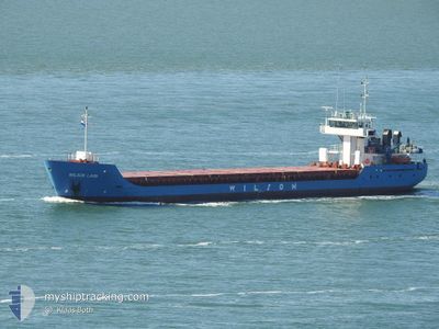
WILSON LAHN
General Cargo
Current Trip
| Time Travelled | 2 days |
|---|---|
| Remaining Time | --- |
| Distance Travelled | 551.23 nm |
| Remaining Distance | --- |
| AVG Speed | 9.7 Knop |
| MAX Speed | 11.4 Knop |
| AVG Wind | 14.8 knots |
| MAX Wind | 23 knots |
| MIN Temp | 12.6°C / 54.68°F |
| MAX Temp | 26.1°C / 78.98°F |
| Djupgående | 4.2 m |
| Position mottagen | 18 h, 24 m sen |
Current Position
| Longitud | 3.46802° |
|---|---|
| Latitude | 58.16546° |
| Status | Under way using engine |
| Fart | 9.9 Knop |
| Kurs | 280.7° |
| Område | North Sea |
| Station | T-AIS |
| Position mottagen | 18 h, 24 m sen |
Info
Information
The current position of WILSON LAHN is in North Sea with coordinates 58.16546° / 3.46802° as reported on 2024-08-31 10:35 by AIS to our vessel tracker app. The vessel's current speed is 9.9 Knop and is heading at the port of KYLE OF LOCHALSH. The estimated time of arrival as calculated by MyShipTracking vessel tracking app is 2024-09-02 00:00 LT
The vessel WILSON LAHN (IMO: 9198458, MMSI: 314259000) is a General Cargo that was built in 2001 ( 23 År gammal ). It's sailing under the flag of [BB] Barbados.
In this page you can find informations about the vessels current position, last detected port calls, and current voyage information. If the vessels is not in coverage by AIS you will find the latest position.
The current position of WILSON LAHN is detected by our AIS receivers and we are not responsible for the reliability of the data. The last position was recorded while the vessel was in Coverage by the Ais receivers of our vessel tracking app.
The current draught of WILSON LAHN as reported by AIS is 4.2 meters
Weather
| Temperature | 12.8°C / 55.04°F |
|---|---|
| Wind Speed | 20 knots |
| Direction | 147° SSE |
| Pressure | 1022.9 hPa |
| Humidity | 88.6 % |
| Cloud Coverage | 23 % |
Featured Company
Last Port Calls
| Port | Arrival | Departure | Time In Port |
|---|---|---|---|
| 2024-08-28 15:13 | 2024-08-29 17:45 | 1 d | |
| 2024-08-26 20:49 | 2024-08-27 12:45 | 15 h | |
| 2024-08-24 12:35 | 2024-08-24 19:34 | 6 h | |
| 2024-08-20 19:11 | 2024-08-21 19:45 | 1 d | |
| 2024-08-17 20:39 | 2024-08-20 17:35 | 2 d | |
| 2024-08-13 03:14 | 2024-08-13 18:55 | 15 h | |
| 2024-08-12 17:02 | 2024-08-13 03:08 | 10 h | |
| 2024-08-06 19:56 | 2024-08-08 12:32 | 1 d | |
| 2024-07-19 19:32 | 2024-08-05 18:29 | 16 d | |
| 2024-07-16 21:32 | 2024-07-17 22:11 | 1 d |
Last Trips
| Origin | Departure | Destination | Arrival | Distance | |
|---|---|---|---|---|---|
| 2024-08-27 12:45 | 2024-08-28 15:13 | 269.68 nm | |||
| 2024-08-24 19:34 | 2024-08-26 20:49 | 308.71 nm | |||
| 2024-08-21 19:45 | 2024-08-24 12:35 | 636.62 nm | |||
| 2024-08-20 17:35 | 2024-08-20 19:11 | 18.12 nm | |||
| 2024-08-13 18:55 | 2024-08-17 20:39 | 670.45 nm | |||
| 2024-08-13 03:08 | 2024-08-13 03:14 | 0.14 nm | |||
| 2024-08-08 12:32 | 2024-08-12 17:02 | 900.98 nm | |||
| 2024-08-05 18:29 | 2024-08-06 19:56 | 252.09 nm | |||
| 2024-07-17 22:11 | 2024-07-19 19:32 | 510.94 nm | |||
| 2024-07-13 00:43 | 2024-07-16 21:32 | 796.76 nm |
Events
| Tid | Event | Detaljer | Position / Dest | Information |
|---|---|---|---|---|
| 2024-08-31 10:35 | UTANFÖR täckningsområde |
58.16546 / 3.46802
North Sea
DKAAR>GBKYL
|
Fart: 9.9 kn Kurs: 280.7° |
|
| 2024-08-31 10:35 | Status ändrad | Under way using engine Default |
58.16546 / 3.46802
DKAAR>GBKYL
|
Fart: 9.9 kn Kurs: 282° |
| 2024-08-31 10:27 | Status ändrad | Default Under way using engine |
58.16115 / 3.51038
DKAAR>GBKYL
|
Fart: 9.7 kn Kurs: 280.4° |
| 2024-08-31 08:59 | Status ändrad | Under way using engine Default |
58.12284 / 3.94588
DKAAR>GBKYL
|
Fart: 9.5 kn Kurs: 279° |
| 2024-08-31 08:35 | Status ändrad | Default Under way using engine |
58.11377 / 4.06340
DKAAR>GBKYL
|
Fart: 9.4 kn Kurs: 278.2° |
| 2024-08-31 08:24 | Status ändrad | Under way using engine Default |
58.10957 / 4.11809
DKAAR>GBKYL
|
Fart: 9.4 kn Kurs: 276° |
| 2024-08-31 07:58 | Status ändrad | Default Under way using engine |
58.10074 / 4.24367
DKAAR>GBKYL
|
Fart: 9.3 kn Kurs: 275.7° |
| 2024-08-30 22:01 | Upptäckt i hav | Norwegian part of the North Sea |
57.88806 / 7.18772
North Sea
DKAAR>GBKYL
|
Fart: 9.3 kn Kurs: 274.4° |
| 2024-08-30 15:08 | Upptäckt i hav | Norwegian part of the Skaggerak |
57.86727 / 9.16692
Skaggerak
DKAAR>GBKYL
|
Fart: 7.9 kn Kurs: 271.9° |
| 2024-08-30 09:06 | Djupgående ändrat | 4.2 4.4 |
57.78730 / 10.77464
DKAAR>GBKYL
|
Fart: 9.7 kn Kurs: 332° |