
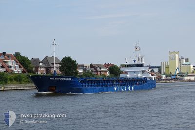
WILSON DURNESS
General Cargo
Current Trip
| Trip Time | 4 days |
|---|---|
| Trip Distance | 1010.14 nm |
| AVG Speed | 9.5 Knop |
| MAX Speed | 11.7 Knop |
| Djupgående | 5.8 m |
| AVG Wind | 12.1 knots |
| MAX Wind | 22.8 knots |
| MIN Temp | 3.3°C / 37.94°F |
| MAX Temp | 15.4°C / 59.72°F |
| Position mottagen | 7 h, 38 m sen |
Current Position
| Longitud | 13.13368° |
|---|---|
| Latitude | 65.89509° |
| Status | Under way using engine |
| Fart | 9.8 Knop |
| Kurs | 159.9° |
| Område | Norwegian Sea |
| Station | T-AIS |
| Position mottagen | 7 h, 38 m sen |
Info
Information
The current position of WILSON DURNESS is in Norwegian Sea with coordinates 65.89509° / 13.13368° as reported on 2024-05-12 00:02 by AIS to our vessel tracker app. The vessel's current speed is 9.8 Knop and is currently inside the port of MOSJOEN.
The vessel WILSON DURNESS (IMO: 9390135, MMSI: 314632000) is a General Cargo that was built in 2008 ( 16 År gammal ). It's sailing under the flag of [BB] Barbados.
In this page you can find informations about the vessels current position, last detected port calls, and current voyage information. If the vessels is not in coverage by AIS you will find the latest position.
The current position of WILSON DURNESS is detected by our AIS receivers and we are not responsible for the reliability of the data. The last position was recorded while the vessel was in Coverage by the Ais receivers of our vessel tracking app.
The current draught of WILSON DURNESS as reported by AIS is 5.8 meters
Weather
| Temperature | 4°C / 39.2°F |
|---|---|
| Wind Speed | 6 knots |
| Direction | 186° S |
| Pressure | 1020.5 hPa |
| Humidity | 97.5 % |
| Cloud Coverage | 100 % |
Featured Company
Last Port Calls
| Port | Arrival | Departure | Time In Port |
|---|---|---|---|
| 2024-05-12 00:20 | |||
| 2024-05-06 19:05 | 2024-05-07 15:37 | 20 h | |
| 2024-04-24 05:46 | 2024-05-03 10:47 | 9 d | |
| 2024-04-18 05:08 | 2024-04-19 13:06 | 1 d | |
| 2024-04-15 17:29 | 2024-04-17 08:43 | 1 d | |
| 2024-04-10 12:16 | 2024-04-12 01:33 | 1 d | |
| 2024-04-04 04:23 | 2024-04-05 20:16 | 1 d | |
| 2024-03-31 00:36 | 2024-04-02 20:47 | 2 d | |
| 2024-03-20 08:54 | 2024-03-22 15:23 | 2 d | |
| 2024-03-17 13:57 | 2024-03-19 13:58 | 2 d |
Last Trips
| Origin | Departure | Destination | Arrival | Distance | |
|---|---|---|---|---|---|
| 2024-05-07 17:37 | 2024-05-12 02:20 | 1010.14 nm | |||
| 2024-05-03 12:47 | 2024-05-06 21:05 | 368.66 nm | |||
| 2024-04-19 15:06 | 2024-04-24 07:46 | 985.78 nm | |||
| 2024-04-17 10:43 | 2024-04-18 07:08 | 190.72 nm | |||
| 2024-04-12 03:33 | 2024-04-15 19:29 | 862.30 nm | |||
| 2024-04-05 22:16 | 2024-04-10 14:16 | 864.71 nm | |||
| 2024-04-02 22:47 | 2024-04-04 06:23 | 313.69 nm | |||
| 2024-03-22 15:23 | 2024-03-31 01:36 | 1198.92 nm | |||
| 2024-03-19 13:58 | 2024-03-20 08:54 | 186.36 nm | |||
| 2024-02-26 05:15 | 2024-03-17 13:57 | 3210.75 nm |
Events
| Tid | Event | Detaljer | Position / Dest | Information |
|---|---|---|---|---|
| 2024-05-12 00:20 | ANLÄNDER HAMN |
|
65.85108 / 13.18630
[NO] MOSJOEN
|
Fart: 9.9 kn Kurs: 161° |
| 2024-05-12 00:03 | Status ändrad | Default Under way using engine |
65.89294 / 13.13549
NOMJF
|
Fart: 9.8 kn Kurs: 159.9° |
| 2024-05-12 00:02 | UTANFÖR täckningsområde |
65.89509 / 13.13368
Norwegian Sea
[NO] MOSJOEN
|
Fart: 9.8 kn Kurs: 159.9° |
|
| 2024-05-11 13:11 | ETA ändrat | 2024/05/11 21:00 2024/05/11 23:00 |
65.53780 / 10.50500
NOMJF
|
Fart: 10 kn Kurs: 28.6° |
| 2024-05-11 13:04 | ETA ändrat | 2024/05/11 23:00 2024/05/11 20:00 |
65.51675 / 10.48220
NOMJF
|
Fart: 10 kn Kurs: 24° |
| 2024-05-10 03:46 | Byter havsområde | Norwegian part of the Norwegian Sea Norwegian part of the North Sea |
61.00674 / 4.28590
Norwegian Sea
NOMJF
|
Fart: 9.1 kn Kurs: 2.3° |
| 2024-05-09 04:14 | Status ändrad | Under way using engine Default |
57.40027 / 5.27068
NOMJF
|
Fart: 9.6 kn Kurs: 351° |
| 2024-05-09 04:03 | Status ändrad | Default Under way using engine |
57.37007 / 5.28006
NOMJF
|
Fart: 9.6 kn Kurs: 349.5° |
| 2024-05-09 04:01 | Status ändrad | Under way using engine Default |
57.36569 / 5.28149
NOMJF
|
Fart: 9.6 kn Kurs: 350° |
| 2024-05-09 04:01 | I täckningsområde |
57.36569 / 5.28149
North Sea
NOMJF
|
Fart: 9.6 kn Kurs: 349.5° |