
WHY WORRY
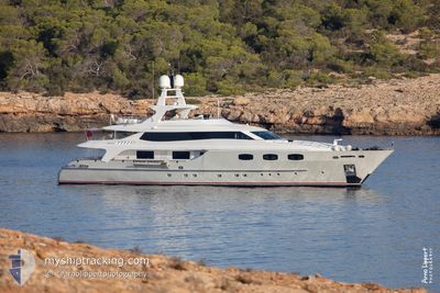
Pleasure Craft
Current Trip
| Trip Time | 14 days |
|---|---|
| Trip Distance | 468.85 nm |
| AVG Speed | 9.8 Knop |
| MAX Speed | 12.6 Knop |
| Djupgående | 3.2 m |
| AVG Wind | 7 knots |
| MAX Wind | 10.6 knots |
| MIN Temp | 13.5°C / 56.3°F |
| MAX Temp | 17.9°C / 64.22°F |
| Position mottagen | 2 m sen |
Current Position
| Longitud | 2.63646° |
|---|---|
| Latitude | 39.56220° |
| Status | Moored |
| Fart | |
| Kurs | 324° |
| Område | Balearic Sea |
| Station | T-AIS |
| Position mottagen | 2 m sen |
Info
Information
The current position of WHY WORRY is in Balearic Sea with coordinates 39.56220° / 2.63646° as reported on 2024-05-01 05:55 by AIS to our vessel tracker app. The vessel's current speed is 0 Knop and is currently inside the port of PALMA DE MALLORCA.
The vessel WHY WORRY (IMO: 9653032, MMSI: 235090917) is a Pleasure Craft It's sailing under the flag of [GB] United Kingdom.
In this page you can find informations about the vessels current position, last detected port calls, and current voyage information. If the vessels is not in coverage by AIS you will find the latest position.
The current position of WHY WORRY is detected by our AIS receivers and we are not responsible for the reliability of the data. The last position was recorded while the vessel was in Coverage by the Ais receivers of our vessel tracking app.
The current draught of WHY WORRY as reported by AIS is 3.2 meters
Weather
| Temperature | 13.7°C / 56.66°F |
|---|---|
| Wind Speed | 9 knots |
| Direction | 276° W |
| Pressure | 1007.4 hPa |
| Humidity | 86 % |
| Cloud Coverage | 3 % |
Featured Company
Last Port Calls
| Port | Arrival | Departure | Time In Port |
|---|---|---|---|
| 2024-04-30 10:12 | |||
| 2024-04-15 07:15 | 2024-04-15 13:55 | 6 h |
Most Visited Ports (Last year)
| Port | Arrivals | |
|---|---|---|
| 2 | ||
| 2 | ||
| 1 |
Last Trips
| Origin | Departure | Destination | Arrival | Distance | |
|---|---|---|---|---|---|
| 2024-04-15 15:55 | 2024-04-30 12:12 | 468.85 nm |
Events
| Tid | Event | Detaljer | Position / Dest | Information |
|---|---|---|---|---|
| 2024-05-01 00:01 | ETA ändrat | 2025/04/30 12:00 2024/04/30 12:00 |
39.56218 / 2.63646
[ES] PALMA DE MALLORCA
|
Fart: Kurs: 324° |
| 2024-04-30 10:37 | Status ändrad | Moored Under way using engine |
39.56413 / 2.63830
[ES] PALMA DE MALLORCA
|
Fart: Kurs: 128° |
| 2024-04-30 10:24 | STOPPAR förflyttning |
39.56495 / 2.63721
[ES] PALMA DE MALLORCA
|
Fart: 0.3 kn Kurs: 115° |
|
| 2024-04-30 10:12 | ANLÄNDER HAMN |
|
39.55473 / 2.64127
[ES] PALMA DE MALLORCA
|
Fart: 10.4 kn Kurs: 317.5° |
| 2024-04-30 09:06 | ETA ändrat | 2024/04/30 12:00 2024/04/24 21:00 |
39.48356 / 2.46769
PALMA MALLORCA
|
Fart: 9.1 kn Kurs: 203.5° |
| 2024-04-30 09:06 | Status ändrad | Under way using engine Moored |
39.48395 / 2.46791
PALMA MALLORCA
|
Fart: 8.6 kn Kurs: 204.3° |
| 2024-04-30 09:01 | STARTAR förflyttning | 0.2 nm, North West of PORT ADRIANO |
39.49148 / 2.47460
PALMA MALLORCA
|
Fart: 4.4 kn Kurs: 247° |
| 2024-04-25 18:57 | Status ändrad | Moored Under way using engine |
39.48988 / 2.47503
PALMA MALLORCA
|
Fart: Kurs: 75° |
| 2024-04-25 18:44 | STOPPAR förflyttning | 0.1 nm, West of PORT ADRIANO |
39.48997 / 2.47588
PALMA MALLORCA
|
Fart: 0.2 kn Kurs: 148° |
| 2024-04-25 17:27 | ETA ändrat | 2024/04/24 21:00 2024/04/24 23:00 |
39.35888 / 2.24708
PALMA MALLORCA
|
Fart: 12 kn Kurs: 49.9° |