
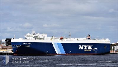
VENUS LEADER
Cargo
Current Trip
| Time Travelled | 6 days |
|---|---|
| Remaining Time | 7 days |
| Distance Travelled | 2046.74 nm |
| Remaining Distance | 2336.18 nm |
| AVG Speed | 14.5 Knop |
| MAX Speed | 19.2 Knop |
| AVG Wind | 8.4 knots |
| MAX Wind | 22 knots |
| MIN Temp | 22.3°C / 72.14°F |
| MAX Temp | 28.6°C / 83.48°F |
| Djupgående | 6.7 m |
| Position mottagen | 6 m sen |
Current Position
| Longitud | --- |
|---|---|
| Latitude | --- |
| Status | Under way using engine |
| Fart | 13.3 Knop |
| Kurs | 90.7° |
| Område | Laccadive Sea |
| Station | T-AIS |
| Position mottagen | 6 m sen |
Info
Information
The current position of VENUS LEADER is in Laccadive Sea with coordinates 5.71049° / 80.07675° as reported on 2025-12-12 19:27 by AIS to our vessel tracker app. The vessel's current speed is 13.3 Knop and is heading at the port of LAEM CHABANG. The estimated time of arrival as calculated by MyShipTracking vessel tracking app is 2025-12-20 17:29 LT
The vessel VENUS LEADER (IMO: 9392341, MMSI: 431824000) is a Cargo It's sailing under the flag of [JP] Japan.
In this page you can find informations about the vessels current position, last detected port calls, and current voyage information. If the vessels is not in coverage by AIS you will find the latest position.
The current position of VENUS LEADER is detected by our AIS receivers and we are not responsible for the reliability of the data. The last position was recorded while the vessel was in Coverage by the Ais receivers of our vessel tracking app.
The current draught of VENUS LEADER as reported by AIS is 6.7 meters
Weather
| Temperature | 27.4°C / 81.32°F |
|---|---|
| Wind Speed | 10 knots |
| Direction | 88° E |
| Pressure | 1010.5 hPa |
| Humidity | 74.4 % |
| Cloud Coverage | 100 % |
Featured Company
Last Port Calls
| Port | Arrival | Departure | Time In Port |
|---|---|---|---|
| 2025-12-06 10:06 | 2025-12-06 20:20 | 10 h | |
| 2025-12-04 11:51 | 2025-12-05 11:58 | 1 d | |
| 2025-11-23 23:35 | 2025-11-24 22:06 | 22 h | |
| 2025-11-23 23:13 | 2025-11-23 23:19 | 6 m | |
| 2025-11-20 05:25 | 2025-11-21 01:12 | 19 h | |
| 2025-11-17 07:42 | 2025-11-17 16:22 | 8 h | |
| 2025-11-12 06:02 | 2025-11-12 23:50 | 17 h | |
| 2025-11-02 18:58 | 2025-11-03 04:59 | 10 h | |
| 2025-10-29 13:29 | 2025-11-01 20:23 | 3 d | |
| 2025-10-18 06:12 | 2025-10-18 22:07 | 15 h |
Most Visited Ports (Last year)
| Port | Arrivals | |
|---|---|---|
| 9 | ||
| 8 | ||
| 8 | ||
| 4 | ||
| 4 | ||
| 2 |
Last Trips
| Origin | Departure | Destination | Arrival | Distance | |
|---|---|---|---|---|---|
| 2025-12-05 11:58 | 2025-12-06 10:06 | 323.56 nm | |||
| 2025-11-24 22:06 | 2025-12-04 11:51 | 3798.09 nm | |||
| 2025-11-23 23:19 | 2025-11-23 23:35 | 0.35 nm | |||
| 2025-11-21 01:12 | 2025-11-23 23:13 | 810.72 nm | |||
| 2025-11-17 16:22 | 2025-11-20 05:25 | 826.46 nm | |||
| 2025-11-12 23:50 | 2025-11-17 07:42 | 1623.38 nm | |||
| 2025-11-03 04:59 | 2025-11-12 06:02 | 2738.29 nm | |||
| 2025-11-01 20:23 | 2025-11-02 18:58 | 323.19 nm | |||
| 2025-10-18 22:07 | 2025-10-29 13:29 | 3869.78 nm | |||
| 2025-10-15 22:29 | 2025-10-18 06:12 | 809.91 nm |
Events
| Tid | Event | Detaljer | Position / Dest | Information |
|---|---|---|---|---|
| 2025-12-12 19:27 | Upptäckt i hav | Sri Lankan part of the Laccadive Sea |
5.71049 / 80.07675
Laccadive Sea
TH LCH
|
Fart: 13.3 kn Kurs: 90.7° |
| 2025-12-12 19:26 | Status ändrad | Under way using engine Default |
5.71054 / 80.07188
TH LCH
|
Fart: 13.2 kn Kurs: 90° |
| 2025-12-12 19:17 | I täckningsområde |
5.71049 / 80.07675
Laccadive Sea
TH LCH
|
Fart: 13.3 kn Kurs: 90.7° |
|
| 2025-12-12 03:52 | UTANFÖR täckningsområde |
7.45286 / 77.30204
Laccadive Sea
TH LCH
|
Fart: 15.2 kn Kurs: 128.8° |
|
| 2025-12-12 00:41 | Upptäckt i hav | Indian part of the Laccadive Sea |
8.02886 / 76.65921
Laccadive Sea
TH LCH
|
Fart: 17.1 kn Kurs: 134.3° |
| 2025-12-12 00:41 | I täckningsområde |
8.02886 / 76.65921
Laccadive Sea
TH LCH
|
Fart: 17.1 kn Kurs: 134.3° |
|
| 2025-12-07 09:01 | Status ändrad | Default Under way using engine |
25.15869 / 57.00674
TH LCH
|
Fart: 17.8 kn Kurs: 122.7° |
| 2025-12-07 08:49 | UTANFÖR täckningsområde |
25.18924 / 56.95543
Gulf of Oman
TH LCH
|
Fart: 17.8 kn Kurs: 122.7° |
|
| 2025-12-07 06:55 | Byter havsområde | United Arab Emirates part of the Gulf of Oman Omani part of the Gulf of Oman |
25.66138 / 56.74898
Gulf of Oman
TH LCH
|
Fart: 16.4 kn Kurs: 176.3° |
| 2025-12-07 05:55 | Byter havsområde | Omani part of the Gulf of Oman Omani part of the Persian Gulf |
25.91408 / 56.73901
Gulf of Oman
TH LCH
|
Fart: 14.9 kn Kurs: 183.5° |