
URANUS III
Pallet Carrier
Current Trip
| Time Travelled | 1 day |
|---|---|
| Remaining Time | 6 days |
| Distance Travelled | 353.40 nm |
| Remaining Distance | 1999.60 nm |
| AVG Speed | 9.7 Knop |
| MAX Speed | 13.4 Knop |
| AVG Wind | 10.6 knots |
| MAX Wind | 18 knots |
| MIN Temp | 15.7°C / 60.26°F |
| MAX Temp | 18.1°C / 64.58°F |
| Djupgående | 5.6 m |
| Position mottagen | 7 m sen |
Current Position
| Longitud | --- |
|---|---|
| Latitude | --- |
| Status | Under way using engine |
| Fart | 13.7 Knop |
| Kurs | 87° |
| Område | Alboran Sea |
| Station | T-AIS |
| Position mottagen | 7 m sen |
Info
Information
The current position of URANUS III is in Alboran Sea with coordinates 36.00643° / -4.94555° as reported on 2025-12-06 17:50 by AIS to our vessel tracker app. The vessel's current speed is 13.7 Knop and is heading at the port of HAIFA. The estimated time of arrival as calculated by MyShipTracking vessel tracking app is 2025-12-13 15:47 LT
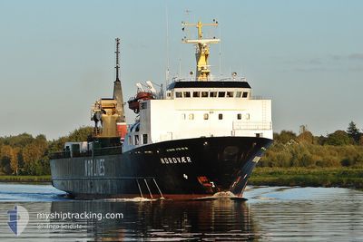
The vessel URANUS III (IMO: 8601680, MMSI: 352002212) is a Pallet Carrier that was built in 1986 ( 39 År gammal ). It's sailing under the flag of [PA] Panama.
In this page you can find informations about the vessels current position, last detected port calls, and current voyage information. If the vessels is not in coverage by AIS you will find the latest position.
The current position of URANUS III is detected by our AIS receivers and we are not responsible for the reliability of the data. The last position was recorded while the vessel was in Coverage by the Ais receivers of our vessel tracking app.
The current draught of URANUS III as reported by AIS is 5.6 meters
Weather
| Temperature | 17.8°C / 64.04°F |
|---|---|
| Wind Speed | 14 knots |
| Direction | 253° WSW |
| Pressure | 1022.1 hPa |
| Humidity | 82.3 % |
| Cloud Coverage | --- |
Featured Company
Events
| Tid | Event | Detaljer | Position / Dest | Information |
|---|---|---|---|---|
| 2025-12-06 17:55 | Status ändrad | Default Under way using engine |
36.00667 / -4.92333
HAIFA
|
Fart: 13.7 kn Kurs: 87° |
| 2025-12-06 16:28 | Byter havsområde | Spanish part of the Alboran Sea Spanish part of the Strait of Gibraltar |
35.97830 / -5.30911
Alboran Sea
HAIFA
|
Fart: 12.5 kn Kurs: 85.6° |
| 2025-12-06 16:13 | Byter havsområde | Spanish part of the Strait of Gibraltar Moroccan part of the Strait of Gibraltar |
35.97259 / -5.37196
Strait of Gibraltar
HAIFA
|
Fart: 12.2 kn Kurs: 83.1° |
| 2025-12-06 15:06 | Djupgående ändrat | 5.6 5.3 |
35.91853 / -5.62036
HAIFA
|
Fart: 10.1 kn Kurs: 80.7° |
| 2025-12-06 14:40 | Status ändrad | Under way using engine Default |
35.91273 / -5.70395
HAIFA
|
Fart: 7.8 kn Kurs: 88° |
| 2025-12-06 14:39 | Status ändrad | Default Under way using engine |
35.91261 / -5.70667
HAIFA
|
Fart: 7.8 kn Kurs: 86.5° |
| 2025-12-06 14:33 | Status ändrad | Under way using engine Default |
35.91158 / -5.72241
HAIFA
|
Fart: 7.8 kn Kurs: 78° |
| 2025-12-06 14:23 | Status ändrad | Default Under way using engine |
35.90839 / -5.74836
HAIFA
|
Fart: 8 kn Kurs: 81.2° |
| 2025-12-06 14:10 | Status ändrad | Under way using engine Default |
35.90333 / -5.78599
HAIFA
|
Fart: 7.3 kn Kurs: 79° |
| 2025-12-06 14:07 | Status ändrad | Default Under way using engine |
35.90280 / -5.79234
HAIFA
|
Fart: 7 kn Kurs: 78.4° |