
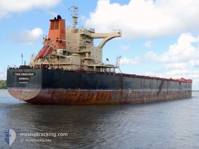
TRUE CRUSADER
Cargo
Current Trip
| Time Travelled | 46 days |
|---|---|
| Remaining Time | 11 days |
| Distance Travelled | 11216.30 nm |
| Remaining Distance | 2840.83 nm |
| AVG Speed | 11.2 Knop |
| MAX Speed | 15.5 Knop |
| AVG Wind | 13.3 knots |
| MAX Wind | 39 knots |
| MIN Temp | 9.6°C / 49.28°F |
| MAX Temp | 29.9°C / 85.82°F |
| Djupgående | 9.6 m |
| Position mottagen | 20 h, 47 m sen |
Current Position
| Longitud | --- |
|---|---|
| Latitude | --- |
| Status | Under way using engine |
| Fart | 9.3 Knop |
| Kurs | 262.4° |
| Område | South Atlantic Ocean |
| Station | T-AIS |
| Position mottagen | 20 h, 47 m sen |
Info
Information
The current position of TRUE CRUSADER is in South Atlantic Ocean with coordinates -34.92254° / 14.39483° as reported on 2025-12-16 07:14 by AIS to our vessel tracker app. The vessel's current speed is 9.3 Knop and is heading at the port of PONTA UBU. The estimated time of arrival as calculated by MyShipTracking vessel tracking app is 2025-12-28 12:13 LT
The vessel TRUE CRUSADER (IMO: 9693587, MMSI: 636022070) is a Cargo It's sailing under the flag of [LR] Liberia.
In this page you can find informations about the vessels current position, last detected port calls, and current voyage information. If the vessels is not in coverage by AIS you will find the latest position.
The current position of TRUE CRUSADER is detected by our AIS receivers and we are not responsible for the reliability of the data. The last position was recorded while the vessel was in Coverage by the Ais receivers of our vessel tracking app.
The current draught of TRUE CRUSADER as reported by AIS is 9.6 meters
Weather
| Temperature | 15°C / 59°F |
|---|---|
| Wind Speed | 16 knots |
| Direction | 193° SSW |
| Pressure | 1019.8 hPa |
| Humidity | 70.1 % |
| Cloud Coverage | 76 % |
Featured Company
Last Port Calls
| Port | Arrival | Departure | Time In Port |
|---|---|---|---|
| 2025-10-30 09:50 | 2025-10-31 16:38 | 1 d | |
| 2025-10-07 10:59 | 2025-10-11 06:52 | 3 d |
Most Visited Ports (Last year)
| Port | Arrivals | |
|---|---|---|
| 1 | ||
| 1 | ||
| 1 | ||
| 1 | ||
| 1 | ||
| 1 |
Last Trips
| Origin | Departure | Destination | Arrival | Distance | |
|---|---|---|---|---|---|
| 2025-10-11 06:52 | 2025-10-30 09:50 | 3056.70 nm | |||
| 2025-08-19 00:22 | 2025-10-07 10:59 | 7295.01 nm |
Events
| Tid | Event | Detaljer | Position / Dest | Information |
|---|---|---|---|---|
| 2025-12-16 07:14 | Status ändrad | Default Under way using engine |
-34.92263 / 14.39262
PONTA UBU
|
Fart: 9.3 kn Kurs: 262.4° |
| 2025-12-16 07:14 | Status ändrad | Under way using engine Default |
-34.92254 / 14.39483
PONTA UBU
|
Fart: 9.7 kn Kurs: 266° |
| 2025-12-16 07:14 | UTANFÖR täckningsområde |
-34.92254 / 14.39483
South Atlantic Ocean
PONTA UBU
|
Fart: 9.3 kn Kurs: 262.4° |
|
| 2025-12-16 07:10 | Status ändrad | Default Under way using engine |
-34.92218 / 14.40781
PONTA UBU
|
Fart: 10.1 kn Kurs: 266.5° |
| 2025-12-16 07:03 | Status ändrad | Under way using engine Default |
-34.92115 / 14.43008
PONTA UBU
|
Fart: 10 kn Kurs: 267° |
| 2025-12-16 07:00 | Status ändrad | Default Under way using engine |
-34.92077 / 14.44055
PONTA UBU
|
Fart: 9.7 kn Kurs: 267.7° |
| 2025-12-16 06:46 | Status ändrad | Under way using engine Default |
-34.91930 / 14.48659
PONTA UBU
|
Fart: 10.1 kn Kurs: 268° |
| 2025-12-16 06:08 | Status ändrad | Default Under way using engine |
-34.91790 / 14.62021
PONTA UBU
|
Fart: 10.9 kn Kurs: 268.9° |
| 2025-12-16 05:54 | Status ändrad | Under way using engine Default |
-34.91864 / 14.66874
PONTA UBU
|
Fart: 10.4 kn Kurs: 270° |
| 2025-12-16 05:54 | I täckningsområde |
-34.91864 / 14.66874
South Atlantic Ocean
PONTA UBU
|
Fart: 10.6 kn Kurs: 271.1° |