
THALASSA AXIA
Cargo D
Current Trip
| Time Travelled | 12 days |
|---|---|
| Remaining Time | 8 days |
| Distance Travelled | 5429.81 nm |
| Remaining Distance | 3882.24 nm |
| AVG Speed | 18 Knop |
| MAX Speed | 20.4 Knop |
| AVG Wind | 13.4 knots |
| MAX Wind | 29.6 knots |
| MIN Temp | 2.4°C / 36.32°F |
| MAX Temp | 27°C / 80.6°F |
| Djupgående | 14.5 m |
| Position mottagen | 8 d sen |
Current Position
| Longitud | 142.03641° |
|---|---|
| Latitude | 41.62386° |
| Status | Under way using engine |
| Fart | 18.1 Knop |
| Kurs | 88° |
| Område | North Pacific Ocean |
| Station | T-AIS |
| Position mottagen | 8 d sen |
Info
Information
The current position of THALASSA AXIA is in North Pacific Ocean with coordinates 41.62386° / 142.03641° as reported on 2024-04-25 01:02 by AIS to our vessel tracker app. The vessel's current speed is 18.1 Knop and is heading at the port of BALBOA. The estimated time of arrival as calculated by MyShipTracking vessel tracking app is 2024-05-12 01:15 LT
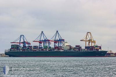
The vessel THALASSA AXIA (IMO: 9667186, MMSI: 636018701) is a Cargo D It's sailing under the flag of [LR] Liberia.
In this page you can find informations about the vessels current position, last detected port calls, and current voyage information. If the vessels is not in coverage by AIS you will find the latest position.
The current position of THALASSA AXIA is detected by our AIS receivers and we are not responsible for the reliability of the data. The last position was recorded while the vessel was in Coverage by the Ais receivers of our vessel tracking app.
The current draught of THALASSA AXIA as reported by AIS is 14.5 meters
Weather
| Temperature | 14.4°C / 57.92°F |
|---|---|
| Wind Speed | 18 knots |
| Direction | 244° WSW |
| Pressure | 1022.9 hPa |
| Humidity | 89.1 % |
| Cloud Coverage | 70 % |
Featured Company
Last Port Calls
| Port | Arrival | Departure | Time In Port |
|---|---|---|---|
| 2024-04-19 17:06 | 2024-04-20 17:56 | 1 d | |
| 2024-04-18 17:19 | 2024-04-19 11:57 | 18 h | |
| 2024-04-15 18:41 | 2024-04-17 15:56 | 1 d | |
| 2024-04-07 07:17 | 2024-04-08 06:33 | 23 h |
Last Trips
| Origin | Departure | Destination | Arrival | Distance | |
|---|---|---|---|---|---|
| 2024-04-19 19:57 | 2024-04-20 01:06 | 62.14 nm | |||
| 2024-04-17 23:56 | 2024-04-19 01:19 | 355.61 nm | |||
| 2024-04-08 14:33 | 2024-04-16 02:41 | 2277.72 nm | |||
| 2024-02-29 03:05 | 2024-04-07 15:17 | 12263.99 nm |
Events
| Tid | Event | Detaljer | Position / Dest | Information |
|---|---|---|---|---|
| 2024-04-25 01:06 | Status ändrad | Default Under way using engine |
41.62455 / 142.06325
PABLB
|
Fart: 18.1 kn Kurs: 88° |
| 2024-04-25 01:02 | UTANFÖR täckningsområde |
41.62386 / 142.03641
North Pacific Ocean
PABLB
|
Fart: 18.1 kn Kurs: 88° |
|
| 2024-04-24 23:17 | Byter havsområde | Japanese part of the North Pacific Ocean Japanese part of the Japan Sea |
41.61366 / 141.30609
North Pacific Ocean
PABLB
|
Fart: 19.2 kn Kurs: 88.1° |
| 2024-04-24 22:48 | Status ändrad | Under way using engine Default |
41.60962 / 141.10576
PABLB
|
Fart: 19.5 kn Kurs: 89° |
| 2024-04-24 22:44 | Status ändrad | Default Under way using engine |
41.60918 / 141.07871
PABLB
|
Fart: 19.4 kn Kurs: 89° |
| 2024-04-24 22:22 | Status ändrad | Under way using engine Default |
41.60370 / 140.91986
PABLB
|
Fart: 20.4 kn Kurs: 78° |
| 2024-04-24 22:20 | Status ändrad | Default Under way using engine |
41.60236 / 140.90904
PABLB
|
Fart: 19 kn Kurs: 60.6° |
| 2024-04-24 20:56 | Status ändrad | Under way using engine Default |
41.34981 / 140.41296
PABLB
|
Fart: 19 kn Kurs: 59° |
| 2024-04-24 20:48 | Status ändrad | Default Under way using engine |
41.32834 / 140.36586
PABLB
|
Fart: 19.1 kn Kurs: 58.4° |
| 2024-04-24 20:35 | Status ändrad | Under way using engine Default |
41.29318 / 140.28924
PABLB
|
Fart: 18.6 kn Kurs: 59° |