
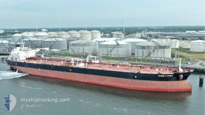
SYDNEY SPIRIT
Crude Oil Tanker
Current Trip
| Trip Time | 13 days |
|---|---|
| Trip Distance | 3285.22 nm |
| AVG Speed | 9.2 Knop |
| MAX Speed | 14.6 Knop |
| Djupgående | 10.7 m |
| AVG Wind | 12.8 knots |
| MAX Wind | 31 knots |
| MIN Temp | 12.7°C / 54.86°F |
| MAX Temp | 31.2°C / 88.16°F |
| Position mottagen | 1 d sen |
Current Position
| Longitud | -122.23397° |
|---|---|
| Latitude | 38.06294° |
| Status | Under way using engine |
| Fart | 9.6 Knop |
| Kurs | 91.8° |
| Område | North Pacific Ocean |
| Station | T-AIS |
| Position mottagen | 1 d sen |
Info
Information
The current position of SYDNEY SPIRIT is in North Pacific Ocean with coordinates 38.06294° / -122.23397° as reported on 2024-06-05 03:44 by AIS to our vessel tracker app. The vessel's current speed is 9.6 Knop and is currently inside the port of BENICIA.
The vessel SYDNEY SPIRIT (IMO: 9594781, MMSI: 311000451) is a Crude Oil Tanker that was built in 2012 ( 12 År gammal ). It's sailing under the flag of [BS] Bahamas.
In this page you can find informations about the vessels current position, last detected port calls, and current voyage information. If the vessels is not in coverage by AIS you will find the latest position.
The current position of SYDNEY SPIRIT is detected by our AIS receivers and we are not responsible for the reliability of the data. The last position was recorded while the vessel was in Coverage by the Ais receivers of our vessel tracking app.
The current draught of SYDNEY SPIRIT as reported by AIS is 10.7 meters
Weather
| Temperature | 18.9°C / 66.02°F |
|---|---|
| Wind Speed | 5 knots |
| Direction | 216° SW |
| Pressure | 1009.6 hPa |
| Humidity | 56.4 % |
| Cloud Coverage | --- |
Featured Company
Last Port Calls
| Port | Arrival | Departure | Time In Port |
|---|---|---|---|
| 2024-06-04 22:01 | |||
| 2024-05-20 10:19 | 2024-05-22 05:58 | 1 d |
Most Visited Ports (Last year)
| Port | Arrivals | |
|---|---|---|
| 2 | ||
| 1 | ||
| 1 | ||
| 1 | ||
| 1 | ||
| 1 |
Last Trips
| Origin | Departure | Destination | Arrival | Distance | |
|---|---|---|---|---|---|
| 2024-05-22 05:58 | 2024-06-04 22:01 | 3285.22 nm |
Events
| Tid | Event | Detaljer | Position / Dest | Information |
|---|---|---|---|---|
| 2024-06-05 05:01 | STOPPAR förflyttning |
38.04498 / -122.12825
[US] BENICIA
|
Fart: 0.3 kn Kurs: 226° |
|
| 2024-06-05 05:01 | ANLÄNDER HAMN |
|
38.04498 / -122.12825
[US] BENICIA
|
Fart: 1.3 kn Kurs: 206° |
| 2024-06-05 03:50 | Status ändrad | Default Under way using engine |
38.06156 / -122.21514
US SFO
|
Fart: 9.6 kn Kurs: 91.8° |
| 2024-06-05 03:44 | UTANFÖR täckningsområde |
38.06294 / -122.23397
North Pacific Ocean
US SFO
|
Fart: 9.6 kn Kurs: 91.8° |
|
| 2024-06-04 22:34 | ETA ändrat | 2024/06/05 00:45 2024/06/05 00:30 |
37.55889 / -123.00709
US SFO
|
Fart: 10 kn Kurs: 58.1° |
| 2024-06-04 19:22 | ETA ändrat | 2024/06/05 00:30 2024/06/02 19:00 |
37.06302 / -123.06209
US SFO
|
Fart: 9.7 kn Kurs: 348.9° |
| 2024-06-04 11:15 | Status ändrad | Under way using engine Default |
36.86086 / -123.02478
US SFO
|
Fart: 5 kn Kurs: 277° |
| 2024-06-04 11:11 | Status ändrad | Default Under way using engine |
36.86044 / -123.01814
US SFO
|
Fart: 5 kn Kurs: 276.7° |
| 2024-06-04 10:49 | Status ändrad | Under way using engine Default |
36.85625 / -122.98042
US SFO
|
Fart: 4.8 kn Kurs: 282° |
| 2024-06-04 10:43 | Status ändrad | Default Under way using engine |
36.85558 / -122.97013
US SFO
|
Fart: 4.5 kn Kurs: 287° |