
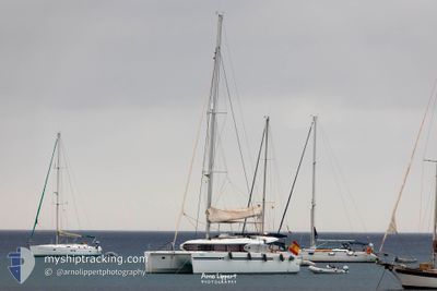
SUNSHINE OF THE SEA
Sailing
Current Trip
Unknown
| Time Travelled | 6 days |
|---|---|
| Remaining Time | --- |
| Distance Travelled | 29.38 nm |
| Remaining Distance | --- |
| AVG Speed | 5.4 Knop |
| MAX Speed | 7.3 Knop |
| AVG Wind | 7.9 knots |
| MAX Wind | 9.8 knots |
| MIN Temp | 17.8°C / 64.04°F |
| MAX Temp | 19.8°C / 67.64°F |
| Djupgående | 0 m |
| Position mottagen | 3 d sen |
Current Position
| Longitud | 1.24983° |
|---|---|
| Latitude | 38.85428° |
| Status | Default |
| Fart | 5.8 Knop |
| Kurs | 274.7° |
| Område | Balearic Sea |
| Station | T-AIS |
| Position mottagen | 3 d sen |
Info
Information
The current position of SUNSHINE OF THE SEA is in Balearic Sea with coordinates 38.85428° / 1.24983° as reported on 2024-05-13 08:22 by AIS to our vessel tracker app. The vessel's current speed is 5.8 Knop
The vessel SUNSHINE OF THE SEA (MMSI: 232016646) is a Sailing It's sailing under the flag of [GB] United Kingdom.
In this page you can find informations about the vessels current position, last detected port calls, and current voyage information. If the vessels is not in coverage by AIS you will find the latest position.
The current position of SUNSHINE OF THE SEA is detected by our AIS receivers and we are not responsible for the reliability of the data. The last position was recorded while the vessel was in Coverage by the Ais receivers of our vessel tracking app.
Weather
| Temperature | 18.5°C / 65.3°F |
|---|---|
| Wind Speed | 6 knots |
| Direction | 85° E |
| Pressure | 1013.9 hPa |
| Humidity | 82.6 % |
| Cloud Coverage | 58 % |
Featured Company
Last Port Calls
| Port | Arrival | Departure | Time In Port |
|---|---|---|---|
| 2024-05-04 23:38 | 2024-05-10 17:12 | 5 d | |
| 2024-05-03 17:22 | 2024-05-04 20:55 | 1 d | |
| 2024-05-03 13:47 |
Most Visited Ports (Last year)
| Port | Arrivals | |
|---|---|---|
| 18 | ||
| 4 | ||
| 1 | ||
| 1 |
Last Trips
| Origin | Departure | Destination | Arrival | Distance | |
|---|---|---|---|---|---|
| 2024-05-04 20:55 | 2024-05-04 23:38 | 16.53 nm | |||
| 2024-05-03 13:47 | 2024-05-03 17:22 | 0.38 nm |
Events
| Tid | Event | Detaljer | Position / Dest | Information |
|---|---|---|---|---|
| 2024-05-13 08:22 | UTANFÖR täckningsområde |
38.85428 / 1.24983
Balearic Sea
|
Fart: 5.8 kn Kurs: 274.7° |
|
| 2024-05-13 07:50 | I täckningsområde |
38.86298 / 1.31069
Balearic Sea
|
Fart: 5.5 kn Kurs: 246.1° |
|
| 2024-05-12 07:13 | UTANFÖR täckningsområde |
38.86516 / 1.31576
Balearic Sea
|
Fart: 0.2 kn Kurs: 187.8° |
|
| 2024-05-12 07:13 | I täckningsområde |
38.86516 / 1.31576
Balearic Sea
|
Fart: 0.2 kn Kurs: 187.8° |
|
| 2024-05-11 19:53 | UTANFÖR täckningsområde |
38.85093 / 1.32087
Balearic Sea
|
Fart: 7.1 kn Kurs: 333.6° |
|
| 2024-05-11 18:30 | STARTAR förflyttning | 2.29 nm, South West of IBIZA |
38.88180 / 1.40981
|
Fart: 6.7 kn Kurs: 170.8° |
| 2024-05-11 10:20 | STOPPAR förflyttning | 2.2 nm, South West of IBIZA |
38.88426 / 1.40945
|
Fart: 0.2 kn Kurs: 511° |
| 2024-05-11 10:15 | STARTAR förflyttning | 2.05 nm, South West of IBIZA |
38.88682 / 1.41095
|
Fart: 3.3 kn Kurs: 202.1° |
| 2024-05-11 10:12 | STOPPAR förflyttning | 1.95 nm, South West of IBIZA |
38.88877 / 1.41191
|
Fart: 0.1 kn Kurs: 511° |
| 2024-05-11 07:22 | I täckningsområde |
38.78271 / 1.39546
Balearic Sea
|
Fart: 3.7 kn Kurs: 318.5° |