
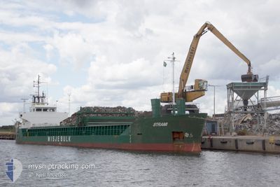
STRAMI
General Cargo
Current Trip
| Time Travelled | 1 day |
|---|---|
| Remaining Time | --- |
| Distance Travelled | 364.75 nm |
| Remaining Distance | 695.41 nm |
| AVG Speed | 9.4 Knop |
| MAX Speed | 12 Knop |
| AVG Wind | 12.5 knots |
| MAX Wind | 23.4 knots |
| MIN Temp | 7.6°C / 45.68°F |
| MAX Temp | 11.3°C / 52.34°F |
| Djupgående | 5.1 m |
| Position mottagen | 1 d sen |
Current Position
| Longitud | -5.06365° |
|---|---|
| Latitude | 53.18707° |
| Status | Under way using engine |
| Fart | 7.3 Knop |
| Kurs | 200.2° |
| Område | Irish Sea and St. George's Channel |
| Station | T-AIS |
| Position mottagen | 1 d sen |
Info
Information
The current position of STRAMI is in Irish Sea and St. George's Channel with coordinates 53.18707° / -5.06365° as reported on 2024-04-27 23:31 by AIS to our vessel tracker app. The vessel's current speed is 7.3 Knop and is heading at the port of SETUBAL. The estimated time of arrival as calculated by MyShipTracking vessel tracking app is 2024-05-02 05:00 LT
The vessel STRAMI (IMO: 8922254, MMSI: 311973000) is a General Cargo that was built in 1992 ( 32 År gammal ). It's sailing under the flag of [BS] Bahamas.
In this page you can find informations about the vessels current position, last detected port calls, and current voyage information. If the vessels is not in coverage by AIS you will find the latest position.
The current position of STRAMI is detected by our AIS receivers and we are not responsible for the reliability of the data. The last position was recorded while the vessel was in Coverage by the Ais receivers of our vessel tracking app.
The current draught of STRAMI as reported by AIS is 5.1 meters
Weather
| Temperature | 11.3°C / 52.34°F |
|---|---|
| Wind Speed | 23 knots |
| Direction | 211° SSW |
| Pressure | 1010.4 hPa |
| Humidity | 86.2 % |
| Cloud Coverage | 100 % |
Featured Company
Last Port Calls
| Port | Arrival | Departure | Time In Port |
|---|---|---|---|
| 2024-04-27 12:18 | 2024-04-27 13:08 | 50 m | |
| 2024-04-27 10:52 | 2024-04-27 11:21 | 29 m | |
| 2024-04-24 13:16 | 2024-04-24 13:29 | 12 m | |
| 2024-04-24 12:22 | 2024-04-24 13:02 | 39 m | |
| 2024-04-24 00:45 | 2024-04-24 08:52 | 8 h | |
| 2024-04-12 22:39 | 2024-04-14 03:04 | 1 d | |
| 2024-04-07 19:27 | 2024-04-11 11:22 | 3 d | |
| 2024-04-05 23:33 | 2024-04-05 23:36 | 2 m | |
| 2024-03-27 13:43 | 2024-03-28 09:34 | 19 h | |
| 2024-03-24 05:38 | 2024-03-26 16:54 | 2 d |
Most Visited Ports (Last year)
| Port | Arrivals | |
|---|---|---|
| 5 | ||
| 5 | ||
| 4 | ||
| 4 | ||
| 4 | ||
| 4 |
Last Trips
| Origin | Departure | Destination | Arrival | Distance | |
|---|---|---|---|---|---|
| 2024-04-27 12:21 | 2024-04-27 13:18 | 1.85 nm | |||
| 2024-04-24 14:29 | 2024-04-27 11:52 | 51.02 nm | |||
| 2024-04-24 14:02 | 2024-04-24 14:16 | 1.86 nm | |||
| 2024-04-14 06:04 | 2024-04-24 13:22 | 1680.17 nm | |||
| 2024-04-14 06:04 | 2024-04-24 01:45 | 1652.22 nm | |||
| 2024-04-11 13:22 | 2024-04-13 01:39 | 150.06 nm | |||
| 2024-04-06 01:36 | 2024-04-07 21:27 | 400.29 nm | |||
| 2024-03-28 09:34 | 2024-04-06 01:33 | 1760.90 nm | |||
| 2024-03-26 16:54 | 2024-03-27 13:43 | 79.42 nm | |||
| 2024-03-14 16:53 | 2024-03-24 05:38 | 1828.80 nm |
Events
| Tid | Event | Detaljer | Position / Dest | Information |
|---|---|---|---|---|
| 2024-04-27 23:42 | Status ändrad | Default Under way using engine |
53.16500 / -5.07667
SETUBAL
|
Fart: 7.3 kn Kurs: 200.2° |
| 2024-04-27 23:31 | UTANFÖR täckningsområde |
53.18707 / -5.06365
Irish Sea and St. George's Channel
SETUBAL
|
Fart: 7.3 kn Kurs: 200.2° |
|
| 2024-04-27 22:53 | Status ändrad | Under way using engine Default |
53.25791 / -5.01998
SETUBAL
|
Fart: 7 kn Kurs: 201° |
| 2024-04-27 22:09 | Status ändrad | Default Under way using engine |
53.33333 / -4.96667
SETUBAL
|
Fart: 6.7 kn Kurs: 203.8° |
| 2024-04-27 22:01 | Status ändrad | Under way using engine Default |
53.34616 / -4.95707
SETUBAL
|
Fart: 6.8 kn Kurs: 196° |
| 2024-04-27 22:01 | I täckningsområde |
53.34532 / -4.95765
Irish Sea and St. George's Channel
SETUBAL
|
Fart: 6.5 kn Kurs: 202.7° |
|
| 2024-04-27 16:50 | Status ändrad | Default Under way using engine |
53.56482 / -3.80328
SETUBAL
|
Fart: 11.1 kn Kurs: 270.1° |
| 2024-04-27 16:42 | UTANFÖR täckningsområde |
53.56461 / -3.75719
Irish Sea and St. George's Channel
SETUBAL
|
Fart: 11.1 kn Kurs: 270.1° |
|
| 2024-04-27 13:08 | AVGÅTT HAMN |
|
53.32876 / -2.95315
SETUBAL
|
Fart: 6.8 kn Kurs: 333° |
| 2024-04-27 13:05 | STARTAR förflyttning |
53.32303 / -2.94829
[GB] EASTHAM
|
Fart: 3.1 kn Kurs: 331° |