
SOHO SQUARE
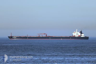
Oil Products Tanker
Current Trip
| Time Travelled | 37 days |
|---|---|
| Remaining Time | --- |
| Distance Travelled | 4200.96 nm |
| Remaining Distance | --- |
| AVG Speed | 6.8 Knop |
| MAX Speed | 14.9 Knop |
| AVG Wind | 19.3 knots |
| MAX Wind | 39 knots |
| MIN Temp | 4.5°C / 40.1°F |
| MAX Temp | 21.1°C / 69.98°F |
| Djupgående | 11.5 m |
| Position mottagen | 4 h, 58 m sen |
Current Position
| Longitud | --- |
|---|---|
| Latitude | --- |
| Status | Moored |
| Fart | |
| Kurs | 145° |
| Område | Ligurian Sea |
| Station | T-AIS |
| Position mottagen | 4 h, 58 m sen |
Info
Information
The current position of SOHO SQUARE is in Ligurian Sea with coordinates 44.27901° / 8.46023° as reported on 2026-01-03 10:06 by AIS to our vessel tracker app. The vessel's current speed is 0 Knop
The vessel SOHO SQUARE (IMO: 9505819, MMSI: 636019142) is a Oil Products Tanker that was built in 2012 ( 14 År gammal ). It's sailing under the flag of [LR] Liberia.
In this page you can find informations about the vessels current position, last detected port calls, and current voyage information. If the vessels is not in coverage by AIS you will find the latest position.
The current position of SOHO SQUARE is detected by our AIS receivers and we are not responsible for the reliability of the data. The last position was recorded while the vessel was in Coverage by the Ais receivers of our vessel tracking app.
The current draught of SOHO SQUARE as reported by AIS is 11.5 meters
Weather
| Temperature | 8.4°C / 47.12°F |
|---|---|
| Wind Speed | 7 knots |
| Direction | 333° NNW |
| Pressure | 1002.9 hPa |
| Humidity | 53.1 % |
| Cloud Coverage | 91 % |
Featured Company
Most Visited Ports (Last year)
| Port | Arrivals | |
|---|---|---|
| 2 | ||
| 2 | ||
| 2 | ||
| 2 | ||
| 1 | ||
| 1 |
Events
| Tid | Event | Detaljer | Position / Dest | Information |
|---|---|---|---|---|
| 2026-01-03 10:12 | Status ändrad | Default Moored |
44.27900 / 8.46020
ITSVN
|
Fart: Kurs: 145° |
| 2026-01-03 10:06 | Status ändrad | Moored Under way using engine |
44.27901 / 8.46023
ITSVN
|
Fart: Kurs: 145° |
| 2026-01-03 10:06 | UTANFÖR täckningsområde |
44.27901 / 8.46023
Ligurian Sea
|
Fart: Kurs: 236° |
|
| 2026-01-03 08:46 | STOPPAR förflyttning | 0.58 nm, North East of VADO LIGURE |
44.27297 / 8.46266
ITSVN
|
Fart: 0.3 kn Kurs: 3° |
| 2026-01-03 07:02 | STARTAR förflyttning | 6.67 nm, East of NOLI |
44.17844 / 8.56965
ITSVN
|
Fart: 3.1 kn Kurs: 337° |
| 2026-01-03 06:40 | STOPPAR förflyttning | 6.89 nm, East of NOLI |
44.17370 / 8.57338
ITSVN
|
Fart: 0.3 kn Kurs: 353° |
| 2026-01-03 04:12 | Status ändrad | Under way using engine Default |
44.07196 / 8.65503
ITSVN
|
Fart: 4 kn Kurs: 270° |
| 2026-01-03 03:57 | Status ändrad | Default Under way using engine |
44.07256 / 8.68193
ITSVN
|
Fart: 3.4 kn Kurs: 270° |
| 2026-01-03 01:42 | Status ändrad | Under way using engine Default |
44.00162 / 8.55134
ITSVN
|
Fart: 3.8 kn Kurs: 46° |
| 2026-01-03 01:37 | Status ändrad | Default Under way using engine |
43.99791 / 8.54582
ITSVN
|
Fart: 2.7 kn Kurs: 55° |