
SIRIUS
Cargo
Current Trip
ESCAS
| Time Travelled | 20 h, 20 mins |
|---|---|
| Remaining Time | --- |
| Distance Travelled | 44.75 nm |
| Remaining Distance | --- |
| AVG Speed | 8.8 Knop |
| MAX Speed | 13.2 Knop |
| AVG Wind | 6.4 knots |
| MAX Wind | 23.3 knots |
| MIN Temp | 12.7°C / 54.86°F |
| MAX Temp | 17.1°C / 62.78°F |
| Djupgående | 5.5 m |
| Position mottagen | 2 m sen |
Current Position
| Longitud | --- |
|---|---|
| Latitude | --- |
| Status | At anchor |
| Fart | 0.1 Knop |
| Kurs | 248° |
| Område | Balearic Sea |
| Station | T-AIS |
| Position mottagen | 2 m sen |
Info
Information
The current position of SIRIUS is in Balearic Sea with coordinates 39.96354° / 0.06255° as reported on 2025-12-05 20:41 by AIS to our vessel tracker app. The vessel's current speed is 0.1 Knop
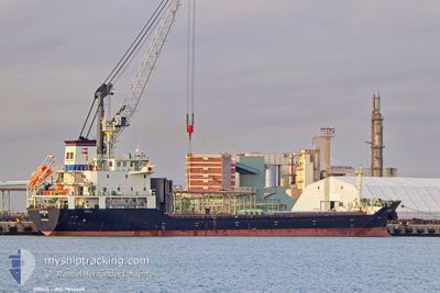
The vessel SIRIUS (IMO: 9846469, MMSI: 255916299) is a Cargo It's sailing under the flag of [PT] Portugal.
In this page you can find informations about the vessels current position, last detected port calls, and current voyage information. If the vessels is not in coverage by AIS you will find the latest position.
The current position of SIRIUS is detected by our AIS receivers and we are not responsible for the reliability of the data. The last position was recorded while the vessel was in Coverage by the Ais receivers of our vessel tracking app.
The current draught of SIRIUS as reported by AIS is 5.5 meters
Weather
| Temperature | 14.4°C / 57.92°F |
|---|---|
| Wind Speed | 4 knots |
| Direction | 321° NW |
| Pressure | 1017.4 hPa |
| Humidity | 45.4 % |
| Cloud Coverage | 95 % |
Featured Company
Last Port Calls
| Port | Arrival | Departure | Time In Port |
|---|---|---|---|
| 2025-12-03 17:46 | 2025-12-05 01:24 | 1 d | |
| 2025-12-01 05:14 | 2025-12-01 20:18 | 15 h | |
| 2025-11-22 19:24 | 2025-11-23 12:58 | 17 h | |
| 2025-11-19 14:23 | 2025-11-20 18:25 | 1 d | |
| 2025-11-12 09:35 | 2025-11-13 18:00 | 1 d | |
| 2025-11-11 12:49 | 2025-11-11 17:48 | 4 h | |
| 2025-11-10 10:44 | 2025-11-10 22:13 | 11 h | |
| 2025-11-04 03:31 | |||
| 2025-10-23 05:48 | 2025-10-24 08:10 | 1 d |
Last Trips
| Origin | Departure | Destination | Arrival | Distance | |
|---|---|---|---|---|---|
| 2025-12-01 20:18 | 2025-12-03 17:46 | 471.32 nm | |||
| 2025-11-23 12:58 | 2025-12-01 05:14 | 1327.15 nm | |||
| 2025-11-20 18:25 | 2025-11-22 19:24 | 89.90 nm | |||
| 2025-11-13 18:00 | 2025-11-19 14:23 | 1550.26 nm | |||
| 2025-11-11 17:48 | 2025-11-12 09:35 | 175.05 nm | |||
| 2025-11-10 22:13 | 2025-11-11 12:49 | 164.89 nm | |||
| 2025-11-04 03:31 | 2025-11-10 10:44 | 1380.05 nm |
Events
| Tid | Event | Detaljer | Position / Dest | Information |
|---|---|---|---|---|
| 2025-12-05 19:57 | Status ändrad | At anchor Under way using engine |
39.96330 / .06261
ESCAS
|
Fart: 0.1 kn Kurs: 268° |
| 2025-12-05 17:27 | STOPPAR förflyttning | 1.84 nm, East of CASTELLON |
39.96274 / .06111
ESCAS
|
Fart: 0.2 kn Kurs: 356° |
| 2025-12-05 14:05 | I täckningsområde |
39.92658 / .42237
Balearic Sea
|
Fart: 1 kn Kurs: 48.6° |
|
| 2025-12-05 10:51 | UTANFÖR täckningsområde |
39.91714 / .33727
Balearic Sea
|
Fart: 1.6 kn Kurs: 79° |
|
| 2025-12-05 09:39 | I täckningsområde |
39.92047 / .35377
Balearic Sea
|
Fart: 10.9 kn Kurs: 272.6° |
|
| 2025-12-05 04:32 | UTANFÖR täckningsområde |
39.90290 / .35781
Balearic Sea
|
Fart: 1.6 kn Kurs: 74.4° |
|
| 2025-12-05 00:33 | Status ändrad | Under way using engine Moored |
39.94680 / .06083
ESCAS
|
Fart: 11.7 kn Kurs: 101.1° |
| 2025-12-05 00:24 | AVGÅTT HAMN |
|
39.95151 / .02940
ESCAS
|
Fart: 5.1 kn Kurs: 156° |
| 2025-12-05 00:14 | STARTAR förflyttning |
39.95873 / .01717
[ES] CASTELLON
|
Fart: 4 kn Kurs: 77° |
|
| 2025-12-04 11:23 | I täckningsområde |
39.95595 / .01464
Balearic Sea
[ES] CASTELLON
|
Fart: Kurs: 311.6° |