
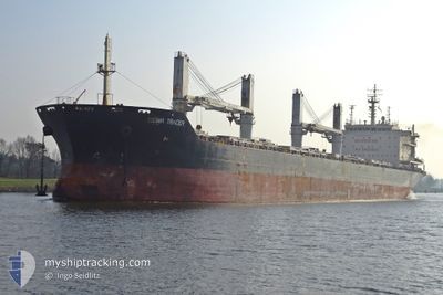
SIGMA TRADER
Bulk Carrier
Current Trip
SANTA MARTA
| Time Travelled | 4 days |
|---|---|
| Remaining Time | --- |
| Distance Travelled | 884.22 nm |
| Remaining Distance | --- |
| AVG Speed | 9.4 Knop |
| MAX Speed | 11.1 Knop |
| AVG Wind | 15.6 knots |
| MAX Wind | 20 knots |
| MIN Temp | 21.8°C / 71.24°F |
| MAX Temp | 27.4°C / 81.32°F |
| Djupgående | 6.4 m |
| Position mottagen | 2 d sen |
Current Position
| Longitud | --- |
|---|---|
| Latitude | --- |
| Status | Under way using engine |
| Fart | 9.1 Knop |
| Kurs | 55.9° |
| Område | North Atlantic Ocean |
| Station | T-AIS |
| Position mottagen | 2 d sen |
Info
Information
The current position of SIGMA TRADER is in North Atlantic Ocean with coordinates 14.50285° / -59.61143° as reported on 2025-12-18 10:14 by AIS to our vessel tracker app. The vessel's current speed is 9.1 Knop
The vessel SIGMA TRADER (IMO: 9486568, MMSI: 538008018) is a Bulk Carrier that was built in 2010 ( 15 År gammal ). It's sailing under the flag of [MH] Marshall Is.
In this page you can find informations about the vessels current position, last detected port calls, and current voyage information. If the vessels is not in coverage by AIS you will find the latest position.
The current position of SIGMA TRADER is detected by our AIS receivers and we are not responsible for the reliability of the data. The last position was recorded while the vessel was in Coverage by the Ais receivers of our vessel tracking app.
The current draught of SIGMA TRADER as reported by AIS is 6.4 meters
Weather
| Temperature | 25.9°C / 78.62°F |
|---|---|
| Wind Speed | 16 knots |
| Direction | 97° E |
| Pressure | 1018.5 hPa |
| Humidity | 70.8 % |
| Cloud Coverage | --- |
Featured Company
Last Port Calls
| Port | Arrival | Departure | Time In Port |
|---|---|---|---|
| 2025-12-04 15:35 | 2025-12-16 06:56 | 11 d | |
| 2025-11-21 18:35 | 2025-11-23 08:55 | 1 d | |
| 2025-11-05 04:42 | 2025-11-07 05:20 | 2 d | |
| 2025-10-31 21:14 | 2025-11-05 04:02 | 4 d | |
| 2025-10-11 02:53 | 2025-10-16 19:25 | 5 d | |
| 2025-10-01 04:20 |
Most Visited Ports (Last year)
| Port | Arrivals | |
|---|---|---|
| 3 | ||
| 2 | ||
| 1 | ||
| 1 | ||
| 1 | ||
| 1 |
Last Trips
| Origin | Departure | Destination | Arrival | Distance | |
|---|---|---|---|---|---|
| 2025-11-23 08:55 | 2025-12-04 15:35 | 1845.07 nm | |||
| 2025-11-07 05:20 | 2025-11-21 18:35 | 1392.42 nm | |||
| 2025-11-05 04:02 | 2025-11-05 04:42 | 4.26 nm | |||
| 2025-10-16 19:25 | 2025-10-31 21:14 | 4238.28 nm | |||
| 2025-10-01 04:20 | 2025-10-11 02:53 | 1047.61 nm |
Events
| Tid | Event | Detaljer | Position / Dest | Information |
|---|---|---|---|---|
| 2025-12-18 10:18 | Status ändrad | Default Under way using engine |
14.50667 / -59.60333
SANTA MARTA
|
Fart: 9.1 kn Kurs: 55.9° |
| 2025-12-18 10:14 | UTANFÖR täckningsområde |
14.50285 / -59.61143
North Atlantic Ocean
|
Fart: 9.1 kn Kurs: 55.9° |
|
| 2025-12-18 10:14 | Byter havsområde | Barbados part of the North Atlantic Ocean Guadeloupe and Martinique part of the North Atlantic Ocean |
14.50285 / -59.61143
North Atlantic Ocean
|
Fart: 9.1 kn Kurs: 55.9° |
| 2025-12-18 10:11 | Byter havsområde | Guadeloupe and Martinique part of the North Atlantic Ocean Guadeloupe and Martinique part of the Caribbean Sea |
14.49878 / -59.61714
North Atlantic Ocean
|
Fart: 9.7 kn Kurs: 52.7° |
| 2025-12-18 10:03 | Status ändrad | Under way using engine Default |
14.48640 / -59.63537
SANTA MARTA
|
Fart: 9 kn Kurs: 55° |
| 2025-12-18 09:35 | Status ändrad | Default Under way using engine |
14.44333 / -59.69667
SANTA MARTA
|
Fart: 9.1 kn Kurs: 56.5° |
| 2025-12-18 09:23 | Status ändrad | Under way using engine Default |
14.42528 / -59.72607
SANTA MARTA
|
Fart: 9 kn Kurs: 56° |
| 2025-12-18 08:38 | Status ändrad | Default Under way using engine |
14.35833 / -59.82500
SANTA MARTA
|
Fart: 9.7 kn Kurs: 54.2° |
| 2025-12-18 08:36 | Status ändrad | Under way using engine Default |
14.35558 / -59.83217
SANTA MARTA
|
Fart: 9 kn Kurs: 54° |
| 2025-12-18 08:29 | Status ändrad | Default Under way using engine |
14.34500 / -59.84500
SANTA MARTA
|
Fart: 9.9 kn Kurs: 55.6° |