
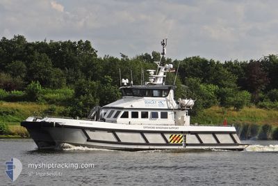
BF DEFENDER
Search and Rescue vessel
Current Trip
Current Position
| Longitud | 1.42321° |
|---|---|
| Latitude | 51.32957° |
| Status | Under way using engine |
| Fart | |
| Kurs | 260° |
| Område | North Sea |
| Station | T-AIS |
| Position mottagen | Nu |
Info
Information
The current position of BF DEFENDER is in North Sea with coordinates 51.32957° / 1.42321° as reported on 2024-05-01 09:34 by AIS to our vessel tracker app. The vessel's current speed is 0 Knop and is currently inside the port of RAMSGATE.
The vessel BF DEFENDER (IMO: 835460300, MMSI: 235098051) is a Search and Rescue vessel It's sailing under the flag of [GB] United Kingdom.
In this page you can find informations about the vessels current position, last detected port calls, and current voyage information. If the vessels is not in coverage by AIS you will find the latest position.
The current position of BF DEFENDER is detected by our AIS receivers and we are not responsible for the reliability of the data. The last position was recorded while the vessel was in Coverage by the Ais receivers of our vessel tracking app.
The current draught of BF DEFENDER as reported by AIS is 1.4 meters
Weather
| Temperature | 12°C / 53.6°F |
|---|---|
| Wind Speed | 5 knots |
| Direction | 111° ESE |
| Pressure | 1008.2 hPa |
| Humidity | 95.8 % |
| Cloud Coverage | 89 % |
Featured Company
Last Port Calls
| Port | Arrival | Departure | Time In Port |
|---|---|---|---|
| 2024-05-01 00:11 | |||
| 2024-04-30 22:50 | 2024-04-30 23:22 | 31 m | |
| 2024-04-30 19:04 | 2024-04-30 19:46 | 42 m | |
| 2024-04-30 11:46 | 2024-04-30 15:52 | 4 h | |
| 2024-04-27 14:34 | 2024-04-30 10:17 | 2 d | |
| 2024-04-27 11:15 | 2024-04-27 13:56 | 2 h | |
| 2024-04-26 13:55 | 2024-04-27 05:36 | 15 h | |
| 2024-04-26 11:53 | 2024-04-26 13:11 | 1 h | |
| 2024-04-24 10:27 | 2024-04-26 09:39 | 1 d | |
| 2024-04-24 09:18 | 2024-04-24 09:43 | 24 m |
Most Visited Ports (Last year)
| Port | Arrivals | |
|---|---|---|
| 112 | ||
| 91 | ||
| 1 |
Last Trips
| Origin | Departure | Destination | Arrival | Distance | |
|---|---|---|---|---|---|
| 2024-05-01 00:22 | 2024-05-01 01:11 | 16.63 nm | |||
| 2024-04-30 20:46 | 2024-04-30 23:50 | 40.46 nm | |||
| 2024-04-30 16:52 | 2024-04-30 20:04 | 41.47 nm | |||
| 2024-04-30 11:17 | 2024-04-30 12:46 | 8.91 nm | |||
| 2024-04-27 14:56 | 2024-04-27 15:34 | 14.15 nm | |||
| 2024-04-27 06:36 | 2024-04-27 12:15 | 70.92 nm | |||
| 2024-04-26 14:11 | 2024-04-26 14:55 | 16.17 nm | |||
| 2024-04-26 10:39 | 2024-04-26 12:53 | 33.34 nm | |||
| 2024-04-24 10:43 | 2024-04-24 11:27 | 16.23 nm | |||
| 2024-04-24 09:49 | 2024-04-24 10:18 | 5.91 nm |
Events
| Tid | Event | Detaljer | Position / Dest | Information |
|---|---|---|---|---|
| 2024-05-01 00:17 | STOPPAR förflyttning |
51.32957 / 1.42320
[GB] RAMSGATE
|
Fart: 0.3 kn Kurs: 261° |
|
| 2024-05-01 00:11 | ANLÄNDER HAMN |
|
51.32502 / 1.42395
[GB] RAMSGATE
|
Fart: 13.1 kn Kurs: 273.3° |
| 2024-05-01 00:02 | ETA ändrat | 2025/04/27 07:00 2024/04/27 07:00 |
51.28933 / 1.47574
SAR
|
Fart: 19.1 kn Kurs: 8.2° |
| 2024-04-30 23:32 | Byter havsområde | United Kingdom part of the North Sea United Kingdom part of the English Channel |
51.13533 / 1.39520
North Sea
|
Fart: 20.2 kn Kurs: 26.2° |
| 2024-04-30 23:22 | AVGÅTT HAMN |
|
51.11181 / 1.33480
SAR
|
Fart: 15.4 kn Kurs: 95° |
| 2024-04-30 22:50 | ANLÄNDER HAMN |
|
51.12023 / 1.34314
[GB] DOVER
|
Fart: 17.7 kn Kurs: 246.7° |
| 2024-04-30 22:47 | Byter havsområde | United Kingdom part of the English Channel United Kingdom part of the North Sea |
51.12770 / 1.37579
English Channel
|
Fart: 19.3 kn Kurs: 251° |
| 2024-04-30 21:50 | Status ändrad | Under way using engine Restricted manoeuverability |
51.14161 / 1.77693
SAR
|
Fart: 16.1 kn Kurs: 316.8° |
| 2024-04-30 21:47 | STARTAR förflyttning | 10.77 nm, North of CALAIS |
51.14328 / 1.78413
SAR
|
Fart: 3.4 kn Kurs: 146° |
| 2024-04-30 21:29 | STOPPAR förflyttning | 10.94 nm, North of CALAIS |
51.14625 / 1.78478
SAR
|
Fart: 0.3 kn Kurs: 123° |