
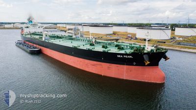
SEA PEARL
Tanker
Current Trip
| Time Travelled | --- |
|---|---|
| Remaining Time | 22 h, 50 mins |
| Distance Travelled | 7499.33 nm |
| Remaining Distance | 286.03 nm |
| AVG Speed | 11.7 Knop |
| MAX Speed | 15.6 Knop |
| AVG Wind | 14.5 knots |
| MAX Wind | 29 knots |
| MIN Temp | 18.8°C / 65.84°F |
| MAX Temp | 29.1°C / 84.38°F |
| Djupgående | 11.3 m |
| Position mottagen | 1 m sen |
Current Position
| Longitud | 52.73615° |
|---|---|
| Latitude | 26.84021° |
| Status | Under way using engine |
| Fart | 11.8 Knop |
| Kurs | 335° |
| Område | Persian Gulf |
| Station | T-AIS |
| Position mottagen | 1 m sen |
Info
Information
The current position of SEA PEARL is in Persian Gulf with coordinates 26.84021° / 52.73615° as reported on 2024-06-12 09:27 by AIS to our vessel tracker app. The vessel's current speed is 11.8 Knop and is heading at the port of MINA AL AHMADI. The estimated time of arrival as calculated by MyShipTracking vessel tracking app is 2024-06-13 11:18 LT
The vessel SEA PEARL (IMO: 9779604, MMSI: 241465000) is a Tanker It's sailing under the flag of [GR] Greece.
In this page you can find informations about the vessels current position, last detected port calls, and current voyage information. If the vessels is not in coverage by AIS you will find the latest position.
The current position of SEA PEARL is detected by our AIS receivers and we are not responsible for the reliability of the data. The last position was recorded while the vessel was in Coverage by the Ais receivers of our vessel tracking app.
The current draught of SEA PEARL as reported by AIS is 11.3 meters
Weather
| Temperature | 32.3°C / 90.14°F |
|---|---|
| Wind Speed | 12 knots |
| Direction | 283° WNW |
| Pressure | 1001.6 hPa |
| Humidity | 70.3 % |
| Cloud Coverage | --- |
Featured Company
Last Port Calls
Last Trips
| Origin | Departure | Destination | Arrival | Distance |
|---|
Events
| Tid | Event | Detaljer | Position / Dest | Information |
|---|---|---|---|---|
| 2024-06-12 09:27 | Status ändrad | Under way using engine Default |
26.84021 / 52.73615
KWMEA
|
Fart: 12.6 kn Kurs: 355° |
| 2024-06-12 09:21 | Status ändrad | Default Under way using engine |
26.81991 / 52.74021
KWMEA
|
Fart: 12.7 kn Kurs: 354.5° |
| 2024-06-12 09:01 | Status ändrad | Under way using engine Default |
26.75307 / 52.74759
KWMEA
|
Fart: 12.7 kn Kurs: 350° |
| 2024-06-12 08:57 | Status ändrad | Default Under way using engine |
26.73747 / 52.75099
KWMEA
|
Fart: 12.8 kn Kurs: 349.6° |
| 2024-06-12 08:18 | Status ändrad | Under way using engine Default |
26.60440 / 52.78558
KWMEA
|
Fart: 12.3 kn Kurs: 347° |
| 2024-06-12 08:15 | Status ändrad | Default Under way using engine |
26.59376 / 52.78846
KWMEA
|
Fart: 12.2 kn Kurs: 348.9° |
| 2024-06-11 23:26 | Byter havsområde | Iranian part of the Persian Gulf United Arab Emirates part of the Persian Gulf |
25.69327 / 54.58535
Persian Gulf
KWMEA
|
Fart: 13 kn Kurs: 268.1° |
| 2024-06-11 17:35 | Byter havsområde | United Arab Emirates part of the Persian Gulf Omani part of the Persian Gulf |
26.20105 / 55.84670
Persian Gulf
KWMEA
|
Fart: 12.9 kn Kurs: 225.7° |
| 2024-06-11 13:58 | Byter havsområde | Omani part of the Persian Gulf Omani part of the Gulf of Oman |
26.63419 / 56.49520
Persian Gulf
KWMEA
|
Fart: 12.8 kn Kurs: 266.3° |
| 2024-06-11 13:56 | Status ändrad | Under way using engine Default |
26.63452 / 56.50517
KWMEA
|
Fart: 12.9 kn Kurs: 274° |