
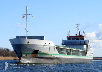
SCHELDEBANK
Cargo
Current Trip
| Time Travelled | 22 h, 57 mins |
|---|---|
| Remaining Time | 1 day |
| Distance Travelled | 218.79 nm |
| Remaining Distance | 506.20 nm |
| AVG Speed | 9.1 Knop |
| MAX Speed | 13 Knop |
| AVG Wind | 11.5 knots |
| MAX Wind | 17 knots |
| MIN Temp | 10.4°C / 50.72°F |
| MAX Temp | 11.7°C / 53.06°F |
| Djupgående | 5 m |
| Position mottagen | 1 m sen |
Current Position
| Longitud | -5.14312° |
|---|---|
| Latitude | 48.69577° |
| Status | Under way using engine |
| Fart | 12.8 Knop |
| Kurs | 50° |
| Område | Celtic Sea |
| Station | T-AIS |
| Position mottagen | 1 m sen |
Info
Information
The current position of SCHELDEBANK is in Celtic Sea with coordinates 48.69577° / -5.14312° as reported on 2024-04-26 15:36 by AIS to our vessel tracker app. The vessel's current speed is 12.8 Knop and is heading at the port of HULL. The estimated time of arrival as calculated by MyShipTracking vessel tracking app is 2024-04-28 09:36 LT
The vessel SCHELDEBANK (MMSI: 244870000) is a Cargo It's sailing under the flag of [NL] Netherlands.
In this page you can find informations about the vessels current position, last detected port calls, and current voyage information. If the vessels is not in coverage by AIS you will find the latest position.
The current position of SCHELDEBANK is detected by our AIS receivers and we are not responsible for the reliability of the data. The last position was recorded while the vessel was in Coverage by the Ais receivers of our vessel tracking app.
The current draught of SCHELDEBANK as reported by AIS is 5 meters
Weather
| Temperature | 10.4°C / 50.72°F |
|---|---|
| Wind Speed | 16 knots |
| Direction | 270° W |
| Pressure | 1001.5 hPa |
| Humidity | 66.2 % |
| Cloud Coverage | 67 % |
Featured Company
Last Port Calls
| Port | Arrival | Departure | Time In Port |
|---|---|---|---|
| 2024-04-24 15:05 | 2024-04-25 16:41 | 1 d | |
| 2024-04-22 23:30 | 2024-04-23 14:24 | 14 h | |
| 2024-04-22 05:26 | 2024-04-22 12:38 | 7 h | |
| 2024-04-16 10:09 | 2024-04-17 21:38 | 1 d | |
| 2024-04-14 10:35 | 2024-04-16 09:27 | 1 d | |
| 2024-04-09 23:40 | 2024-04-12 09:42 | 2 d | |
| 2024-04-09 18:45 | 2024-04-09 20:54 | 2 h | |
| 2024-04-09 04:12 | 2024-04-09 16:09 | 11 h | |
| 2024-04-08 14:48 | |||
| 2024-03-29 18:27 | 2024-04-03 13:28 | 4 d |
Most Visited Ports (Last year)
| Port | Arrivals | |
|---|---|---|
| 6 | ||
| 3 | ||
| 3 | ||
| 3 | ||
| 3 | ||
| 3 |
Last Trips
| Origin | Departure | Destination | Arrival | Distance | |
|---|---|---|---|---|---|
| 2024-04-23 16:24 | 2024-04-24 17:05 | 241.72 nm | |||
| 2024-04-22 14:38 | 2024-04-23 01:30 | 134.32 nm | |||
| 2024-04-17 23:38 | 2024-04-22 07:26 | 1027.65 nm | |||
| 2024-04-16 11:27 | 2024-04-16 12:09 | 6.49 nm | |||
| 2024-04-12 10:42 | 2024-04-14 12:35 | 429.90 nm | |||
| 2024-04-03 14:28 | 2024-04-10 00:40 | 1303.52 nm | |||
| 2024-04-03 14:28 | 2024-04-09 19:45 | 1300.48 nm | |||
| 2024-04-03 14:28 | 2024-04-09 05:12 | 1299.55 nm | |||
| 2024-04-03 14:28 | 2024-04-08 15:48 | 1298.77 nm | |||
| 2024-03-27 20:47 | 2024-03-29 18:27 | 197.45 nm |
Events
| Tid | Event | Detaljer | Position / Dest | Information |
|---|---|---|---|---|
| 2024-04-26 14:59 | Status ändrad | Under way using engine Default |
48.60151 / -5.29051
HULL
|
Fart: 12 kn Kurs: 38° |
| 2024-04-26 14:59 | I täckningsområde |
48.60151 / -5.29051
Celtic Sea
|
Fart: 12.5 kn Kurs: 41.4° |
|
| 2024-04-26 12:00 | Status ändrad | Default Under way using engine |
48.11833 / -5.33333
HULL
|
Fart: 8.7 kn Kurs: 351° |
| 2024-04-26 11:55 | UTANFÖR täckningsområde |
48.10817 / -5.33159
Celtic Sea
|
Fart: 8.7 kn Kurs: 351° |
|
| 2024-04-26 10:36 | Djupgående ändrat | 5 3.9 |
47.94209 / -5.21262
HULL
|
Fart: 7.6 kn Kurs: 321° |
| 2024-04-26 10:36 | Destination ändrad | HULL FRLSO |
47.94209 / -5.21262
HULL
|
Fart: 7.6 kn Kurs: 321° |
| 2024-04-26 10:11 | Status ändrad | Under way using engine Default |
47.89740 / -5.16695
FRLSO
|
Fart: 7 kn Kurs: 317° |
| 2024-04-26 10:09 | Status ändrad | Default Under way using engine |
47.89333 / -5.16167
FRLSO
|
Fart: 7.1 kn Kurs: 317° |
| 2024-04-26 09:55 | Byter havsområde | French part of the Celtic Sea French part of the Bay of Biscay |
47.87410 / -5.13452
Celtic Sea
|
Fart: 7.2 kn Kurs: 316° |
| 2024-04-26 09:55 | Status ändrad | Under way using engine Default |
47.87410 / -5.13452
FRLSO
|
Fart: 7 kn Kurs: 317° |