
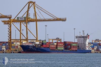
SANTUCA B
Container Ship
Current Trip
| Time Travelled | 19 h, 24 mins |
|---|---|
| Remaining Time | 1 day |
| Distance Travelled | 270.97 nm |
| Remaining Distance | 478.91 nm |
| AVG Speed | 14 Knop |
| MAX Speed | 14.7 Knop |
| AVG Wind | 11 knots |
| MAX Wind | 16.5 knots |
| MIN Temp | 17.3°C / 63.14°F |
| MAX Temp | 20°C / 68°F |
| Djupgående | 6.7 m |
| Position mottagen | 1 m sen |
Current Position
| Longitud | -13.71481° |
|---|---|
| Latitude | 31.53082° |
| Status | Under way using engine |
| Fart | 14.3 Knop |
| Kurs | 50.1° |
| Område | North Atlantic Ocean |
| Station | T-AIS |
| Position mottagen | 1 m sen |
Info
Information
The current position of SANTUCA B is in North Atlantic Ocean with coordinates 31.53082° / -13.71481° as reported on 2024-05-08 18:39 by AIS to our vessel tracker app. The vessel's current speed is 14.3 Knop and is heading at the port of CADIZ. The estimated time of arrival as calculated by MyShipTracking vessel tracking app is 2024-05-10 04:54 LT
The vessel SANTUCA B (IMO: 9287687, MMSI: 255805627) is a Container Ship that was built in 2003 ( 21 År gammal ). It's sailing under the flag of [PT] Portugal.
In this page you can find informations about the vessels current position, last detected port calls, and current voyage information. If the vessels is not in coverage by AIS you will find the latest position.
The current position of SANTUCA B is detected by our AIS receivers and we are not responsible for the reliability of the data. The last position was recorded while the vessel was in Coverage by the Ais receivers of our vessel tracking app.
The current draught of SANTUCA B as reported by AIS is 6.7 meters
Weather
| Temperature | 19.8°C / 67.64°F |
|---|---|
| Wind Speed | 6 knots |
| Direction | 21° NNE |
| Pressure | 1015.1 hPa |
| Humidity | 76.7 % |
| Cloud Coverage | 100 % |
Featured Company
Last Port Calls
| Port | Arrival | Departure | Time In Port |
|---|---|---|---|
| 2024-05-07 20:02 | 2024-05-07 23:17 | 3 h | |
| 2024-05-07 06:25 | 2024-05-07 13:02 | 6 h | |
| 2024-05-06 18:22 | 2024-05-07 00:41 | 6 h | |
| 2024-05-03 04:14 | 2024-05-03 21:33 | 17 h | |
| 2024-04-29 07:30 | 2024-04-30 01:16 | 17 h | |
| 2024-04-28 23:44 | 2024-04-29 04:05 | 4 h | |
| 2024-04-26 05:16 | 2024-04-27 04:29 | 23 h | |
| 2024-04-23 20:42 | 2024-04-24 01:18 | 4 h | |
| 2024-04-23 06:15 | 2024-04-23 14:17 | 8 h | |
| 2024-04-22 18:00 | 2024-04-23 01:54 | 7 h |
Last Trips
| Origin | Departure | Destination | Arrival | Distance | |
|---|---|---|---|---|---|
| 2024-05-07 14:02 | 2024-05-07 21:02 | 100.38 nm | |||
| 2024-05-07 01:41 | 2024-05-07 07:25 | 54.12 nm | |||
| 2024-05-03 23:33 | 2024-05-06 19:22 | 1014.26 nm | |||
| 2024-04-30 02:16 | 2024-05-03 06:14 | 1012.44 nm | |||
| 2024-04-29 05:05 | 2024-04-29 08:30 | 53.62 nm | |||
| 2024-04-27 06:29 | 2024-04-29 00:44 | 701.97 nm | |||
| 2024-04-24 02:18 | 2024-04-26 07:16 | 751.02 nm | |||
| 2024-04-23 15:17 | 2024-04-23 21:42 | 100.32 nm | |||
| 2024-04-23 02:54 | 2024-04-23 07:15 | 54.28 nm | |||
| 2024-04-20 05:01 | 2024-04-22 19:00 | 1014.00 nm |
Events
| Tid | Event | Detaljer | Position / Dest | Information |
|---|---|---|---|---|
| 2024-05-08 18:36 | Status ändrad | Under way using engine Default |
31.52240 / -13.72680
ESCAD
|
Fart: 14.3 kn Kurs: 50° |
| 2024-05-08 18:35 | Status ändrad | Default Under way using engine |
31.51953 / -13.73088
ESCAD
|
Fart: 14.2 kn Kurs: 49.3° |
| 2024-05-08 17:31 | Status ändrad | Under way using engine Default |
31.36337 / -13.95093
ESCAD
|
Fart: 13.7 kn Kurs: 51° |
| 2024-05-08 17:29 | Status ändrad | Default Under way using engine |
31.35741 / -13.95961
ESCAD
|
Fart: 13.7 kn Kurs: 51.4° |
| 2024-05-08 17:06 | Byter havsområde | Spanish (Canary Islands) part of the North Atlantic Ocean Portuguese (Madeira) part of the North Atlantic Ocean |
31.30287 / -14.03853
North Atlantic Ocean
ESCAD
|
Fart: 14 kn Kurs: 51° |
| 2024-05-08 16:43 | Status ändrad | Under way using engine Default |
31.24480 / -14.11951
ESCAD
|
Fart: 13.9 kn Kurs: 48° |
| 2024-05-08 15:58 | Status ändrad | Default Under way using engine |
31.13104 / -14.27545
ESCAD
|
Fart: 14 kn Kurs: 50.8° |
| 2024-05-08 15:50 | Status ändrad | Under way using engine Default |
31.11247 / -14.30224
ESCAD
|
Fart: 14 kn Kurs: 52° |
| 2024-05-08 15:39 | Status ändrad | Default Under way using engine |
31.08305 / -14.34472
ESCAD
|
Fart: 13.9 kn Kurs: 50.8° |
| 2024-05-08 15:33 | Status ändrad | Under way using engine Default |
31.06876 / -14.36524
ESCAD
|
Fart: 13.9 kn Kurs: 50° |