
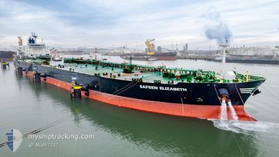
SAFEEN ELIZABETH
Crude Oil Tanker
Current Trip
| Time Travelled | --- |
|---|---|
| Remaining Time | 9 days |
| Distance Travelled | 5430.72 nm |
| Remaining Distance | 2977.22 nm |
| AVG Speed | 10.2 Knop |
| MAX Speed | 15.6 Knop |
| AVG Wind | 14.6 knots |
| MAX Wind | 31.9 knots |
| MIN Temp | 3.1°C / 37.58°F |
| MAX Temp | 26.7°C / 80.06°F |
| Djupgående | 9.2 m |
| Position mottagen | 24 d sen |
Current Position
| Longitud | -46.17561° |
|---|---|
| Latitude | -25.16825° |
| Status | Restricted manoeuverability |
| Fart | 0.5 Knop |
| Kurs | 213° |
| Område | South Atlantic Ocean |
| Station | T-AIS |
| Position mottagen | 24 d sen |
Info
Information
The current position of SAFEEN ELIZABETH is in South Atlantic Ocean with coordinates -25.16825° / -46.17561° as reported on 2024-05-09 02:08 by AIS to our vessel tracker app. The vessel's current speed is 0.5 Knop and is heading at the port of SANTOS. The estimated time of arrival as calculated by MyShipTracking vessel tracking app is 2024-06-12 01:54 LT
The vessel SAFEEN ELIZABETH (IMO: 9524449, MMSI: 538004316) is a Crude Oil Tanker that was built in 2011 ( 13 År gammal ). It's sailing under the flag of [MH] Marshall Is.
In this page you can find informations about the vessels current position, last detected port calls, and current voyage information. If the vessels is not in coverage by AIS you will find the latest position.
The current position of SAFEEN ELIZABETH is detected by our AIS receivers and we are not responsible for the reliability of the data. The last position was recorded while the vessel was in Coverage by the Ais receivers of our vessel tracking app.
The current draught of SAFEEN ELIZABETH as reported by AIS is 9.2 meters
Weather
| Temperature | 8.9°C / 48.02°F |
|---|---|
| Wind Speed | 10 knots |
| Direction | 74° ENE |
| Pressure | 1027 hPa |
| Humidity | 71.8 % |
| Cloud Coverage | 35 % |
Featured Company
Most Visited Ports (Last year)
| Port | Arrivals | |
|---|---|---|
| 2 | ||
| 1 | ||
| 1 | ||
| 1 | ||
| 1 | ||
| 1 |
Events
| Tid | Event | Detaljer | Position / Dest | Information |
|---|---|---|---|---|
| 2024-06-01 03:22 | STARTAR förflyttning | 3.66 nm, North West of LIRQUEN |
-36.66341 / -73.03806
OFF SANTOS BASIN
|
Fart: 3.6 kn Kurs: 39° |
| 2024-05-25 03:46 | STOPPAR förflyttning | 3.41 nm, North West of LIRQUEN |
-36.66681 / -73.03489
OFF SANTOS BASIN
|
Fart: 0.2 kn Kurs: 197° |
| 2024-05-25 01:49 | STARTAR förflyttning | 9.39 nm, North West of TOME |
-36.51372 / -73.10133
OFF SANTOS BASIN
|
Fart: 5.1 kn Kurs: 131° |
| 2024-05-25 00:42 | STOPPAR förflyttning | 9.81 nm, North West of TOME |
-36.51305 / -73.11245
OFF SANTOS BASIN
|
Fart: 0.3 kn Kurs: 165° |