
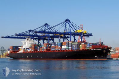
RDO CONCORD
Container Ship
Current Trip
PKBQM
| Time Travelled | 24 days |
|---|---|
| Remaining Time | --- |
| Distance Travelled | 9944.08 nm |
| Remaining Distance | --- |
| AVG Speed | 16.8 Knop |
| MAX Speed | 21.1 Knop |
| AVG Wind | 11 knots |
| MAX Wind | 24 knots |
| MIN Temp | 17.7°C / 63.86°F |
| MAX Temp | 30°C / 86°F |
| Djupgående | 11.3 m |
| Position mottagen | 7 d sen |
Current Position
| Longitud | -9.04067° |
|---|---|
| Latitude | -11.57711° |
| Status | Under way using engine |
| Fart | 16.6 Knop |
| Kurs | 322.1° |
| Område | South Atlantic Ocean |
| Station | T-AIS |
| Position mottagen | 7 d sen |
Info
Information
The current position of RDO CONCORD is in South Atlantic Ocean with coordinates -11.57711° / -9.04067° as reported on 2024-04-21 11:51 by AIS to our vessel tracker app. The vessel's current speed is 16.6 Knop
The vessel RDO CONCORD (IMO: 9401283, MMSI: 636092919) is a Container Ship that was built in 2009 ( 15 År gammal ). It's sailing under the flag of [LR] Liberia.
In this page you can find informations about the vessels current position, last detected port calls, and current voyage information. If the vessels is not in coverage by AIS you will find the latest position.
The current position of RDO CONCORD is detected by our AIS receivers and we are not responsible for the reliability of the data. The last position was recorded while the vessel was in Coverage by the Ais receivers of our vessel tracking app.
The current draught of RDO CONCORD as reported by AIS is 11.3 meters
Weather
| Temperature | 22.7°C / 72.86°F |
|---|---|
| Wind Speed | 6 knots |
| Direction | 28° NNE |
| Pressure | 1016.9 hPa |
| Humidity | 64.2 % |
| Cloud Coverage | 10 % |
Featured Company
Last Port Calls
| Port | Arrival | Departure | Time In Port |
|---|---|---|---|
| 2024-04-04 02:37 | 2024-04-05 03:17 | 1 d | |
| 2024-04-01 03:35 | 2024-04-02 05:41 | 1 d | |
| 2024-03-29 09:36 | 2024-03-30 02:38 | 17 h | |
| 2024-02-26 02:03 | 2024-02-27 17:11 | 1 d | |
| 2024-02-23 16:24 | 2024-02-25 04:22 | 1 d |
Most Visited Ports (Last year)
| Port | Arrivals | |
|---|---|---|
| 6 | ||
| 5 | ||
| 5 | ||
| 5 | ||
| 5 | ||
| 4 |
Last Trips
| Origin | Departure | Destination | Arrival | Distance | |
|---|---|---|---|---|---|
| 2024-04-02 11:11 | 2024-04-04 08:07 | 468.01 nm | |||
| 2024-03-30 07:38 | 2024-04-01 09:05 | 317.58 nm | |||
| 2024-02-27 12:11 | 2024-03-29 14:36 | 11518.43 nm | |||
| 2024-02-24 23:22 | 2024-02-25 21:03 | 303.25 nm | |||
| 2024-01-26 12:46 | 2024-02-23 11:24 | 11456.26 nm |
Events
| Tid | Event | Detaljer | Position / Dest | Information |
|---|---|---|---|---|
| 2024-04-21 11:57 | Status ändrad | Default Under way using engine |
-11.55500 / -9.05667
PKBQM
|
Fart: 16.6 kn Kurs: 322.1° |
| 2024-04-21 11:51 | Status ändrad | Under way using engine Default |
-11.57711 / -9.04067
PKBQM
|
Fart: 16.6 kn Kurs: 324° |
| 2024-04-21 11:51 | UTANFÖR täckningsområde |
-11.57711 / -9.04067
South Atlantic Ocean
|
Fart: 16.6 kn Kurs: 322.1° |
|
| 2024-04-21 11:45 | I täckningsområde |
-11.57711 / -9.04067
South Atlantic Ocean
|
Fart: 16.6 kn Kurs: 322.1° |
|
| 2024-04-21 05:20 | Status ändrad | Default Under way using engine |
-12.82381 / -7.68710
PKBQM
|
Fart: 16.8 kn Kurs: 311.3° |
| 2024-04-21 05:13 | Byter havsområde | High seas of the South Atlantic Ocean St. Helena part of the South Atlantic Ocean |
-12.84635 / -7.66182
South Atlantic Ocean
|
Fart: 16.8 kn Kurs: 311.3° |
| 2024-04-21 05:13 | Status ändrad | Under way using engine Default |
-12.84635 / -7.66182
PKBQM
|
Fart: 17 kn Kurs: 312° |
| 2024-04-21 05:13 | UTANFÖR täckningsområde |
-12.84635 / -7.66182
South Atlantic Ocean
|
Fart: 16.8 kn Kurs: 311.3° |
|
| 2024-04-21 05:09 | I täckningsområde |
-12.84635 / -7.66182
South Atlantic Ocean
|
Fart: 16.8 kn Kurs: 311.3° |
|
| 2024-04-21 03:45 | UTANFÖR täckningsområde |
-13.12503 / -7.35293
South Atlantic Ocean
|
Fart: 16.9 kn Kurs: 310.1° |