
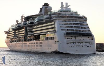
RADIANCE OF THE SEAS
Passengers Ship
Current Trip
USJUN
| Time Travelled | 17 h, 33 mins |
|---|---|
| Remaining Time | --- |
| Distance Travelled | 243.71 nm |
| Remaining Distance | --- |
| AVG Speed | 13.6 Knop |
| MAX Speed | 20.5 Knop |
| AVG Wind | 4.9 knots |
| MAX Wind | 11 knots |
| MIN Temp | 2.9°C / 37.22°F |
| MAX Temp | 12.6°C / 54.68°F |
| Djupgående | 8.8 m |
| Position mottagen | 1 m sen |
Current Position
| Longitud | -128.34003° |
|---|---|
| Latitude | 51.21725° |
| Status | Under way using engine |
| Fart | 20.7 Knop |
| Kurs | 307.2° |
| Område | The Coastal Waters of Southeast Alaska and British Columbia |
| Station | T-AIS |
| Position mottagen | 1 m sen |
Info
Information
The current position of RADIANCE OF THE SEAS is in The Coastal Waters of Southeast Alaska and British Columbia with coordinates 51.21725° / -128.34003° as reported on 2024-05-18 17:36 by AIS to our vessel tracker app. The vessel's current speed is 20.7 Knop
The vessel RADIANCE OF THE SEAS (IMO: 9195195, MMSI: 311319000) is a Passengers Ship that was built in 2001 ( 23 År gammal ). It's sailing under the flag of [BS] Bahamas.
In this page you can find informations about the vessels current position, last detected port calls, and current voyage information. If the vessels is not in coverage by AIS you will find the latest position.
The current position of RADIANCE OF THE SEAS is detected by our AIS receivers and we are not responsible for the reliability of the data. The last position was recorded while the vessel was in Coverage by the Ais receivers of our vessel tracking app.
The current draught of RADIANCE OF THE SEAS as reported by AIS is 8.8 meters
Weather
| Temperature | 8.1°C / 46.58°F |
|---|---|
| Wind Speed | 5 knots |
| Direction | 306° NW |
| Pressure | 1019.6 hPa |
| Humidity | 77.5 % |
| Cloud Coverage | 100 % |
Featured Company
Last Port Calls
| Port | Arrival | Departure | Time In Port |
|---|---|---|---|
| 2024-05-17 06:14 | 2024-05-17 17:05 | 10 h | |
| 2024-05-15 09:22 | 2024-05-15 19:18 | 9 h | |
| 2024-05-13 05:06 | 2024-05-13 20:46 | 15 h | |
| 2024-05-12 07:46 | 2024-05-12 20:14 | 12 h | |
| 2024-05-10 05:06 | 2024-05-10 20:10 | 15 h | |
| 2024-05-08 05:54 | 2024-05-08 16:10 | 10 h | |
| 2024-05-05 13:22 | 2024-05-05 22:34 | 9 h | |
| 2024-05-02 19:43 | 2024-05-03 16:41 | 20 h | |
| 2024-04-25 21:30 | 2024-05-01 19:29 | 5 d | |
| 2024-04-22 06:06 | 2024-04-22 17:12 | 11 h |
Last Trips
| Origin | Departure | Destination | Arrival | Distance | |
|---|---|---|---|---|---|
| 2024-05-15 19:18 | 2024-05-17 06:14 | 539.38 nm | |||
| 2024-05-13 20:46 | 2024-05-15 09:22 | 373.92 nm | |||
| 2024-05-12 20:14 | 2024-05-13 05:06 | 97.68 nm | |||
| 2024-05-10 20:10 | 2024-05-12 07:46 | 620.06 nm | |||
| 2024-05-08 16:10 | 2024-05-10 05:06 | 630.42 nm | |||
| 2024-05-05 22:34 | 2024-05-08 05:54 | 474.87 nm | |||
| 2024-05-03 16:41 | 2024-05-05 13:22 | 791.54 nm | |||
| 2024-05-01 19:29 | 2024-05-02 19:43 | 382.31 nm | |||
| 2024-04-22 17:12 | 2024-04-25 21:30 | 1198.43 nm | |||
| 2024-04-19 19:07 | 2024-04-22 06:06 | 1121.06 nm |
Events
| Tid | Event | Detaljer | Position / Dest | Information |
|---|---|---|---|---|
| 2024-05-18 16:01 | Status ändrad | Under way using engine Default |
50.95996 / -127.73463
USJUN
|
Fart: 14.1 kn Kurs: 311° |
| 2024-05-18 15:57 | Status ändrad | Default Under way using engine |
50.94997 / -127.71680
USJUN
|
Fart: 17 kn Kurs: 311.7° |
| 2024-05-18 15:48 | Status ändrad | Under way using engine Default |
50.92211 / -127.66706
USJUN
|
Fart: 18 kn Kurs: 310° |
| 2024-05-18 15:38 | Status ändrad | Default Under way using engine |
50.88829 / -127.60408
USJUN
|
Fart: 18 kn Kurs: 303.3° |
| 2024-05-18 15:28 | Status ändrad | Under way using engine Default |
50.86087 / -127.53991
USJUN
|
Fart: 17.8 kn Kurs: 300° |
| 2024-05-18 15:28 | I täckningsområde |
50.86220 / -127.54324
The Coastal Waters of Southeast Alaska and British Columbia
USJUN
|
Fart: 17.9 kn Kurs: 302.7° |
|
| 2024-05-18 09:38 | Status ändrad | Default Under way using engine |
50.22167 / -125.37666
USJUN
|
Fart: 16.5 kn Kurs: 348.5° |
| 2024-05-18 09:33 | UTANFÖR täckningsområde |
50.20226 / -125.37109
The Coastal Waters of Southeast Alaska and British Columbia
USJUN
|
Fart: 16.5 kn Kurs: 348.5° |
|
| 2024-05-18 05:18 | Status ändrad | Under way using engine Default |
49.53668 / -124.55504
USJUN
|
Fart: 10.1 kn Kurs: 321° |
| 2024-05-18 05:06 | Status ändrad | Default Under way using engine |
49.51145 / -124.52250
USJUN
|
Fart: 10.1 kn Kurs: 319.3° |