
QING PING SHAN
Cargo
Current Trip
| Time Travelled | 20 days |
|---|---|
| Remaining Time | --- |
| Distance Travelled | 4162.74 nm |
| Remaining Distance | --- |
| AVG Speed | 11.3 Knop |
| MAX Speed | 14 Knop |
| AVG Wind | 13.3 knots |
| MAX Wind | 26.8 knots |
| MIN Temp | 17.7°C / 63.86°F |
| MAX Temp | 30°C / 86°F |
| Djupgående | 9.2 m |
| Position mottagen | 13 h, 58 m sen |
Current Position
| Longitud | -43.79178° |
|---|---|
| Latitude | -22.95443° |
| Status | Under way using engine |
| Fart | 1.8 Knop |
| Kurs | 86° |
| Område | South Atlantic Ocean |
| Station | T-AIS |
| Position mottagen | 13 h, 58 m sen |
Info
Information
The current position of QING PING SHAN is in South Atlantic Ocean with coordinates -22.95443° / -43.79178° as reported on 2024-06-01 12:08 by AIS to our vessel tracker app. The vessel's current speed is 1.8 Knop and is heading at the port of SEPETIBA.
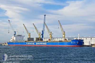
The vessel QING PING SHAN (IMO: 9741504, MMSI: 477078500) is a Cargo It's sailing under the flag of [HK] Hong Kong.
In this page you can find informations about the vessels current position, last detected port calls, and current voyage information. If the vessels is not in coverage by AIS you will find the latest position.
The current position of QING PING SHAN is detected by our AIS receivers and we are not responsible for the reliability of the data. The last position was recorded while the vessel was in Coverage by the Ais receivers of our vessel tracking app.
The current draught of QING PING SHAN as reported by AIS is 9.2 meters
Weather
| Temperature | 18.9°C / 66.02°F |
|---|---|
| Wind Speed | 7 knots |
| Direction | 20° NNE |
| Pressure | 1024.3 hPa |
| Humidity | 83.7 % |
| Cloud Coverage | 29 % |
Featured Company
Last Port Calls
| Port | Arrival | Departure | Time In Port |
|---|---|---|---|
| 2024-05-06 15:49 | 2024-05-12 06:44 | 5 d | |
| 2024-04-28 15:20 | 2024-05-01 18:05 | 3 d |
Last Trips
| Origin | Departure | Destination | Arrival | Distance | |
|---|---|---|---|---|---|
| 2024-05-01 18:05 | 2024-05-06 15:49 | 234.48 nm | |||
| 2024-03-17 19:47 | 2024-04-28 15:20 | 2627.61 nm |
Events
| Tid | Event | Detaljer | Position / Dest | Information |
|---|---|---|---|---|
| 2024-06-01 12:16 | Status ändrad | Default Under way using engine |
-22.95360 / -43.78975
SEPETIBA
|
Fart: 1.8 kn Kurs: 86° |
| 2024-06-01 12:16 | STOPPAR förflyttning | 3.52 nm, East of ITAGUAI |
-22.95360 / -43.78975
SEPETIBA
|
Fart: 0.3 kn Kurs: 102° |
| 2024-06-01 12:08 | UTANFÖR täckningsområde |
-22.95443 / -43.79178
South Atlantic Ocean
|
Fart: 1.8 kn Kurs: 56.3° |
|
| 2024-06-01 12:02 | Status ändrad | Under way using engine Default |
-22.95473 / -43.79465
SEPETIBA
|
Fart: 3.6 kn Kurs: 108° |
| 2024-06-01 11:58 | Status ändrad | Default Under way using engine |
-22.95385 / -43.79821
SEPETIBA
|
Fart: 4.6 kn Kurs: 108° |
| 2024-06-01 11:52 | Status ändrad | Under way using engine Default |
-22.95188 / -43.80503
SEPETIBA
|
Fart: 5.7 kn Kurs: 107° |
| 2024-06-01 11:43 | Status ändrad | Default Under way using engine |
-22.94754 / -43.82104
SEPETIBA
|
Fart: 8.8 kn Kurs: 79.5° |
| 2024-06-01 11:36 | Status ändrad | Under way using engine Default |
-22.94585 / -43.83822
SEPETIBA
|
Fart: 11.1 kn Kurs: 52° |
| 2024-06-01 10:47 | Status ändrad | Default Under way using engine |
-23.00800 / -44.01085
SEPETIBA
|
Fart: 13.2 kn Kurs: 24.4° |
| 2024-06-01 10:38 | Status ändrad | Under way using engine Default |
-23.03054 / -44.03210
SEPETIBA
|
Fart: 12.8 kn Kurs: 11° |