
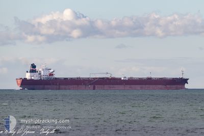
PS AMALFI
Oil Products Tanker
Current Trip
| Time Travelled | 8 days |
|---|---|
| Remaining Time | --- |
| Distance Travelled | 875.91 nm |
| Remaining Distance | --- |
| AVG Speed | 8.6 Knop |
| MAX Speed | 13.7 Knop |
| AVG Wind | 11 knots |
| MAX Wind | 18.9 knots |
| MIN Temp | 10.6°C / 51.08°F |
| MAX Temp | 22.4°C / 72.32°F |
| Djupgående | 8.4 m |
| Position mottagen | 3 d sen |
Current Position
| Longitud | -73.35159° |
|---|---|
| Latitude | 38.20397° |
| Status | Under way using engine |
| Fart | 8.4 Knop |
| Kurs | 98.8° |
| Område | North Atlantic Ocean |
| Station | T-AIS |
| Position mottagen | 3 d sen |
Info
Information
The current position of PS AMALFI is in North Atlantic Ocean with coordinates 38.20397° / -73.35159° as reported on 2024-05-08 04:01 by AIS to our vessel tracker app. The vessel's current speed is 8.4 Knop and is heading at the port of WHIFFEN HEAD. The estimated time of arrival as calculated by MyShipTracking vessel tracking app is 2024-05-14 04:30 LT
The vessel PS AMALFI (IMO: 9439395, MMSI: 229869000) is a Oil Products Tanker that was built in 2010 ( 14 År gammal ). It's sailing under the flag of [MT] Malta.
In this page you can find informations about the vessels current position, last detected port calls, and current voyage information. If the vessels is not in coverage by AIS you will find the latest position.
The current position of PS AMALFI is detected by our AIS receivers and we are not responsible for the reliability of the data. The last position was recorded while the vessel was in Coverage by the Ais receivers of our vessel tracking app.
The current draught of PS AMALFI as reported by AIS is 8.4 meters
Weather
| Temperature | 12.3°C / 54.14°F |
|---|---|
| Wind Speed | 12 knots |
| Direction | 43° NE |
| Pressure | 1005.6 hPa |
| Humidity | 85.3 % |
| Cloud Coverage | 100 % |
Featured Company
Last Port Calls
| Port | Arrival | Departure | Time In Port |
|---|---|---|---|
| 2024-05-02 00:06 | 2024-05-03 00:25 | 1 d | |
| 2024-04-27 22:15 | 2024-04-28 16:38 | 18 h | |
| 2024-03-18 01:56 | 2024-03-19 18:42 | 1 d |
Most Visited Ports (Last year)
| Port | Arrivals | |
|---|---|---|
| 5 | ||
| 4 | ||
| 3 | ||
| 2 | ||
| 2 | ||
| 1 |
Last Trips
| Origin | Departure | Destination | Arrival | Distance | |
|---|---|---|---|---|---|
| 2024-04-28 12:38 | 2024-05-01 20:06 | 144.30 nm | |||
| 2024-03-19 14:42 | 2024-04-27 18:15 | 4607.85 nm | |||
| 2024-02-27 13:20 | 2024-03-17 21:56 | 2747.92 nm |
Events
| Tid | Event | Detaljer | Position / Dest | Information |
|---|---|---|---|---|
| 2024-05-08 04:03 | Status ändrad | Default Under way using engine |
38.20167 / -73.34500
USDCI >>> CAWHH
|
Fart: 8.4 kn Kurs: 98.8° |
| 2024-05-08 04:01 | UTANFÖR täckningsområde |
38.20397 / -73.35159
North Atlantic Ocean
USDCI >>> CAWHH
|
Fart: 8.4 kn Kurs: 98.8° |
|
| 2024-05-08 03:52 | Status ändrad | Under way using engine Default |
38.20735 / -73.37851
USDCI >>> CAWHH
|
Fart: 8 kn Kurs: 99° |
| 2024-05-08 03:36 | I täckningsområde |
38.20735 / -73.37851
North Atlantic Ocean
USDCI >>> CAWHH
|
Fart: 8.5 kn Kurs: 98.5° |
|
| 2024-05-08 00:21 | Status ändrad | Default Under way using engine |
38.29666 / -74.02500
USDCI >>> CAWHH
|
Fart: 8.9 kn Kurs: 100.7° |
| 2024-05-08 00:06 | UTANFÖR täckningsområde |
38.30430 / -74.07412
North Atlantic Ocean
USDCI >>> CAWHH
|
Fart: 8.9 kn Kurs: 100.7° |
|
| 2024-05-08 00:03 | Status ändrad | Under way using engine Default |
38.30536 / -74.08137
USDCI >>> CAWHH
|
Fart: 9 kn Kurs: 101° |
| 2024-05-07 23:54 | Status ändrad | Default Under way using engine |
38.30978 / -74.11073
USDCI >>> CAWHH
|
Fart: 8.9 kn Kurs: 99.6° |
| 2024-05-07 23:39 | Status ändrad | Under way using engine Default |
38.31612 / -74.15855
USDCI >>> CAWHH
|
Fart: 8.8 kn Kurs: 100° |
| 2024-05-07 23:12 | Status ändrad | Default Under way using engine |
38.32834 / -74.23834
USDCI >>> CAWHH
|
Fart: 8.6 kn Kurs: 102.7° |