
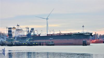
PATRIOTIC
Tanker
Current Trip
| Time Travelled | 11 days |
|---|---|
| Remaining Time | 7 days |
| Distance Travelled | 2875.89 nm |
| Remaining Distance | 2366.63 nm |
| AVG Speed | 9.6 Knop |
| MAX Speed | 14.7 Knop |
| AVG Wind | 16.7 knots |
| MAX Wind | 25.9 knots |
| MIN Temp | 11.4°C / 52.52°F |
| MAX Temp | 19.3°C / 66.74°F |
| Djupgående | 9 m |
| Position mottagen | 4 d sen |
Current Position
| Longitud | -30.95422° |
|---|---|
| Latitude | 36.53275° |
| Status | Under way using engine |
| Fart | 12.3 Knop |
| Kurs | 266.4° |
| Område | North Atlantic Ocean |
| Station | T-AIS |
| Position mottagen | 4 d sen |
Info
Information
The current position of PATRIOTIC is in North Atlantic Ocean with coordinates 36.53275° / -30.95422° as reported on 2024-05-02 15:41 by AIS to our vessel tracker app. The vessel's current speed is 12.3 Knop and is heading at the port of HOUSTON. The estimated time of arrival as calculated by MyShipTracking vessel tracking app is 2024-05-14 14:08 LT
The vessel PATRIOTIC (IMO: 9819832, MMSI: 241646000) is a Tanker It's sailing under the flag of [GR] Greece.
In this page you can find informations about the vessels current position, last detected port calls, and current voyage information. If the vessels is not in coverage by AIS you will find the latest position.
The current position of PATRIOTIC is detected by our AIS receivers and we are not responsible for the reliability of the data. The last position was recorded while the vessel was in Coverage by the Ais receivers of our vessel tracking app.
The current draught of PATRIOTIC as reported by AIS is 9 meters
Weather
| Temperature | 18.4°C / 65.12°F |
|---|---|
| Wind Speed | 13 knots |
| Direction | 22° NNE |
| Pressure | 1019.4 hPa |
| Humidity | 61 % |
| Cloud Coverage | 80 % |
Featured Company
Last Port Calls
| Port | Arrival | Departure | Time In Port |
|---|---|---|---|
| 2024-04-24 02:18 | 2024-04-25 18:39 | 1 d |
Most Visited Ports (Last year)
| Port | Arrivals | |
|---|---|---|
| 3 | ||
| 1 | ||
| 1 | ||
| 1 | ||
| 1 | ||
| 1 |
Last Trips
| Origin | Departure | Destination | Arrival | Distance | |
|---|---|---|---|---|---|
| 2024-02-17 16:20 | 2024-04-24 04:18 | 13061.06 nm |
Events
| Tid | Event | Detaljer | Position / Dest | Information |
|---|---|---|---|---|
| 2024-05-02 15:45 | Status ändrad | Default Under way using engine |
36.53227 / -30.97400
USHOU
|
Fart: 12.3 kn Kurs: 266.4° |
| 2024-05-02 15:41 | UTANFÖR täckningsområde |
36.53275 / -30.95422
North Atlantic Ocean
USHOU
|
Fart: 12.3 kn Kurs: 266.4° |
|
| 2024-05-02 15:39 | Status ändrad | Under way using engine Default |
36.53299 / -30.94495
USHOU
|
Fart: 12.3 kn Kurs: 264° |
| 2024-05-02 15:39 | I täckningsområde |
36.53281 / -30.95209
North Atlantic Ocean
USHOU
|
Fart: 12.3 kn Kurs: 266.9° |
|
| 2024-05-02 14:48 | Status ändrad | Default Under way using engine |
36.54256 / -30.72986
USHOU
|
Fart: 12.3 kn Kurs: 267.7° |
| 2024-05-02 14:29 | UTANFÖR täckningsområde |
36.54533 / -30.65072
North Atlantic Ocean
USHOU
|
Fart: 12.3 kn Kurs: 267.7° |
|
| 2024-05-02 13:56 | Status ändrad | Under way using engine Default |
36.54815 / -30.50712
USHOU
|
Fart: 12.5 kn Kurs: 268° |
| 2024-05-02 13:13 | Status ändrad | Default Under way using engine |
36.54528 / -30.32310
USHOU
|
Fart: 12.4 kn Kurs: 273.4° |
| 2024-05-02 11:58 | Status ändrad | Under way using engine Default |
36.54644 / -30.00852
USHOU
|
Fart: 12 kn Kurs: 264° |
| 2024-05-02 11:49 | Status ändrad | Default Under way using engine |
36.54820 / -29.96851
USHOU
|
Fart: 11.9 kn Kurs: 268.3° |