
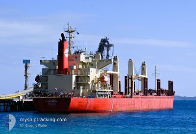
PAN NOVA
Cargo
Current Trip
| Time Travelled | 1 day |
|---|---|
| Remaining Time | 4 h, 59 mins |
| Distance Travelled | 548.26 nm |
| Remaining Distance | 60.26 nm |
| AVG Speed | 11 Knop |
| MAX Speed | 13.1 Knop |
| AVG Wind | 15.4 knots |
| MAX Wind | 30.7 knots |
| MIN Temp | 14.7°C / 58.46°F |
| MAX Temp | 23.6°C / 74.48°F |
| Djupgående | 8.8 m |
| Position mottagen | 1 m sen |
Current Position
| Longitud | --- |
|---|---|
| Latitude | --- |
| Status | Under way using engine |
| Fart | 11.7 Knop |
| Kurs | 269.2° |
| Område | South Pacific Ocean |
| Station | T-AIS |
| Position mottagen | 1 m sen |
Info
Information
The current position of PAN NOVA is in South Pacific Ocean with coordinates -37.35889° / 177.23282° as reported on 2025-12-08 09:16 by AIS to our vessel tracker app. The vessel's current speed is 11.7 Knop and is heading at the port of TAURANGA. The estimated time of arrival as calculated by MyShipTracking vessel tracking app is 2025-12-09 03:16 LT
The vessel PAN NOVA (IMO: 9883003, MMSI: 352546000) is a Cargo It's sailing under the flag of [PA] Panama.
In this page you can find informations about the vessels current position, last detected port calls, and current voyage information. If the vessels is not in coverage by AIS you will find the latest position.
The current position of PAN NOVA is detected by our AIS receivers and we are not responsible for the reliability of the data. The last position was recorded while the vessel was in Coverage by the Ais receivers of our vessel tracking app.
The current draught of PAN NOVA as reported by AIS is 8.8 meters
Weather
| Temperature | 20.2°C / 68.36°F |
|---|---|
| Wind Speed | 9 knots |
| Direction | 340° NNW |
| Pressure | 1021.1 hPa |
| Humidity | 85.9 % |
| Cloud Coverage | 1 % |
Featured Company
Last Port Calls
| Port | Arrival | Departure | Time In Port |
|---|---|---|---|
| 2025-12-05 11:21 | 2025-12-06 22:30 | 1 d | |
| 2025-11-27 08:24 | 2025-11-30 04:04 | 2 d | |
| 2025-11-14 11:27 | 2025-11-21 22:15 | 7 d | |
| 2025-10-11 08:08 | 2025-10-14 07:24 | 2 d |
Last Trips
| Origin | Departure | Destination | Arrival | Distance | |
|---|---|---|---|---|---|
| 2025-11-30 04:04 | 2025-12-05 11:21 | 379.63 nm | |||
| 2025-11-21 22:15 | 2025-11-27 08:24 | 1304.12 nm | |||
| 2025-10-14 07:24 | 2025-11-14 11:27 | 5707.30 nm | |||
| 2025-09-13 23:13 | 2025-10-11 08:08 | 5870.39 nm |
Events
| Tid | Event | Detaljer | Position / Dest | Information |
|---|---|---|---|---|
| 2025-12-08 02:10 | Status ändrad | Under way using engine Default |
-37.55631 / 178.81292
NZ TRG
|
Fart: 10.4 kn Kurs: 335° |
| 2025-12-08 02:03 | Status ändrad | Default Under way using engine |
-37.57438 / 178.82335
NZ TRG
|
Fart: 10.4 kn Kurs: 337° |
| 2025-12-08 01:36 | Status ändrad | Under way using engine Default |
-37.64746 / 178.85142
NZ TRG
|
Fart: 11 kn Kurs: 358° |
| 2025-12-08 01:31 | Status ändrad | Default Under way using engine |
-37.66333 / 178.85167
NZ TRG
|
Fart: 10.6 kn Kurs: 357.6° |
| 2025-12-08 01:21 | Status ändrad | Under way using engine Default |
-37.69287 / 178.85329
NZ TRG
|
Fart: 11 kn Kurs: 11° |
| 2025-12-08 01:19 | Status ändrad | Default Under way using engine |
-37.69873 / 178.85158
NZ TRG
|
Fart: 11.3 kn Kurs: 12.3° |
| 2025-12-08 01:12 | Status ändrad | Under way using engine Default |
-37.71853 / 178.84606
NZ TRG
|
Fart: 11.3 kn Kurs: 12° |
| 2025-12-08 00:55 | Status ändrad | Default Under way using engine |
-37.77167 / 178.83166
NZ TRG
|
Fart: 10.9 kn Kurs: 10.4° |
| 2025-12-07 23:57 | Status ändrad | Under way using engine Default |
-37.93966 / 178.78836
NZ TRG
|
Fart: 10.4 kn Kurs: 13° |
| 2025-12-07 23:47 | Status ändrad | Default Under way using engine |
-37.96624 / 178.77974
NZ TRG
|
Fart: 10.4 kn Kurs: 14.3° |