
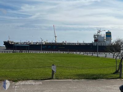
PACIFIC RUBY
Tanker
Current Trip
| Time Travelled | 1 day |
|---|---|
| Remaining Time | --- |
| Distance Travelled | 221.44 nm |
| Remaining Distance | --- |
| AVG Speed | 10.9 Knop |
| MAX Speed | 14.2 Knop |
| AVG Wind | 5.2 knots |
| MAX Wind | 11.9 knots |
| MIN Temp | 8.3°C / 46.94°F |
| MAX Temp | 21.2°C / 70.16°F |
| Djupgående | 9.9 m |
| Position mottagen | 14 h, 8 m sen |
Current Position
| Longitud | -58.08712° |
|---|---|
| Latitude | -34.64550° |
| Status | Under way using engine |
| Fart | 11.3 Knop |
| Kurs | 115.9° |
| Område | Rio de La Plata |
| Station | T-AIS |
| Position mottagen | 14 h, 8 m sen |
Info
Information
The current position of PACIFIC RUBY is in Rio de La Plata with coordinates -34.64550° / -58.08712° as reported on 2024-05-05 05:41 by AIS to our vessel tracker app. The vessel's current speed is 11.3 Knop and is heading at the port of ROTTERDAM. The estimated time of arrival as calculated by MyShipTracking vessel tracking app is 2024-05-25 12:00 LT
The vessel PACIFIC RUBY (IMO: 9906881, MMSI: 636020916) is a Tanker It's sailing under the flag of [LR] Liberia.
In this page you can find informations about the vessels current position, last detected port calls, and current voyage information. If the vessels is not in coverage by AIS you will find the latest position.
The current position of PACIFIC RUBY is detected by our AIS receivers and we are not responsible for the reliability of the data. The last position was recorded while the vessel was in Coverage by the Ais receivers of our vessel tracking app.
The current draught of PACIFIC RUBY as reported by AIS is 9.9 meters
Weather
| Temperature | 18°C / 64.4°F |
|---|---|
| Wind Speed | 1 knots |
| Direction | 319° NW |
| Pressure | 1009.9 hPa |
| Humidity | 96 % |
| Cloud Coverage | 100 % |
Featured Company
Last Port Calls
| Port | Arrival | Departure | Time In Port |
|---|---|---|---|
| 2024-04-25 14:37 | 2024-05-04 10:45 | 8 d | |
| 2024-03-11 16:09 | 2024-03-12 20:57 | 1 d | |
| 2024-03-09 18:37 | 2024-03-09 19:52 | 1 h |
Most Visited Ports (Last year)
| Port | Arrivals | |
|---|---|---|
| 3 | ||
| 3 | ||
| 2 | ||
| 2 | ||
| 2 | ||
| 1 |
Last Trips
| Origin | Departure | Destination | Arrival | Distance | |
|---|---|---|---|---|---|
| 2024-03-12 15:57 | 2024-04-25 11:37 | 6859.10 nm | |||
| 2024-03-09 13:52 | 2024-03-11 11:09 | 20.97 nm |
Events
| Tid | Event | Detaljer | Position / Dest | Information |
|---|---|---|---|---|
| 2024-05-05 07:21 | STOPPAR förflyttning | 8.22 nm, North East of LA PLATA |
-34.73500 / -57.79500
NL RTM
|
Fart: Kurs: -1° |
| 2024-05-05 05:48 | Status ändrad | Default Under way using engine |
-34.65333 / -58.06333
NL RTM
|
Fart: 11.3 kn Kurs: 115.9° |
| 2024-05-05 05:41 | UTANFÖR täckningsområde |
-34.64550 / -58.08712
Rio de La Plata
NL RTM
|
Fart: 11.3 kn Kurs: 115.9° |
|
| 2024-05-05 05:29 | Status ändrad | Under way using engine Default |
-34.63022 / -58.12561
NL RTM
|
Fart: 10 kn Kurs: 99° |
| 2024-05-05 05:24 | Status ändrad | Default Under way using engine |
-34.62500 / -58.14500
NL RTM
|
Fart: 10.2 kn Kurs: 97.8° |
| 2024-05-05 01:38 | Status ändrad | Under way using engine Default |
-34.23810 / -58.76680
NL RTM
|
Fart: 9.3 kn Kurs: 114° |
| 2024-05-05 01:29 | Status ändrad | Default Under way using engine |
-34.23037 / -58.79142
NL RTM
|
Fart: 11.2 kn Kurs: 130.3° |
| 2024-05-05 01:03 | Status ändrad | Under way using engine Default |
-34.17862 / -58.86638
NL RTM
|
Fart: 11.9 kn Kurs: 70° |
| 2024-05-05 00:59 | Status ändrad | Default Under way using engine |
-34.18033 / -58.88248
NL RTM
|
Fart: 10.6 kn Kurs: 67.6° |
| 2024-05-05 00:52 | Status ändrad | Under way using engine Default |
-34.18013 / -58.90394
NL RTM
|
Fart: 9.9 kn Kurs: 158° |