
ONDERNEMING
Other Type
Current Trip
AMSTERDAM
| Time Travelled | 2 days |
|---|---|
| Remaining Time | --- |
| Distance Travelled | 3.83 nm |
| Remaining Distance | --- |
| AVG Speed | 7.7 Knop |
| MAX Speed | 8.8 Knop |
| AVG Wind | 7.2 knots |
| MAX Wind | 7.3 knots |
| MIN Temp | 7.3°C / 45.14°F |
| MAX Temp | 7.7°C / 45.86°F |
| Djupgående | 20 m |
| Position mottagen | 4 m sen |
Current Position
| Longitud | --- |
|---|---|
| Latitude | --- |
| Status | Moored |
| Fart | |
| Kurs | --- |
| Område | North Sea |
| Station | T-AIS |
| Position mottagen | 4 m sen |
Info
Information
The current position of ONDERNEMING is in North Sea with coordinates 52.42985° / 4.76175° as reported on 2025-12-15 04:26 by AIS to our vessel tracker app. The vessel's current speed is 0 Knop
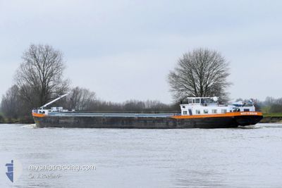
The vessel ONDERNEMING (MMSI: 244690719) is a Other Type It's sailing under the flag of [NL] Netherlands.
In this page you can find informations about the vessels current position, last detected port calls, and current voyage information. If the vessels is not in coverage by AIS you will find the latest position.
The current position of ONDERNEMING is detected by our AIS receivers and we are not responsible for the reliability of the data. The last position was recorded while the vessel was in Coverage by the Ais receivers of our vessel tracking app.
The current draught of ONDERNEMING as reported by AIS is 20 meters
Weather
| Temperature | 6.2°C / 43.16°F |
|---|---|
| Wind Speed | 11 knots |
| Direction | 187° S |
| Pressure | 1013.2 hPa |
| Humidity | 83.3 % |
| Cloud Coverage | 4 % |
Featured Company
Last Port Calls
| Port | Arrival | Departure | Time In Port |
|---|---|---|---|
| 2025-12-12 10:28 | 2025-12-12 11:01 | 32 m | |
| 2025-12-11 09:01 | 2025-12-11 09:39 | 38 m | |
| 2025-12-10 20:45 | 2025-12-10 21:15 | 30 m | |
| 2025-12-10 10:00 | 2025-12-10 10:37 | 37 m | |
| 2025-12-05 10:07 | 2025-12-05 10:43 | 35 m | |
| 2025-12-04 09:55 | 2025-12-04 10:34 | 39 m | |
| 2025-12-03 22:57 | 2025-12-03 23:29 | 32 m | |
| 2025-12-03 10:00 | 2025-12-03 10:38 | 37 m | |
| 2025-12-02 20:38 | 2025-12-02 21:10 | 31 m | |
| 2025-12-02 09:35 | 2025-12-02 10:13 | 37 m |
Most Visited Ports (Last year)
| Port | Arrivals | |
|---|---|---|
| 61 | ||
| 28 | ||
| 26 | ||
| 22 | ||
| 15 | ||
| 15 |
Last Trips
| Origin | Departure | Destination | Arrival | Distance | |
|---|---|---|---|---|---|
| 2025-12-11 09:39 | 2025-12-12 10:28 | 51.36 nm | |||
| 2025-12-10 21:15 | 2025-12-11 09:01 | 8.01 nm | |||
| 2025-12-10 10:37 | 2025-12-10 20:45 | 50.40 nm | |||
| 2025-12-05 10:43 | 2025-12-10 10:00 | 7.86 nm | |||
| 2025-12-04 10:34 | 2025-12-05 10:07 | 50.69 nm | |||
| 2025-12-03 23:29 | 2025-12-04 09:55 | 8.12 nm | |||
| 2025-12-03 10:38 | 2025-12-03 22:57 | 49.90 nm | |||
| 2025-12-02 21:10 | 2025-12-03 10:00 | 8.14 nm | |||
| 2025-12-02 10:13 | 2025-12-02 20:38 | 50.27 nm | |||
| 2025-12-01 21:57 | 2025-12-02 09:35 | 8.28 nm |
Events
| Tid | Event | Detaljer | Position / Dest | Information |
|---|---|---|---|---|
| 2025-12-12 10:53 | Status ändrad | Moored Under way using engine |
52.42986 / 4.76173
AMSTERDAM
|
Fart: Kurs: 511° |
| 2025-12-12 10:34 | STOPPAR förflyttning | 0.63 nm, South East of NAUERNA |
52.42986 / 4.76173
AMSTERDAM
|
Fart: 0.2 kn Kurs: 511° |
| 2025-12-12 10:05 | Destination ändrad | AMSTERDAM MARKER WADDEN |
52.41780 / 4.84797
AMSTERDAM
|
Fart: 8.6 kn Kurs: 279.5° |
| 2025-12-12 10:05 | ETA ändrat | 2025/12/12 11:00 2026/11/26 13:00 |
52.41780 / 4.84797
AMSTERDAM
|
Fart: 8.6 kn Kurs: 279.5° |
| 2025-12-12 10:01 | AVGÅTT HAMN |
|
52.41493 / 4.86270
MARKER WADDEN
|
Fart: 8.6 kn Kurs: 296.8° |
| 2025-12-12 09:28 | ANLÄNDER HAMN |
|
52.38293 / 4.93651
[NL] AMSTERDAM
|
Fart: 8.6 kn Kurs: 268.9° |
| 2025-12-12 09:22 | STARTAR förflyttning | 0.25 nm, West of SCHELLINGWOUDE |
52.38245 / 4.95826
MARKER WADDEN
|
Fart: 5.4 kn Kurs: 293.6° |
| 2025-12-12 09:12 | STOPPAR förflyttning | 0.14 nm, West of SCHELLINGWOUDE |
52.38148 / 4.96096
MARKER WADDEN
|
Fart: Kurs: 511° |
| 2025-12-12 06:30 | STARTAR förflyttning | 1.45 nm, North West of FLEVO MARINA |
52.57055 / 5.43211
MARKER WADDEN
|
Fart: 6 kn Kurs: 221° |
| 2025-12-12 06:28 | Status ändrad | Under way using engine Moored |
52.57229 / 5.43302
MARKER WADDEN
|
Fart: Kurs: 511° |