
ODYSSEY
Passengers Ship
Current Trip
| Trip Time | 5 days |
|---|---|
| Trip Distance | 861.47 nm |
| AVG Speed | 8.3 Knop |
| MAX Speed | 8.3 Knop |
| Djupgående | 5.6 m |
| AVG Wind | 9.5 knots |
| MAX Wind | 22.8 knots |
| MIN Temp | 5.2°C / 41.36°F |
| MAX Temp | 9.8°C / 49.64°F |
| Position mottagen | 6 d sen |
Current Position
| Longitud | -5.81920° |
|---|---|
| Latitude | 54.67710° |
| Status | Under way using engine |
| Fart | 9.4 Knop |
| Kurs | 235° |
| Område | Inner Seas off the West Coast of Scotland |
| Station | T-AIS |
| Position mottagen | 6 d sen |
Info
Information
The current position of ODYSSEY is in Inner Seas off the West Coast of Scotland with coordinates 54.67710° / -5.81920° as reported on 2024-04-28 07:26 by AIS to our vessel tracker app. The vessel's current speed is 9.4 Knop and is currently inside the port of BELFAST.
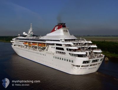
The vessel ODYSSEY (IMO: 9000699, MMSI: 311541000) is a Passengers Ship that was built in 1993 ( 31 År gammal ). It's sailing under the flag of [BS] Bahamas.
In this page you can find informations about the vessels current position, last detected port calls, and current voyage information. If the vessels is not in coverage by AIS you will find the latest position.
The current position of ODYSSEY is detected by our AIS receivers and we are not responsible for the reliability of the data. The last position was recorded while the vessel was in Coverage by the Ais receivers of our vessel tracking app.
The current draught of ODYSSEY as reported by AIS is 5.6 meters
Weather
| Temperature | 11.6°C / 52.88°F |
|---|---|
| Wind Speed | 1 knots |
| Direction | 69° ENE |
| Pressure | 1007 hPa |
| Humidity | 93.5 % |
| Cloud Coverage | 100 % |
Featured Company
Most Visited Ports (Last year)
| Port | Arrivals | |
|---|---|---|
| 1 |
Events
| Tid | Event | Detaljer | Position / Dest | Information |
|---|---|---|---|---|
| 2024-05-01 02:15 | ETA ändrat | 2025/04/28 07:00 2024/04/28 07:00 |
54.62077 / -5.89240
[GB] BELFAST
|
Fart: Kurs: 195° |
| 2024-04-28 08:22 | STOPPAR förflyttning |
54.62087 / -5.89235
[GB] BELFAST
|
Fart: 0.2 kn Kurs: 194° |
|
| 2024-04-28 07:46 | ANLÄNDER HAMN |
|
54.64402 / -5.86613
[GB] BELFAST
|
Fart: 6.5 kn Kurs: 216° |
| 2024-04-28 07:34 | Status ändrad | Default Under way using engine |
54.66160 / -5.84382
BELFAST UK
|
Fart: 9.4 kn Kurs: 235° |
| 2024-04-28 07:26 | UTANFÖR täckningsområde |
54.67710 / -5.81920
Inner Seas off the West Coast of Scotland
[GB] BELFAST
|
Fart: 9.4 kn Kurs: 235° |
|
| 2024-04-28 06:17 | STARTAR förflyttning | 1.7 nm, North East of GROOMSPORT |
54.69615 / -5.58210
BELFAST UK
|
Fart: 3.1 kn Kurs: 308° |
| 2024-04-27 23:18 | ETA ändrat | 2024/04/28 07:00 2024/04/27 07:00 |
54.70362 / -5.57197
BELFAST UK
|
Fart: 0.6 kn Kurs: 328° |
| 2024-04-27 18:04 | STOPPAR förflyttning | 2.63 nm, North East of GROOMSPORT |
54.70687 / -5.56303
BELFAST UK
|
Fart: 0.2 kn Kurs: 330° |
| 2024-04-27 14:32 | STARTAR förflyttning | 2.93 nm, North of GROOMSPORT |
54.72600 / -5.60848
BELFAST UK
|
Fart: 3.1 kn Kurs: 173° |
| 2024-04-27 13:03 | Status ändrad | Under way using engine Default |
54.71207 / -5.59027
BELFAST UK
|
Fart: 0.8 kn Kurs: 9° |