
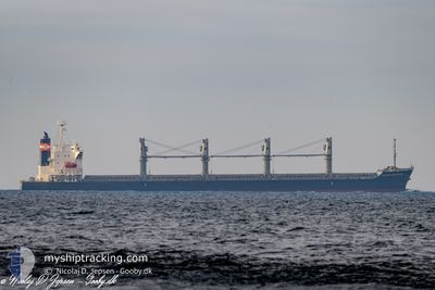
OCEAN GRACIOUS
Bulk Carrier
Current Trip
| Time Travelled | 14 days |
|---|---|
| Remaining Time | 4 days |
| Distance Travelled | 3774.82 nm |
| Remaining Distance | 1262.83 nm |
| AVG Speed | 11.4 Knop |
| MAX Speed | 13.4 Knop |
| AVG Wind | 17.4 knots |
| MAX Wind | 27 knots |
| MIN Temp | 0.7°C / 33.26°F |
| MAX Temp | 26.1°C / 78.98°F |
| Djupgående | 10.2 m |
| Position mottagen | Nu |
Current Position
| Longitud | --- |
|---|---|
| Latitude | --- |
| Status | Under way using engine |
| Fart | 11.9 Knop |
| Kurs | 171° |
| Område | North Atlantic Ocean |
| Station | T-AIS |
| Position mottagen | Nu |
Info
Information
The current position of OCEAN GRACIOUS is in North Atlantic Ocean with coordinates 11.53884° / -17.43869° as reported on 2025-12-06 12:03 by AIS to our vessel tracker app. The vessel's current speed is 11.9 Knop and is heading at the port of TEMA. The estimated time of arrival as calculated by MyShipTracking vessel tracking app is 2025-12-10 20:08 LT
The vessel OCEAN GRACIOUS (IMO: 9642174, MMSI: 352715000) is a Bulk Carrier that was built in 2013 ( 12 År gammal ). It's sailing under the flag of [PA] Panama.
In this page you can find informations about the vessels current position, last detected port calls, and current voyage information. If the vessels is not in coverage by AIS you will find the latest position.
The current position of OCEAN GRACIOUS is detected by our AIS receivers and we are not responsible for the reliability of the data. The last position was recorded while the vessel was in Coverage by the Ais receivers of our vessel tracking app.
The current draught of OCEAN GRACIOUS as reported by AIS is 10.2 meters
Weather
| Temperature | 26.1°C / 78.98°F |
|---|---|
| Wind Speed | 15 knots |
| Direction | 11° N |
| Pressure | 1013.2 hPa |
| Humidity | 60 % |
| Cloud Coverage | 51 % |
Featured Company
Events
| Tid | Event | Detaljer | Position / Dest | Information |
|---|---|---|---|---|
| 2025-12-06 11:53 | Status ändrad | Under way using engine Default |
11.57325 / -17.44395
GHTEM
|
Fart: 11.8 kn Kurs: 172° |
| 2025-12-06 11:30 | Status ändrad | Default Under way using engine |
11.64924 / -17.45563
GHTEM
|
Fart: 12 kn Kurs: 171° |
| 2025-12-06 10:19 | Upptäckt i hav | Guinea Bissau part of the North Atlantic Ocean |
11.88376 / -17.49068
North Atlantic Ocean
GHTEM
|
Fart: 11.8 kn Kurs: 173.6° |
| 2025-12-06 04:29 | Byter havsområde | Senegalese part of the North Atlantic Ocean Gambian part of the North Atlantic Ocean |
13.05339 / -17.66299
North Atlantic Ocean
GHTEM
|
Fart: 12 kn Kurs: 169.6° |
| 2025-12-06 01:46 | Byter havsområde | Gambian part of the North Atlantic Ocean Senegalese part of the North Atlantic Ocean |
13.58840 / -17.73443
North Atlantic Ocean
GHTEM
|
Fart: 12.4 kn Kurs: 171.1° |
| 2025-12-05 16:47 | ETA ändrat | 2025/12/10 20:00 2025/12/10 21:00 |
15.41680 / -17.91008
GHTEM
|
Fart: 13.1 kn Kurs: 177.6° |
| 2025-12-05 16:25 | Byter havsområde | Senegalese part of the North Atlantic Ocean Spanish (Canary Islands) part of the North Atlantic Ocean |
15.49839 / -17.91271
North Atlantic Ocean
GHTEM
|
Fart: 12.7 kn Kurs: 178.4° |
| 2025-12-05 16:24 | Status ändrad | Under way using engine Default |
15.49953 / -17.91274
GHTEM
|
Fart: 12.8 kn Kurs: 176° |
| 2025-12-05 16:19 | I täckningsområde |
15.49839 / -17.91271
North Atlantic Ocean
GHTEM
|
Fart: 12.7 kn Kurs: 178.4° |
|
| 2025-12-03 04:40 | UTANFÖR täckningsområde |
27.26803 / -15.36184
North Atlantic Ocean
GHTEM
|
Fart: 12.4 kn Kurs: 200.7° |