
NILOS
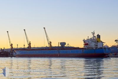
Bulk Carrier
Current Trip
| Time Travelled | 18 days |
|---|---|
| Remaining Time | 3 days |
| Distance Travelled | 4936.85 nm |
| Remaining Distance | 1181.41 nm |
| AVG Speed | 11 Knop |
| MAX Speed | 14 Knop |
| AVG Wind | 10.9 knots |
| MAX Wind | 29.9 knots |
| MIN Temp | 2.2°C / 35.96°F |
| MAX Temp | 24.6°C / 76.28°F |
| Djupgående | 13.1 m |
| Position mottagen | 1 d sen |
Current Position
| Longitud | 128.70993° |
|---|---|
| Latitude | 34.11935° |
| Status | Under way using engine |
| Fart | 11.3 Knop |
| Kurs | 210.1° |
| Område | Japan Sea |
| Station | T-AIS |
| Position mottagen | 1 d sen |
Info
Information
The current position of NILOS is in Japan Sea with coordinates 34.11935° / 128.70993° as reported on 2024-06-16 13:25 by AIS to our vessel tracker app. The vessel's current speed is 11.3 Knop and is heading at the port of BATANGAS. The estimated time of arrival as calculated by MyShipTracking vessel tracking app is 2024-06-21 08:08 LT
The vessel NILOS (IMO: 9311153, MMSI: 256683000) is a Bulk Carrier that was built in 2006 ( 18 År gammal ). It's sailing under the flag of [MT] Malta.
In this page you can find informations about the vessels current position, last detected port calls, and current voyage information. If the vessels is not in coverage by AIS you will find the latest position.
The current position of NILOS is detected by our AIS receivers and we are not responsible for the reliability of the data. The last position was recorded while the vessel was in Coverage by the Ais receivers of our vessel tracking app.
The current draught of NILOS as reported by AIS is 13.1 meters
Weather
| Temperature | 22.9°C / 73.22°F |
|---|---|
| Wind Speed | 17 knots |
| Direction | 257° WSW |
| Pressure | 1003.8 hPa |
| Humidity | 91.1 % |
| Cloud Coverage | 96 % |
Featured Company
Last Port Calls
| Port | Arrival | Departure | Time In Port |
|---|---|---|---|
| 2024-05-26 05:22 | 2024-05-29 23:24 | 3 d | |
| 2024-05-07 01:20 |
Most Visited Ports (Last year)
| Port | Arrivals | |
|---|---|---|
| 2 | ||
| 1 | ||
| 1 | ||
| 1 | ||
| 1 | ||
| 1 |
Last Trips
| Origin | Departure | Destination | Arrival | Distance | |
|---|---|---|---|---|---|
| 2024-05-07 09:20 | 2024-05-25 22:22 | 5504.13 nm |
Events
| Tid | Event | Detaljer | Position / Dest | Information |
|---|---|---|---|---|
| 2024-06-16 13:29 | Status ändrad | Default Under way using engine |
34.10621 / 128.70096
PH BTG
|
Fart: 11.3 kn Kurs: 210.1° |
| 2024-06-16 13:25 | UTANFÖR täckningsområde |
34.11935 / 128.70993
Japan Sea
PH BTG
|
Fart: 11.3 kn Kurs: 210.1° |
|
| 2024-06-16 13:21 | Status ändrad | Under way using engine Default |
34.12756 / 128.71557
PH BTG
|
Fart: 11.5 kn Kurs: 210° |
| 2024-06-16 13:09 | Status ändrad | Default Under way using engine |
34.16140 / 128.73865
PH BTG
|
Fart: 11.5 kn Kurs: 209.8° |
| 2024-06-16 13:02 | Byter havsområde | Japanese part of the Japan Sea South Korean part of the Japan Sea |
34.18300 / 128.75403
Japan Sea
PH BTG
|
Fart: 11.7 kn Kurs: 210° |
| 2024-06-16 12:56 | Status ändrad | Under way using engine Default |
34.19949 / 128.76617
PH BTG
|
Fart: 12 kn Kurs: 198° |
| 2024-06-16 12:45 | Status ändrad | Default Under way using engine |
34.23098 / 128.78001
PH BTG
|
Fart: 11.7 kn Kurs: 200.9° |
| 2024-06-16 12:11 | Status ändrad | Under way using engine Default |
34.33302 / 128.83460
PH BTG
|
Fart: 11.7 kn Kurs: 204° |
| 2024-06-16 12:09 | Status ändrad | Default Under way using engine |
34.33695 / 128.83666
PH BTG
|
Fart: 11.6 kn Kurs: 204.2° |
| 2024-06-16 11:57 | Status ändrad | Under way using engine Default |
34.37248 / 128.85542
PH BTG
|
Fart: 11.5 kn Kurs: 200° |