
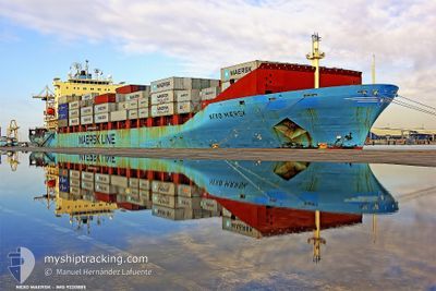
NEXOE MAERSK
Container Ship
Current Trip
ILHFA>ITC79
| Time Travelled | --- |
|---|---|
| Remaining Time | --- |
| Distance Travelled | --- |
| Remaining Distance | --- |
| AVG Speed | --- |
| MAX Speed | --- |
| AVG Wind | --- |
| MAX Wind | --- |
| MIN Temp | --- |
| MAX Temp | --- |
| Djupgående | 10.1 m |
| Position mottagen | 1 m sen |
Current Position
| Longitud | 25.63753° |
|---|---|
| Latitude | 34.22944° |
| Status | Under way using engine |
| Fart | 15.8 Knop |
| Kurs | 279° |
| Område | Mediterranean Sea - Eastern Basin |
| Station | T-AIS |
| Position mottagen | 1 m sen |
Info
Information
The current position of NEXOE MAERSK is in Mediterranean Sea - Eastern Basin with coordinates 34.22944° / 25.63753° as reported on 2024-04-27 17:39 by AIS to our vessel tracker app. The vessel's current speed is 15.8 Knop
The vessel NEXOE MAERSK (IMO: 9220885, MMSI: 477642400) is a Container Ship that was built in 2001 ( 23 År gammal ). It's sailing under the flag of [HK] Hong Kong.
In this page you can find informations about the vessels current position, last detected port calls, and current voyage information. If the vessels is not in coverage by AIS you will find the latest position.
The current position of NEXOE MAERSK is detected by our AIS receivers and we are not responsible for the reliability of the data. The last position was recorded while the vessel was in Coverage by the Ais receivers of our vessel tracking app.
The current draught of NEXOE MAERSK as reported by AIS is 10.1 meters
Weather
| Temperature | 18.4°C / 65.12°F |
|---|---|
| Wind Speed | 7 knots |
| Direction | 307° NW |
| Pressure | 1014.1 hPa |
| Humidity | 73.8 % |
| Cloud Coverage | --- |
Featured Company
Last Port Calls
| Port | Arrival | Departure | Time In Port |
|---|---|---|---|
| 2024-04-26 01:18 | |||
| 2024-04-25 20:06 | |||
| 2024-04-23 20:41 | 2024-04-24 23:32 | 1 d | |
| 2024-04-21 13:51 | 2024-04-22 18:33 | 1 d | |
| 2024-04-16 00:05 | 2024-04-17 02:33 | 1 d | |
| 2024-04-10 23:26 | 2024-04-11 17:48 | 18 h | |
| 2024-04-09 19:12 | 2024-04-10 13:39 | 18 h | |
| 2024-04-07 02:33 | 2024-04-07 17:32 | 14 h | |
| 2024-04-01 18:07 | 2024-04-02 13:13 | 19 h | |
| 2024-03-31 05:45 |
Last Trips
| Origin | Departure | Destination | Arrival | Distance | |
|---|---|---|---|---|---|
| 2024-04-25 02:32 | 2024-04-25 23:06 | 258.17 nm | |||
| 2024-04-22 20:33 | 2024-04-23 23:41 | 453.69 nm | |||
| 2024-04-17 04:33 | 2024-04-21 15:51 | 1805.80 nm | |||
| 2024-04-11 19:48 | 2024-04-16 02:05 | 548.46 nm | |||
| 2024-04-10 15:39 | 2024-04-11 01:26 | 163.72 nm | |||
| 2024-04-07 19:32 | 2024-04-09 21:12 | 232.18 nm | |||
| 2024-04-02 16:13 | 2024-04-07 04:33 | 1728.63 nm | |||
| 2024-03-29 15:01 | 2024-03-31 08:45 | 440.46 nm | |||
| 2024-03-21 19:42 | 2024-03-28 14:57 | 1872.21 nm | |||
| 2024-03-17 21:01 | 2024-03-21 00:55 | 332.29 nm |
Events
| Tid | Event | Detaljer | Position / Dest | Information |
|---|---|---|---|---|
| 2024-04-27 16:50 | Status ändrad | Under way using engine Default |
34.19559 / 25.89828
ILHFA>ITC79
|
Fart: 15.9 kn Kurs: 280° |
| 2024-04-27 16:32 | I täckningsområde |
34.19586 / 25.89631
Mediterranean Sea - Eastern Basin
ILHFA>ITC79
|
Fart: 15.9 kn Kurs: 279.8° |
|
| 2024-04-27 14:49 | Status ändrad | Default Under way using engine |
34.10680 / 26.54096
ILHFA>ITC79
|
Fart: 16.4 kn Kurs: 280.2° |
| 2024-04-27 14:42 | UTANFÖR täckningsområde |
34.10095 / 26.57917
Mediterranean Sea - Eastern Basin
ILHFA>ITC79
|
Fart: 16.4 kn Kurs: 280.2° |
|
| 2024-04-27 14:16 | Status ändrad | Under way using engine Default |
34.08035 / 26.71501
ILHFA>ITC79
|
Fart: 16 kn Kurs: 279° |
| 2024-04-27 13:55 | Status ändrad | Default Under way using engine |
34.06446 / 26.83037
ILHFA>ITC79
|
Fart: 15.9 kn Kurs: 279.2° |
| 2024-04-27 13:43 | Status ändrad | Under way using engine Default |
34.05664 / 26.89028
ILHFA>ITC79
|
Fart: 16.2 kn Kurs: 280° |
| 2024-04-27 13:30 | I täckningsområde |
34.05664 / 26.89028
Mediterranean Sea - Eastern Basin
ILHFA>ITC79
|
Fart: 16.1 kn Kurs: 279° |
|
| 2024-04-27 09:00 | Status ändrad | Default Under way using engine |
33.84468 / 28.37650
ILHFA>ITC79
|
Fart: 15.6 kn Kurs: 280.4° |
| 2024-04-27 08:56 | UTANFÖR täckningsområde |
33.84104 / 28.39906
Mediterranean Sea - Eastern Basin
ILHFA>ITC79
|
Fart: 15.6 kn Kurs: 280.4° |