
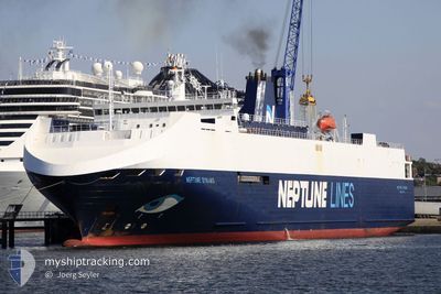
NEPTUNE DYNAMIS
Vehicles Carrier
Current Trip
| Time Travelled | 1 day |
|---|---|
| Remaining Time | --- |
| Distance Travelled | 433.25 nm |
| Remaining Distance | 372.44 nm |
| AVG Speed | 13 Knop |
| MAX Speed | 19.5 Knop |
| AVG Wind | 14.7 knots |
| MAX Wind | 20.5 knots |
| MIN Temp | 3°C / 37.4°F |
| MAX Temp | 8°C / 46.4°F |
| Djupgående | 5.3 m |
| Position mottagen | 1 d sen |
Current Position
| Longitud | --- |
|---|---|
| Latitude | --- |
| Status | Under way using engine |
| Fart | 13.1 Knop |
| Kurs | 176.3° |
| Område | Celtic Sea |
| Station | T-AIS |
| Position mottagen | 1 d sen |
Info
Information
The current position of NEPTUNE DYNAMIS is in Celtic Sea with coordinates 52.11686° / -6.26809° as reported on 2026-01-03 12:01 by AIS to our vessel tracker app. The vessel's current speed is 13.1 Knop and is heading at the port of SANTANDER. The estimated time of arrival as calculated by MyShipTracking vessel tracking app is 2026-01-05 06:00 LT
The vessel NEPTUNE DYNAMIS (IMO: 9240976, MMSI: 215188000) is a Vehicles Carrier that was built in 2002 ( 24 År gammal ). It's sailing under the flag of [MT] Malta.
In this page you can find informations about the vessels current position, last detected port calls, and current voyage information. If the vessels is not in coverage by AIS you will find the latest position.
The current position of NEPTUNE DYNAMIS is detected by our AIS receivers and we are not responsible for the reliability of the data. The last position was recorded while the vessel was in Coverage by the Ais receivers of our vessel tracking app.
The current draught of NEPTUNE DYNAMIS as reported by AIS is 5.3 meters
Weather
| Temperature | 7.5°C / 45.5°F |
|---|---|
| Wind Speed | 11 knots |
| Direction | 46° NE |
| Pressure | 1017.4 hPa |
| Humidity | 52.5 % |
| Cloud Coverage | 55 % |
Featured Company
Last Port Calls
| Port | Arrival | Departure | Time In Port |
|---|---|---|---|
| 2026-01-03 08:57 | 2026-01-03 11:20 | 2 h | |
| 2026-01-02 08:57 | 2026-01-02 16:30 | 7 h | |
| 2025-12-30 06:33 | 2025-12-30 19:37 | 13 h | |
| 2025-12-28 11:32 | 2025-12-28 15:13 | 3 h | |
| 2025-12-24 19:02 | 2025-12-28 02:43 | 3 d | |
| 2025-12-22 20:25 | 2025-12-23 18:15 | 21 h | |
| 2025-12-19 22:16 | 2025-12-20 13:23 | 15 h | |
| 2025-12-18 14:36 | 2025-12-19 17:21 | 1 d | |
| 2025-12-16 12:50 | 2025-12-17 02:31 | 13 h | |
| 2025-12-14 17:48 | 2025-12-15 07:53 | 14 h |
Last Trips
| Origin | Departure | Destination | Arrival | Distance | |
|---|---|---|---|---|---|
| 2026-01-02 16:30 | 2026-01-03 08:57 | 5.16 nm | |||
| 2025-12-30 19:37 | 2026-01-02 08:57 | 552.25 nm | |||
| 2025-12-28 15:13 | 2025-12-30 06:33 | 548.67 nm | |||
| 2025-12-28 02:43 | 2025-12-28 11:32 | 169.43 nm | |||
| 2025-12-23 18:15 | 2025-12-24 19:02 | 404.35 nm | |||
| 2025-12-20 13:23 | 2025-12-22 20:25 | 215.42 nm | |||
| 2025-12-19 17:21 | 2025-12-19 22:16 | 84.32 nm | |||
| 2025-12-17 02:31 | 2025-12-18 14:36 | 523.27 nm | |||
| 2025-12-15 07:53 | 2025-12-16 12:50 | 411.07 nm | |||
| 2025-12-14 03:55 | 2025-12-14 17:48 | 213.94 nm |
Events
| Tid | Event | Detaljer | Position / Dest | Information |
|---|---|---|---|---|
| 2026-01-03 12:08 | Status ändrad | Default Under way using engine |
52.09500 / -6.26500
ESSDR
|
Fart: 13.1 kn Kurs: 176.3° |
| 2026-01-03 12:01 | UTANFÖR täckningsområde |
52.11686 / -6.26809
Celtic Sea
ESSDR
|
Fart: 13.1 kn Kurs: 176.3° |
|
| 2026-01-03 11:52 | Byter havsområde | Irish part of the Celtic Sea Irish part of the Irish Sea and St. George's Channel |
52.15185 / -6.26635
Celtic Sea
ESSDR
|
Fart: 13.3 kn Kurs: 181.9° |
| 2026-01-03 11:20 | AVGÅTT HAMN |
|
52.26015 / -6.33732
ESSDR
|
Fart: 7.2 kn Kurs: 65° |
| 2026-01-03 11:16 | STARTAR förflyttning |
52.25539 / -6.33812
[IE] ROSSLARE
|
Fart: 3.1 kn Kurs: 327° |
|
| 2026-01-03 11:15 | Status ändrad | Under way using engine Moored |
52.25501 / -6.33773
[IE] ROSSLARE
|
Fart: 0.1 kn Kurs: 325° |
| 2026-01-03 10:40 | Djupgående ändrat | 5.3 5.4 |
52.25478 / -6.33756
[IE] ROSSLARE
|
Fart: Kurs: 326° |
| 2026-01-03 10:29 | Status ändrad | Moored Default |
52.25478 / -6.33756
[IE] ROSSLARE
|
Fart: Kurs: 326° |
| 2026-01-03 10:26 | Status ändrad | Default Moored |
52.25478 / -6.33756
[IE] ROSSLARE
|
Fart: Kurs: 326° |
| 2026-01-03 10:14 | Status ändrad | Moored Default |
52.25480 / -6.33755
[IE] ROSSLARE
|
Fart: Kurs: 326° |