
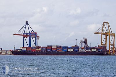
NEOKASTRO
Container Ship
Current Trip
| Time Travelled | 23 h, 54 mins |
|---|---|
| Remaining Time | 21 h, 1 mins |
| Distance Travelled | 387.44 nm |
| Remaining Distance | 472.41 nm |
| AVG Speed | 16.3 Knop |
| MAX Speed | 18.8 Knop |
| AVG Wind | 19 knots |
| MAX Wind | 27 knots |
| MIN Temp | 16.8°C / 62.24°F |
| MAX Temp | 18.1°C / 64.58°F |
| Djupgående | 12.5 m |
| Position mottagen | 21 h, 26 m sen |
Current Position
| Longitud | --- |
|---|---|
| Latitude | --- |
| Status | Under way using engine |
| Fart | 17 Knop |
| Kurs | 305.5° |
| Område | Mediterranean Sea - Eastern Basin |
| Station | T-AIS |
| Position mottagen | 21 h, 26 m sen |
Info
Information
The current position of NEOKASTRO is in Mediterranean Sea - Eastern Basin with coordinates 36.00833° / 13.89117° as reported on 2025-12-07 15:07 by AIS to our vessel tracker app. The vessel's current speed is 17 Knop and is heading at the port of VALENCIA. The estimated time of arrival as calculated by MyShipTracking vessel tracking app is 2025-12-09 10:35 LT
The vessel NEOKASTRO (IMO: 9400215, MMSI: 636020345) is a Container Ship that was built in 2011 ( 14 År gammal ). It's sailing under the flag of [LR] Liberia.
In this page you can find informations about the vessels current position, last detected port calls, and current voyage information. If the vessels is not in coverage by AIS you will find the latest position.
The current position of NEOKASTRO is detected by our AIS receivers and we are not responsible for the reliability of the data. The last position was recorded while the vessel was in Coverage by the Ais receivers of our vessel tracking app.
The current draught of NEOKASTRO as reported by AIS is 12.5 meters
Weather
| Temperature | 17.4°C / 63.32°F |
|---|---|
| Wind Speed | 11 knots |
| Direction | 261° W |
| Pressure | 1022.7 hPa |
| Humidity | 82.4 % |
| Cloud Coverage | 27 % |
Featured Company
Last Port Calls
| Port | Arrival | Departure | Time In Port |
|---|---|---|---|
| 2025-12-05 21:07 | 2025-12-07 13:40 | 1 d | |
| 2025-11-29 11:54 | 2025-11-30 09:21 | 21 h | |
| 2025-11-27 18:14 | 2025-11-28 08:33 | 14 h | |
| 2025-11-26 02:56 | 2025-11-27 14:06 | 1 d | |
| 2025-11-24 17:45 | 2025-11-25 07:26 | 13 h | |
| 2025-11-20 12:32 | |||
| 2025-11-17 14:23 | 2025-11-18 10:48 | 20 h | |
| 2025-11-13 04:24 | 2025-11-14 04:17 | 23 h | |
| 2025-11-02 09:42 | 2025-11-06 05:42 | 3 d | |
| 2025-10-29 14:27 | 2025-10-31 21:16 | 2 d |
Most Visited Ports (Last year)
| Port | Arrivals | |
|---|---|---|
| 15 | ||
| 11 | ||
| 8 | ||
| 8 | ||
| 7 | ||
| 7 |
Last Trips
| Origin | Departure | Destination | Arrival | Distance | |
|---|---|---|---|---|---|
| 2025-11-30 09:21 | 2025-12-05 21:07 | 700.84 nm | |||
| 2025-11-28 08:33 | 2025-11-29 11:54 | 323.85 nm | |||
| 2025-11-27 14:06 | 2025-11-27 18:14 | 46.86 nm | |||
| 2025-11-25 07:26 | 2025-11-26 02:56 | 80.92 nm | |||
| 2025-11-18 10:48 | 2025-11-20 12:32 | 271.60 nm | |||
| 2025-11-14 04:17 | 2025-11-17 14:23 | 888.78 nm | |||
| 2025-11-06 05:42 | 2025-11-13 04:24 | 1232.59 nm | |||
| 2025-10-31 21:16 | 2025-11-02 09:42 | 590.77 nm | |||
| 2025-10-20 06:54 | 2025-10-29 14:27 | 764.72 nm | |||
| 2025-10-16 07:00 | 2025-10-19 02:07 | 683.82 nm |
Events
| Tid | Event | Detaljer | Position / Dest | Information |
|---|---|---|---|---|
| 2025-12-07 15:18 | Status ändrad | Default Under way using engine |
36.03867 / 13.84250
ESVLC
|
Fart: 17 kn Kurs: 305.5° |
| 2025-12-07 15:07 | UTANFÖR täckningsområde |
36.00833 / 13.89117
Mediterranean Sea - Eastern Basin
ESVLC
|
Fart: 17 kn Kurs: 305.5° |
|
| 2025-12-07 15:02 | Status ändrad | Under way using engine Default |
35.99317 / 13.91717
ESVLC
|
Fart: 17 kn Kurs: 296° |
| 2025-12-07 14:53 | I täckningsområde |
35.99700 / 13.91050
Mediterranean Sea - Eastern Basin
ESVLC
|
Fart: 17 kn Kurs: 305.7° |
|
| 2025-12-07 14:08 | Status ändrad | Default Under way using engine |
35.85916 / 14.19150
ESVLC
|
Fart: 17.1 kn Kurs: 302.3° |
| 2025-12-07 14:03 | UTANFÖR täckningsområde |
35.84667 / 14.21583
Mediterranean Sea - Eastern Basin
ESVLC
|
Fart: 17.1 kn Kurs: 302.3° |
|
| 2025-12-07 13:45 | ETA ändrat | 2025/12/09 08:00 2025/12/08 17:00 |
35.79850 / 14.30400
ESVLC
|
Fart: 17.1 kn Kurs: 303.4° |
| 2025-12-07 12:40 | AVGÅTT HAMN |
|
35.81853 / 14.55437
ESVLC
|
Fart: 8.6 kn Kurs: 142° |
| 2025-12-07 12:31 | STARTAR förflyttning |
35.82400 / 14.53733
[MT] MARSAXLOKK
|
Fart: 3.2 kn Kurs: 85° |
|
| 2025-12-07 12:23 | Djupgående ändrat | 12.5 12.4 |
35.82155 / 14.53798
[MT] MARSAXLOKK
|
Fart: 2.1 kn Kurs: 150° |