
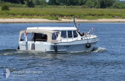
NEELTJE MARIA
Pleasure Craft
Current Trip
Unknown
| Time Travelled | 14 days |
|---|---|
| Remaining Time | --- |
| Distance Travelled | 35.98 nm |
| Remaining Distance | --- |
| AVG Speed | 5.2 Knop |
| MAX Speed | 5.4 Knop |
| AVG Wind | 10.1 knots |
| MAX Wind | 20 knots |
| MIN Temp | 13.8°C / 56.84°F |
| MAX Temp | 18.5°C / 65.3°F |
| Djupgående | --- |
| Position mottagen | 18 h, 32 m sen |
Current Position
| Longitud | 5.80309° |
|---|---|
| Latitude | 53.06265° |
| Status | Default |
| Fart | 5.2 Knop |
| Kurs | 42.2° |
| Område | North Sea |
| Station | T-AIS |
| Position mottagen | 18 h, 32 m sen |
Info
Information
The current position of NEELTJE MARIA is in North Sea with coordinates 53.06265° / 5.80309° as reported on 2024-05-12 09:30 by AIS to our vessel tracker app. The vessel's current speed is 5.2 Knop
The vessel NEELTJE MARIA (MMSI: 244022849) is a Pleasure Craft It's sailing under the flag of [NL] Netherlands.
In this page you can find informations about the vessels current position, last detected port calls, and current voyage information. If the vessels is not in coverage by AIS you will find the latest position.
The current position of NEELTJE MARIA is detected by our AIS receivers and we are not responsible for the reliability of the data. The last position was recorded while the vessel was in Coverage by the Ais receivers of our vessel tracking app.
Weather
| Temperature | 17.9°C / 64.22°F |
|---|---|
| Wind Speed | 11 knots |
| Direction | 107° ESE |
| Pressure | 1019.2 hPa |
| Humidity | 70.4 % |
| Cloud Coverage | 38 % |
Featured Company
Last Port Calls
| Port | Arrival | Departure | Time In Port |
|---|---|---|---|
| 2024-04-28 12:37 |
Last Trips
| Origin | Departure | Destination | Arrival | Distance |
|---|
Events
| Tid | Event | Detaljer | Position / Dest | Information |
|---|---|---|---|---|
| 2024-05-12 09:30 | UTANFÖR täckningsområde |
53.06265 / 5.80309
North Sea
|
Fart: 5.2 kn Kurs: 42.2° |
|
| 2024-05-12 09:14 | STARTAR förflyttning | 0.49 nm, North of TERHERNE |
53.04738 / 5.77554
|
Fart: 5.2 kn Kurs: 52.9° |
| 2024-05-10 09:35 | I täckningsområde |
53.04720 / 5.77159
North Sea
|
Fart: Kurs: 511° |
|
| 2024-05-10 08:20 | UTANFÖR täckningsområde |
53.04724 / 5.77161
North Sea
|
Fart: Kurs: 511° |
|
| 2024-05-08 14:02 | STOPPAR förflyttning | 0.49 nm, North of TERHERNE |
53.04680 / 5.77143
|
Fart: 0.3 kn Kurs: 511° |
| 2024-05-08 13:57 | I täckningsområde |
53.04868 / 5.77796
North Sea
|
Fart: 5.1 kn Kurs: 232.8° |
|
| 2024-05-08 11:31 | UTANFÖR täckningsområde |
53.18898 / 6.01116
North Sea
|
Fart: 5.2 kn Kurs: 231° |
|
| 2024-05-08 11:06 | I täckningsområde |
53.21078 / 6.03498
North Sea
|
Fart: 5.1 kn Kurs: 164.1° |
|
| 2024-05-08 09:17 | UTANFÖR täckningsområde |
53.30349 / 6.14112
North Sea
|
Fart: 5.3 kn Kurs: 216° |
|
| 2024-05-08 08:51 | I täckningsområde |
53.31922 / 6.12307
North Sea
|
Fart: 5.1 kn Kurs: 137.7° |